
Navigational Aids
Trent-Severn Waterway National Historic Site
Aids to navigation are devices designed to help boaters identify the navigation channels and determine their position and course. They also mark the location of hazards and obstructions. They should be used in conjunction with other data (charts, landmarks, Notices to Mariners and other available marine publications) when boating. Historic canal navigation aids conform to the Canadian Aids to Navigation System.
Speed Limits
In an effort to protect the environment, shoreline property owners and the safety of all boaters, over 75 speed limit zones have been established along the navigation channels of the Trent-Severn Waterway. All zones are posted with signs and regulated under the Boating Restriction Regulations, part of the Canada Shipping Act.
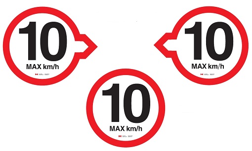
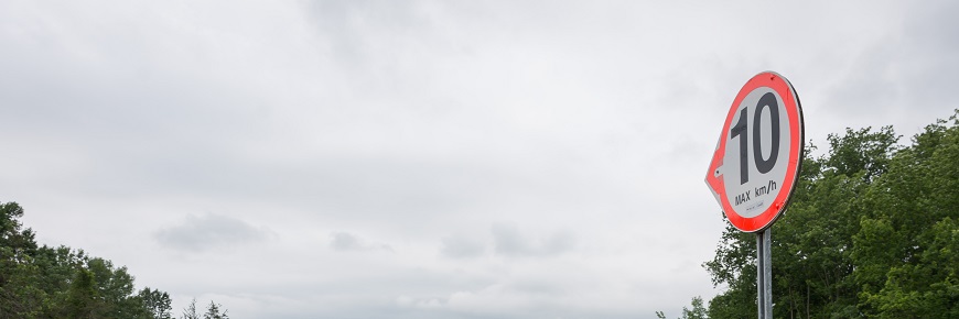
Below: Speed limit sign
There are two types of signs—the boundary markers (arrow signs) which identify the beginning and end of a speed zone, and speed limit signs (circles), which remind boaters to obey the speed limit while they are in the zone. Both types of signs are either posted on the shoreline, on structures, or are attached to floating white buoys adjacent to the navigation channel.
Police officers patrol speed limit zones and may charge boaters found exceeding the speed limit. Where posted, the speed limit is normally 10 km/hr (6 mph).
Watch your wake
Boat wake and wash is a major problem along the Trent-Severn Waterway. Damage to private property, the natural environment and other vessels continues to occur.
As a boat operator, you should be aware of the speeds at which your boat produces a maximum and minimum wake. When travelling through a ‘no wake’ zone, or cruising close to shore, in narrow channels, near other boats, swimmers or docks, operate as close to dead slow as possible while maintaining control of your vessel.
Most of the navigation aids marking the main channels of the Trent-Severn Waterway consist of fixed daybeacons and anchored floating lateral buoys. Although there are some lighted aids, they do not operate on a 24-hour basis, and are not maintained as night navigation systems. Mariners should note that these aids are not under continuous observation so light failures and out of place buoys do occur. Parks Canada staff appreciate receiving reports of any lights out of operation or buoys off position.
Daybeacons
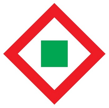
The Port Daybeacon is square, with a black square centre on a white background, and a green reflective boarder. It is also used at lock stations, bridge piers and as a channel marker on shorelines to indicate the port (left) side of the channel when proceeding upstream.

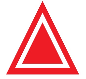
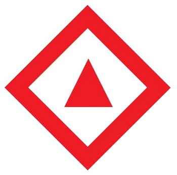
The Starboard Daybeacon is triangular in shape, with a red triangular centre on a white background, and a red reflective border. It is used at lock stations, bridge piers and as a channel marker on shorelines to indicate the starboard (right) side of the channel when proceeding upstream.
Bifurcation or Junction Daybeacons mark a point where a channel divides and may be passed on either side. These daybeacons provide directional assistance when navigating across long reaches (e. g. Rideau Lakes), or at junctions where the main channel may not be clearly defined.
When proceeding upstream, the preferred route is to the left of a starboard bifurcation daybeacon, which features a red reflective triangle on a white diamond, with a red border.
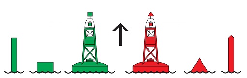
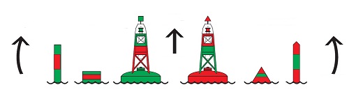
Lateral Buoys
Starboard hand buoys are red-coloured with a pointed top, and mark the starboard (right) side of a channel or the location of a danger. They should appear on your starboard side when boating in an upstream direction.
Port Hand Buoys are green-coloured with a flat top, and mark the port (left) side of a channel or the location of a danger. They should appear on your port side when boating in an upstream direction.
Bifurcation Buoys, both starboard and port, mark the points where a navigation channel divides. The top colour on the buoy indicates the correct side on which vessels should pass to stay in the preferred or main channel. When travelling upstream, if the top colour of the buoy is red, boaters should keep this buoy on their starboard side if they wish to stay in the main channel.
If the top colour is green, boaters should keep this buoy on their port side if they wish to stay in the main channel.
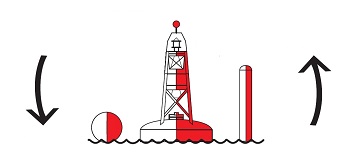
Fairway Buoys are coloured red and white in wide vertical stripes and mark a landfall, channel entrance or the centre of a channel. They may be passed on either side but should be kept to port when proceeding in either direction.
Buoyage Reversal
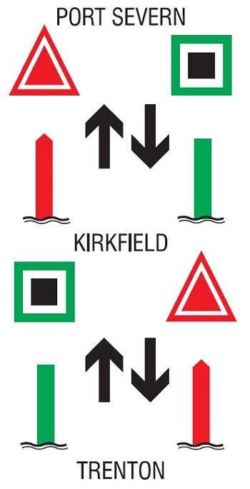
Balsam Lake is the summit of the Trent–Severn Waterway. Water flows downstream to Lake Ontario and Georgian Bay from here in opposite directions. As a result, the red and green buoys will be on opposite or reverse sides of the channel after you pass through the Kirkfield Lift Lock in either direction.
To avoid confusion, consider the following rule for navigating the Rideau Canal and Trent–Severn Waterway. Red buoys on your right when going upstream.
- Date modified :