
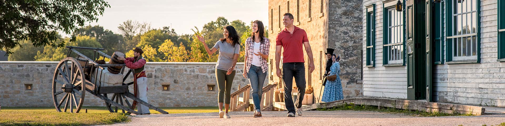
Self-guided tour
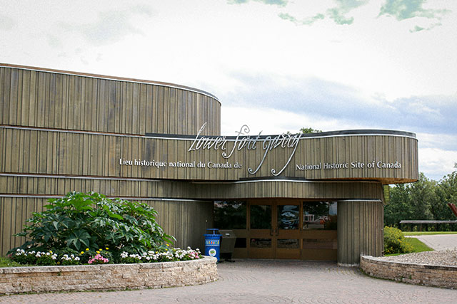
Lower Fort Garry National Historic Site
Lower Fort Garry National Historic Site is located on Treaty No. 1 territory and is the actual site where Treaty No. 1 was signed in 1871. It is the traditional territory of Anishinaabe, Cree, Anisininewuk, Dakota, and Dene people, and the homeland of the Red River Métis.
Lower Fort Garry, also known as the “Stone Fort”, is one of the finest collections of early stone buildings in western Canada. It was a fur trade post, established by the Hudson’s Bay Company in 1832 as regional headquarters. Today, the fort is restored to the early 1850s, when it was a bustling transshipment centre and home to Governor Eden Colvile and his wife Anne.
This site served various other functions over time, such as: as a temporary location for both Manitoba’s first penitentiary and psychiatric facility, a North-West Mounted Police training post, and a Motor Country Club.
Given all of its roles and residents, there are many stories to be told here at this historic site.
 Flag installations
 Buildings, fort walls, bastions and grounds
 Washrooms
 Accessible elevator
 Picnic Shelter
 Dogs on leash
 Pick up after dogs
 No recreational vehicles
 No fishing
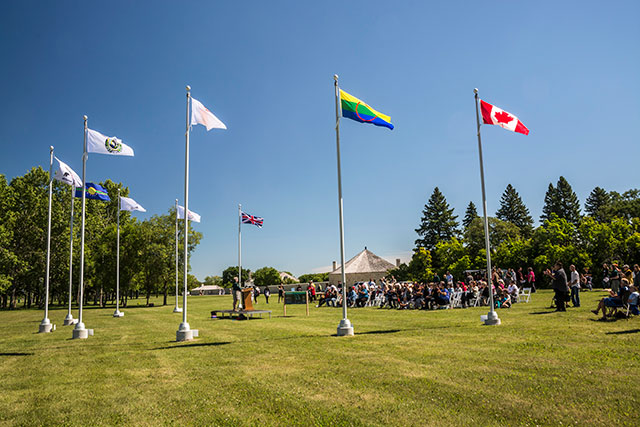
A. Métis flag installation
Unveiled in 2020, this flag installation recognizes the fundamental role of the Red River Métis in the creation of the province of Manitoba and the confederation of Canada. The Métis flag flies with the Canadian flag, symbolizing the ongoing relationship between the two nations, and the traditional connection they have with the lands and waters that comprise Lower Fort Garry.
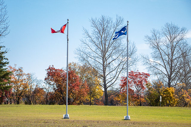
B. Treaty No. 1 Legacy Flag installation
Unveiled in 2017, this flag installation symbolizes the importance of the nation-to-nation agreement made here between the Crown and Treaty No.1 First Nations in 1871 which initiated a series of treaties that allowed for the expansion of the Canadian Nation.
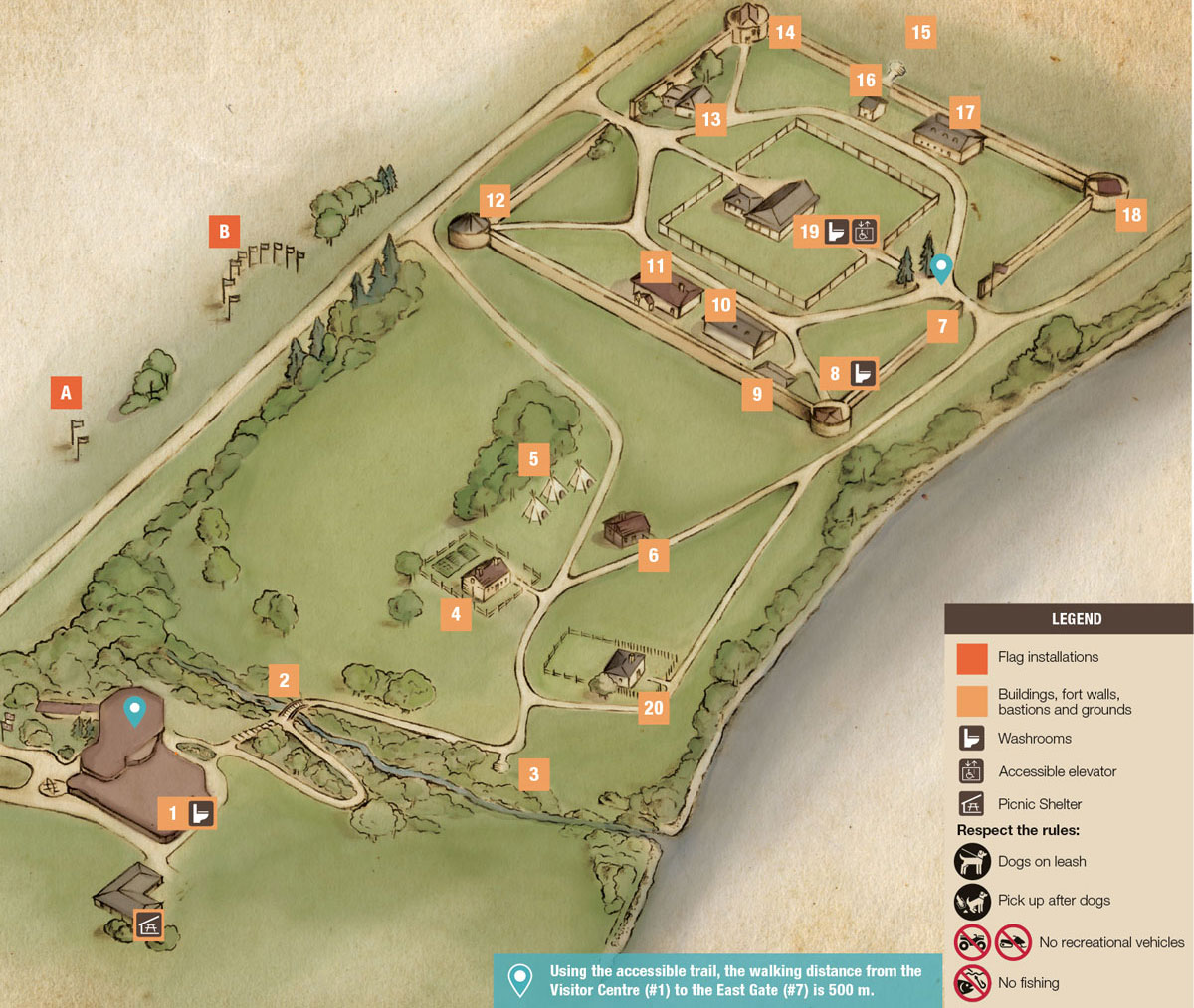
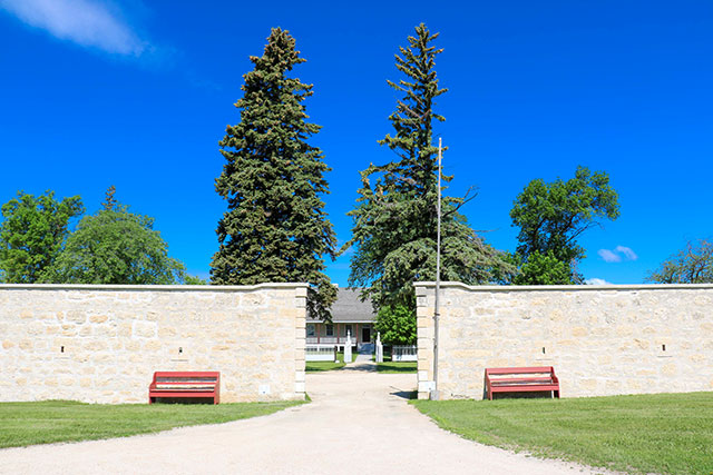
1. Visitor Centre
Built in 1979, the Visitor Centre was designed by the renowned architect Étienne Gaboury, who is recognized for several of Manitoba’s most iconic structures, including the Manitoba Mint and Esplanade Riel (alongside the Provencher Bridge).
2. Monkman's Creek
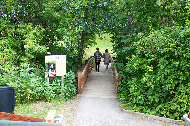
Indigenous Peoples frequently used the creek and surrounding area for fishing, camping and gathering. Archaeological investigations in 2006 found pottery shards, chert flakes and food residue.
3. Industrial Complex
If you look towards the creek, you can see remnants of foundations of many of the buildings from the Industrial Complex. Lime kilns, a brewery, malt barn, storehouse and the miller’s house were all located near the creek during the 1860s.
4. Farm Manager's Cottage
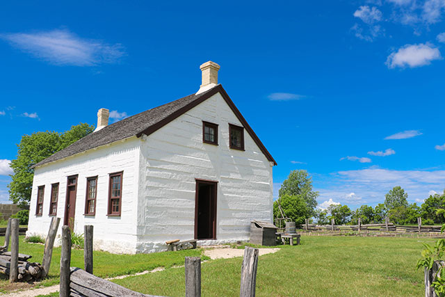
The original farm manager’s cottage was dismantled prior to 1884. The house you see today was built around 1835 in present-day Winnipeg and moved here to represent that cottage. In the mid-19th century, the Hudson’s Bay Company assigned Alexander Lillie to manage a 100-acre experimental farm, where crops of barley, wheat, peas, beans, and other garden vegetables were grown to provision the northern Company trading posts. The cottage is an example of Red River Frame or post-on-sill construction.
5. Gabeshiwin (Camp)
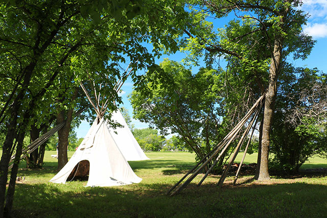
Indigenous Peoples who occasionally visited Lower Fort Garry to trade, sell goods, work or visit relatives, typically camped nearby for the duration of their stay, often in temporary birchbark dwellings. In the 1850s, the Indigenous communities nearest to the fort were mainly Métis, Anishinaabeg (Ojibwe), and Ininiwak (Mushkegowuk / Swampy Cree) who lived in the nearby parishes of St. Peters and St. Andrews.
6. Blacksmith Shop
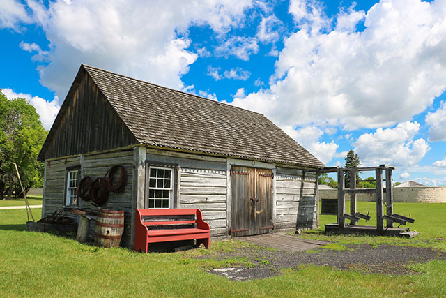
This blacksmith shop is a reproduction building that was placed here in 1971 to closely resemble those that stood here previously. The original shop, built in the 1830s, was destroyed in a fiery explosion in 1877. At Lower Fort Garry, the blacksmith played a crucial role in keeping the fort and the farm running effectively, such as repairing tools and farm equipment, producing trade goods, and doing other artisanal tasks.
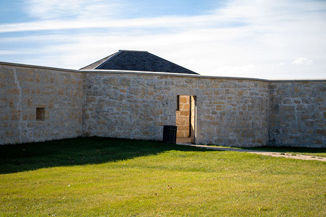
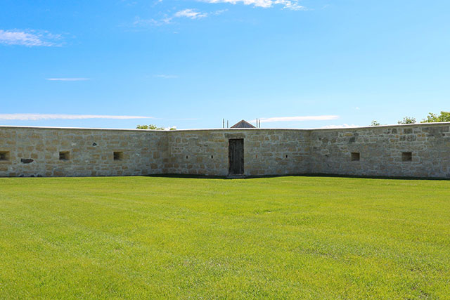
7. Fort Walls
The fort walls and corner bastions were built between 1841 and 1848 by stone masons Duncan McRae and John Clouston and by soldiers from the Sixth Regiment of Foot. Though the walls suggest a military purpose, they mostly functioned to create an aura of permanence and respect for the Hudson’s Bay Company and its residing governors or officers. In recent years, the walls have undergone extensive repair and improvements to help preserve them. Caulking in ‘control joints’ prevents the limestone from cracking as the walls shift. A ‘coping stone’ has also been added to the top of the walls, creating a drip edge to help rain to fall away.
8. Southeast Bastion
Presently providing modern washroom facilities, the southeast bastion was originally built by the British Sixth Regiment of Foot during its stay at Lower Fort Garry from 1845 to 1846. For many years, the bastion served as an icehouse. When members of the North-West Mounted Police were quartered here (1873-1874), the bastion was used as a provision store.
9. York Boat
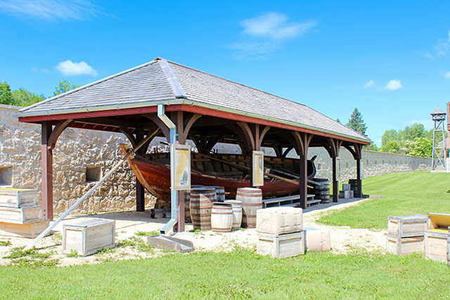
York boats were the workhorses of the 19th-century fur trade, enabling the transport of furs, trade goods, food supplies, and people throughout a complex network of posts to the north and west. As the name reflects, most of these boats were destined for York Factory, the key Company depot on Hudson Bay. York Factory is located in northern Manitoba and is a national historic site. This replica on display shows the impressive size, capacity, and craftsmanship of these heavy boats.
10. Fur Loft/Sales Shop
The Fur Loft/Sales Shop was built between 1830 and 1831 by Pierre Leblanc. The second floor stored extra inventory, while the top floor was where the fur pelts were dried, sorted, pressed and bundled for shipment to European markets. On the main floor, the sales shop served the local people who brought their goods — mostly farm produce and manufactured items — to exchange for a wide array of imported goods such as cloth, blankets, glassware, guns, beads, tea and tobacco. The farm produce was used by the Company to supply its northern brigades and distant trading posts. Note the symmetry of this building is typical of the British classical tradition — for example, the balance of its windows and entrances, and the mirroring effect with the Warehouse building across from it.
11. Museum
This building was constructed between 1965 and 1966 and is the only reconstructed building within the fort walls. It mimics the original retail store built in 1873, which once stood in this location. The building now houses the exhibit “First Nations and Métis Peoples of the Lower Red River.”
12. Southwest Bastion
Completed by the Sixth Regiment of Foot in 1847, the southwest bastion was initially planned by the skilled and valued stone masons, Duncan McRae and John Clouston, whose work can be seen throughout the local surrounding area. This bastion was used as a wash house and cook house when British troops were garrisoned at the fort and was later used for storage.
13. Men's House
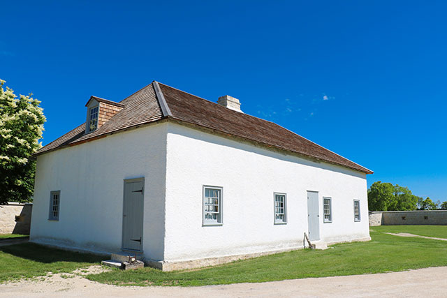
The men’s house provided living quarters for the labourers and tradesmen working here on contract with the Hudson’s Bay Company (the Company). The main building housed the unmarried men, but married employees likely lived here as well, in the north annex.
The main building was constructed in 1852 with a technique combining timber frames filled in with rubble masonry. While Manitoba’s first psychiatric facility was being constructed in Selkirk, this building temporarily housed the women’s ward (1885-1886). It was also used as a stable, icehouse, and storage facility when the fort was leased by the Motor Country Club (1913-1962).
14. Northwest Bastion
The northwest bastion served as a bakehouse shortly after it was constructed. Inside the building were two stone and brick ovens that shared a chimney. Here, bakers used locally ground flour to produce hardtack, a hard dry biscuit that fed Hudson’s Bay Company employees on the boat brigades and at the interior posts. This bastion was used as a stable during the 1890s and an icehouse for the Motor Country Club, after the original ovens were removed in 1911.
15. Agricultural Complex
The Hudson’s Bay Company began a large farming operation during the 1850s to help provision fur trade forts in northern Manitoba, such as York Factory. In this area, the remains of the stableman’s house and stables for oxen, cattle, and horses have been found.
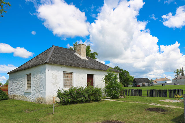
16. Doctor's Office
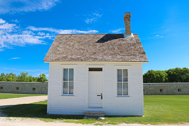
This building was constructed in 1885 when Lower Fort Garry briefly housed the province’s first psychiatric facility while more permanent buildings were under construction in Selkirk. The appointed medical superintendent, Dr. David Young, began his work from this office, which is the only remaining original wooden structure within the fort.
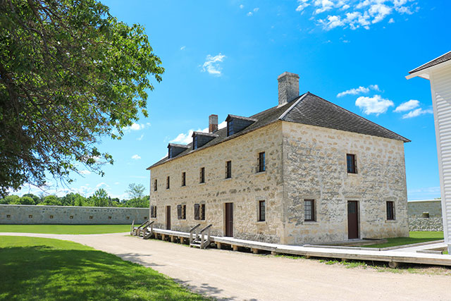
17. Warehouse
The warehouse was built to provide extra storage for Hudson’s Bay Company trade goods. Constructed around 1838 from locally quarried limestone in a British classical style, it served as the barracks for the Sixth Regiment of Foot from 1846 to 1848 and for men of the Wolseley Expedition in 1870. It was refitted to serve as the first penitentiary in western Canada (1871-1877) while permanent facilities were constructed at Stony Mountain. Later, it temporarily housed Manitoba’s new psychiatric facility (1885-1886). Finally, during the Motor Country Club lease, this building became the maids’ quarters.
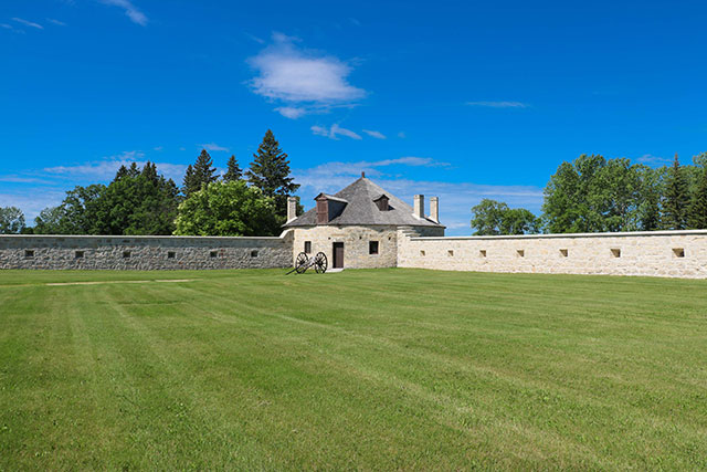
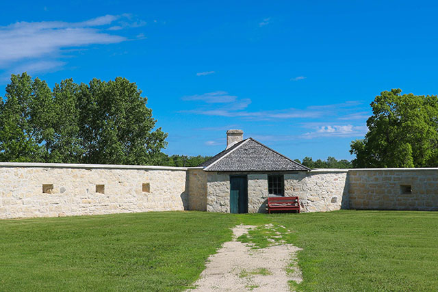
18. Northeast Bastion
The northeast bastion was built in the late 1840s to house the gunpowder magazine. In accordance with Company standards, the bastion was designed so that if the magazine were to explode from within, the blast would be directed upwards and not outwards, thus preventing harm to people and property in the fort. Like the walls and most of the fort’s buildings, the bastion is made of locally quarried limestone. If you look closely, you may see fossils preserved in the stone.
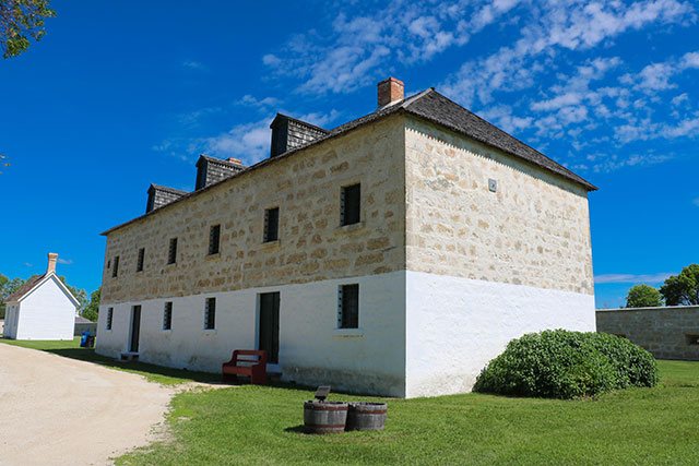
19. Big House
The Big House was originally designed as residence for George Simpson, Governor of the Company’s western and northern trade. Constructed in 1830-1832 (and the annex in 1840), the Big House was continuously altered to suit its occupants — Hudson’s Bay Company governors with their families and household staff; Company officers who managed the local trade; members of the Quebec Rifles, the Sixth Regiment of Foot, and the North West Mounted Police; and members of the Motor Country Club. The house is presently restored to 1851, when Governor Eden Colvile and his wife Anne were the main residents. The basement includes a large kitchen and living quarters for their personal and household servants.
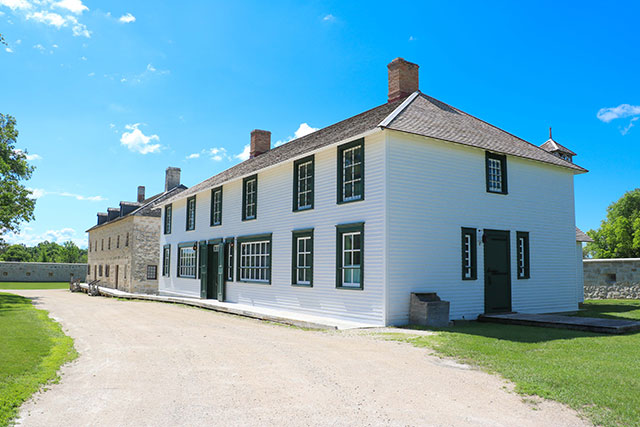
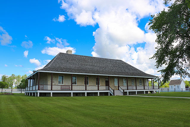
20. Guest Cottage
The guest cottage was built between 1845 and 1847 and restored to the early 1850s when Chief Factor Donald Ross lived here with his wife Mary. Their four youngest children (ages 8 to 14) moved between this house and their nearby schools, where students typically studied and resided. Deteriorating health had forced Ross to leave his long service at Norway House to furlough here, closer to medical help and his children. He succumbed to consumption (tuberculosis) in late 1852. Over time, this cottage housed many others, including Edmund Abell, the engineer in charge of maintaining the growing number of steam engines in the Company’s boats and mills late in the century.
- Date modified :