
Classy trails
Lake Superior National Marine Conservation Area
By Sylvio (Hoss) Pelletier
“Hey guys, last week was a great time, I have been telling everyone about the trails.” Sounds like a note from a friend after a fun visit. Well, it sort of is! Parks Canada trail expert, Mark Schmidt, visited Lake Superior’s north shore for a few days in October to explain Parks Canada's new trail classification system, which is recognized and used globally, to our trail building partners.
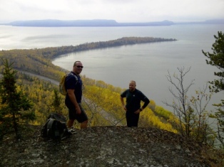 Mike Elliott and Mark Schmidt overlooking Mazookama Bay
 © Parks Canada
Mark is well versed on sustainable trail building for all types of uses. Prior to joining Parks Canada five years ago, Mark worked for the International Mountain Biking Association (IMBA) teaching sustainable trail building in Canada and the U.S.A.
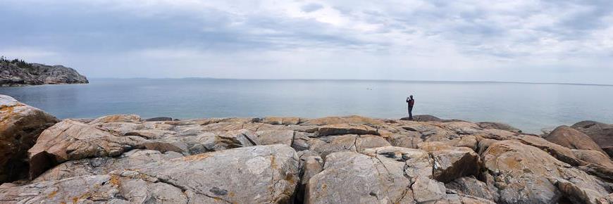
The staff at Lake Superior National Marine Conservation Area (LSNMCA) believe our highway corridor and network of trails will appeal to many visitors. A consistent approach to classifying (based on level of ability), marking and signing trails will assist visitors to our region in knowing what to expect prior to their journey, and providing hikers an incredible experience of Lake Superior and its natural beauty.
On the morning of Oct. 9, Mark met with representatives from Red Rock, Dorion, Nipigon, Red Rock Indian Band and Thunder Bay at the Red Rock Community Centre. That same evening, local trail groups and interested residents representing Rossport, Schreiber, Terrace Bay and the Casque Isles hiking group were on hand for a lively discussion on trail development in Rossport. Approximately 25 people participated in the two workshops.
All participants seemed to see the value in this consistent approach to trail classification. While consistency is great for visitors, it is important to stress that current trails will remain owned, operated and maintained as local trails, respecting those individuals and groups that pioneered the building of these great experiences.
Mark didn’t leave the area right after the two workshops. Along with Parks Canada colleagues and other keen individuals, he hiked some local trails, including Hurkett Cove, How Mountain in Red Rock, the Nip-Rock trail (Red Rock to Nipigon), Ruby Lake, Mazookama Falls, Kama Cliffs and portions of the Casque Isles Trail. As a first timer to the north shore of Lake Superior, Mark was impressed with the trail network community groups and volunteers have created for a variety of users and differing abilities. It’s truly a great regional asset.
If you haven’t had the pleasure of hiking local trails get out and see what our region and volunteers have created. You may be rewarded by an amazing view! By working with local trail groups, Parks Canada hopes to help improve the hiking experience for years to come. For further information on the Parks Canada trail classification system please contact Hoss.
Back to shoreLINES
- Date modified :