
Accessible park facilities
Jasper National Park
Jasper National Park is closed
An Evacuation Order has been issued for Jasper
Everyone in Jasper must evacuate now. Wildfire status.
Reservations from July 23 to August 6 in Jasper National Park will automatically be cancelled and fully refunded
Reservations from July 23 to August 6 in Jasper National Park will automatically be cancelled and fully refunded. There is no need for further action on the part of visitors for these cancellations and refunds.
Reopening dates will be confirmed when available and any further cancelations communicated as required. If you wish to cancel reservations beyond August 6, regular cancellation charges may apply.
We are sorry for the inconvenience and disappointment this news brings to your travel plans. We appreciate your patience as we take necessary action to keep our visitors safe.
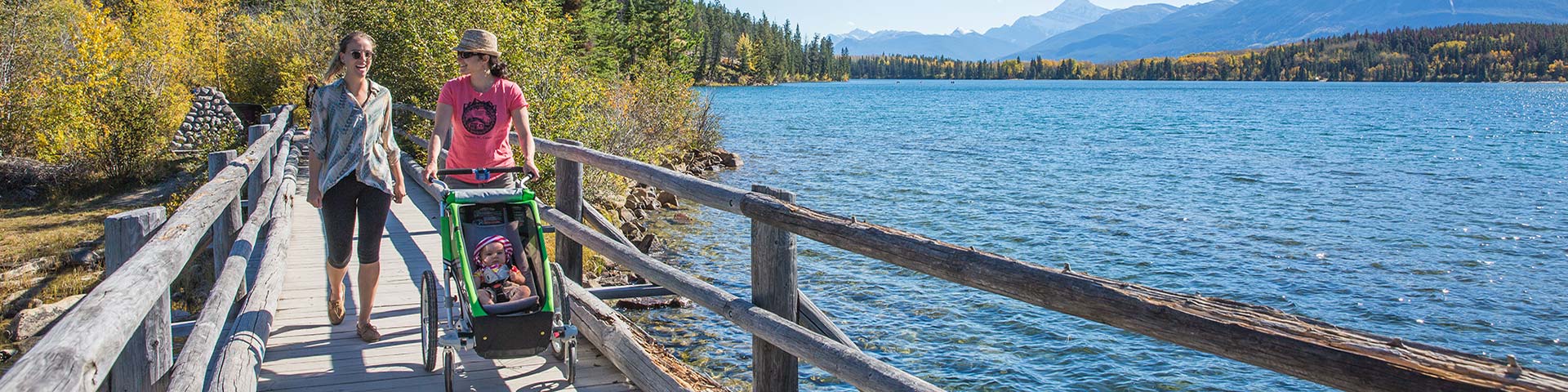
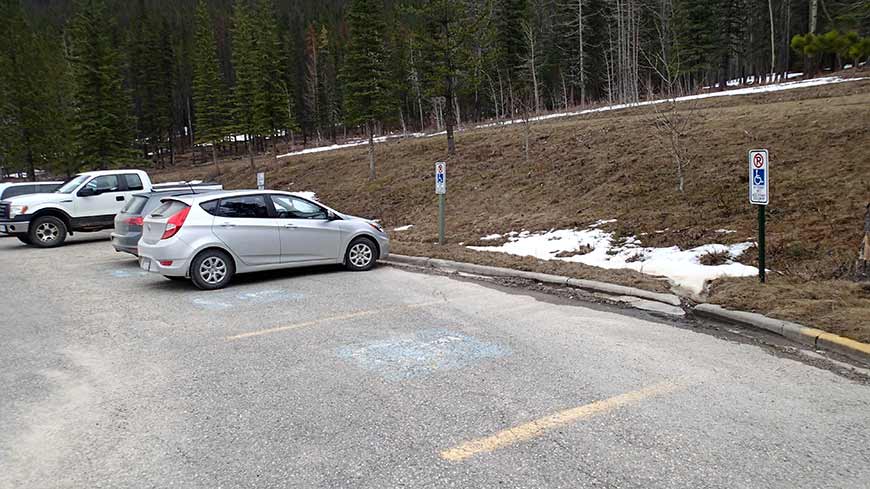
Parks Canada is committed to maximizing accessibility so that all visitors have the opportunity to enjoy Canada’s natural and cultural heritage. Jasper National Park provides public buildings, campgrounds, washrooms, viewpoints and trails that are open to all members of the public. The following is a detailed description of Jasper National Park services and facilities for visitors using wheelchairs, mobility aids or strollers.
Teletypewriter (TTY) service is available though the Parks Canada national information toll-free line, at 1-866-787-6221.
Camping
Frontcountry
Reservable
The summer months in Jasper National Park are very busy. If you wish to camp in one our main campgrounds, reservations are recommended. Please use 1-877-RESERVE (737-3783) or reservation.pc.gc.ca to make a reservation. When booking online, select the check box next to Accessible feature types under Search Preferences to include accessible campsites in your search.
Whistlers Campground offers one oTENTik and multiple campsite types that are designated accessible. There are eighteen combined toilet and shower buildings that contain accessible toilet stalls, urinals and roll-in shower rooms equipped with one bench enclosed on three sides (transfer may be challenging). Whistlers outdoor theatre features interpretive programs and shows with designated wheelchair seating (front row only).
Wapiti Campground is open in winter and offers two serviced RV sites that are designated accessible, as well as an accessible toilet / shower building.
Highway 16 East and Miette Valley
The Palisades Picnic Site (12.5 km from the Town of Jasper)
This picnic site has one accessible picnic table on pavement and a prescribed fire-themed interpretive panel. There is one pit toilet equipped with two grab bars that has a slight lip in the approach. All accessibility standards may not be met and therefore this toilet facility may not be suitable for all visitors. The parking area surface is paved with some loose gravel. There are no designated accessible parking stalls at this location. There are no fire pits at this location.
Jasper House Trail
This 1.4 km return trail takes visitors to a valley-bottom viewpoint overlooking the Athabasca River and the Jasper House National Historic Site across the river. The trail is mostly firm, bare ground with some loose gravel and is narrow in some locations. The trail should be wide enough for most mobility devices. There are two bridges with easy access on, but there is a step to get off, which may be a significant barrier on return. At the end of the trail is a raised viewpoint accessed by six stairs with railings. There is one large, rutted root across the trail less that 10 m from the viewpoint that may act as a barrier to access the end of the trail. There are no designated accessible parking stalls in the paved parking area and no accessible toilets at this location.
Miette Coal Mine Trail
The first stop on the Miette Hotspring Road is the old town and coal mining site. An 800 m loop through the lower ruins is paved and wide, with sections that slope up to 8%. The asphalt path is rough in spots. There are no designated accessible parking stalls at this large, paved parking area. There is a pit toilet with a smooth approach that is equipped with grab bars. All accessibility standards may not be met and therefore this toilet facility may not be suitable for all visitors.
Punchbowl Falls
From the paved parking area, a short (15 m), paved path takes visitors to an accessible wooden bridge providing views of Mountain Creek and the punchbowl-shaped hollow at the base of its falls. There are no designated accessible parking stalls and no toilets at this location. A pit toilet with a smooth approach that is equipped with grab bars is located 1 km away, at the Miette Coal Mine trail.
Miette Hot Springs
Parking: There is a drop-off area at the hot springs facility entrance, and designated accessible parking (no side access aisles) for the hot springs are located next to the building entrance.
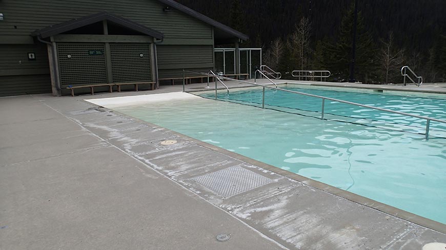
Pool: One of the hot pools is outfitted with a ramp and a railing. A pool-friendly (submersible) wheelchair is freely available for use (based on availability; enquire in advance or at the reception desk).
Toilets, change rooms and showers: Accessible toilets, change rooms and showers are available inside the Miette Hot Springs facility. One-time use lockers that use keys to lock are located in the change rooms. For visitors not using the pools, there is one accessible indoor washroom with a smooth approach. The public indoor washroom can be accessed from outside the Miette Hot Springs facility, near the designated accessible parking area. There is also a pit toilet equipped with grab bars beside the parking lot near the picnic area. There is an approximately five-centimetre lip in the approach to the pit toilet. All accessibility standards may not be met and therefore these facilities may not be suitable for all visitors.
Picnic site: There are three accessible picnic tables on concrete with pedestal fire pits positioned on pavement. These are accessed by a curb cut from the paved parking area. There are no designated accessible parking stalls. The curb cut has an uneven lip from the surface of the parking lot.
Trail: The 1.4 km return Source of the Springs trail is mostly paved or is a wooden boardwalk. After the first bridge, the paved trail climbs steadily with some steeply sloped sections. A paved ramp takes you to the crumbling ruins of the previous hot springs facility (the ‘Aquacourt,’ in operation from 1938 -1984). From here, the trail is mainly a wooden boardwalk that continues to climb. Barriers to access along the way include some large gaps between wooden planks, one large step and a short section of the wooden boardwalk with uneven planks that raise between three and five centimetres. At the end of this boardwalk is a viewing platform accessed by a second large step, but visitors will still be able to see the steam of the springs and smell the sulphur in the air.
Highway 93A
Mount Edith Cavell
Nothing can prepare you for the awesome size and sheerness of the mountain’s north face as seen from the parking area. The summit elevation is impressive at 3,363 metres, but it’s the size of the cliff (1,300 metres) and its close proximity that make this place unforgettable.
Parking: There are three designated accessible parking stalls in the upper paved parking area (no side access aisles) and an additional designated accessible parking stall with a side access aisle on each side.
Toilets: There are two pit toilets located in the lower paved parking area that have a smooth approach but do not meet all accessibility standards. Notably, these two pit toilets do not yet have grab bars. There are no designated accessible parking stalls in the lower paved parking area.
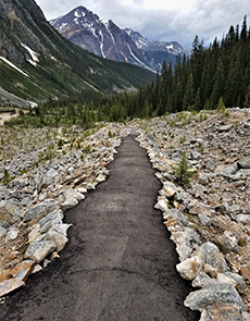
Trail: The paved Path of the Glacier Trail climbs very steeply from the parking area before leveling out 800 m up the trail to provide stunning views of Mount Edith Cavell, Angel Glacier and its melt-water lake below. There are two log benches spaced out along the inclining path and a number of log benches at the end viewpoint. Alternatively, there is a set of 25 stairs (with a landing half-way up) equipped with hand railings leading from the parking lot to an interpretive panel. From here, there are two steps with no railings leading to a paved viewpoint with one bench. This paved segment of trail eventually merges with the steep Path of the Glacier Trail.
Meeting of the Waters Picnic Site
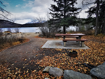
This scenic picnic location is located where the Whirlpool and Athabasca rivers meet. There is an accessible picnic table. The pit toilet has a slight lip in the approach and is equipped with grab bars. All accessibility standards may not be met and therefore this toilet facility may not be suitable for all visitors. There is a designated accessible parking stall in this paved parking area (no side access aisle).
Icefields Parkway
Athabasca Falls
Parking: There are designated accessible parking stalls in the paved parking area (no side access aisles).
Toilets: There are two pit toilets with a smooth approach that are equipped with grab bars at this location. All accessibility standards may not be met and therefore these toilet facilities may not be suitable for all visitors.
Trail: A paved path provides a beautiful view of Mount Kerkeslin and the Athabasca River at the top of these thundering falls. The 150 m path to the falls’ upper viewpoint has steep and uneven sections. The main viewpoint is on a pedestrian bridge that is accessed by a stairway with 14 short steps and a broad handrail on one side. Highway 93A crosses the Athabasca River almost directly above Athabasca Falls; a great vantage point as you drive by.
Sunwapta Falls
Parking: There are two oversized designated accessible parking stalls in the paved parking area (no side access aisles).
Toilets: There is one pit toilet with a smooth approach that is equipped with grab bars at this location, though all features may not meet accessibility standards and therefore this toilet facility may not be suitable for all visitors.
Trail: A short, asphalt path descends steeply (slope greater than 10%) for approximately 30 m before meeting an accessible wooden bridge over the Sunwapta River, providing a great view of Sunwapta Falls and its limestone canyon.
Stutfield Glacier Viewpoint
Ninety-four kilometres south of the Town of Jasper, along the Icefields Parkway, is a paved parking area with two oversized designated accessible stalls (no side access aisle). The parking area acts as a viewpoint for the stunning Stutfield Glacier across a subalpine valley with braided streams. There are two pit toilets with a smooth approach that are equipped with grab bars at this location. All accessibility standards may not be met and therefore these toilet facilities may not be suitable for all visitors
Columbia Icefield Discovery and Information Centre
Parking:
- Designated accessible parking and mobility device access to the building is available by turning at the tour bus/accessible parking sign. This paved parking lot is located 600 m south of the turn-off for the main public parking lot.
- Designated accessible parking is also available in the paved main public parking lot. A paved path ascends to the building access. The path is less than a five percent slope, but is a considerable distance at approximately 200 m.
Toilets: Accessible toilets are available inside the Icefields Centre. There is also an accessible universal washroom.
Parks Canada Information: Visit Parks Canada staff in the basement of the building for area information and maps. Elevators provide access to the Information area and there is an accessible information counter.
Theatre: The 20-minute film “Through Ice and Time” tells a visually stunning story based around the dramatic landscapes of the Columbia Icefield. There are no closed captions for the video. Designated seating for mobility devices is located at the front of the theatre only.
Athabasca Glacier
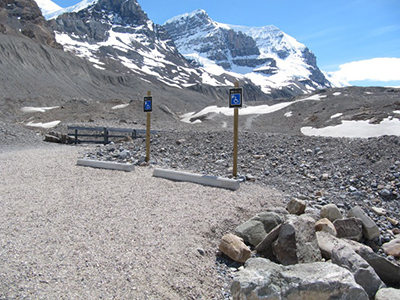
Across from the Columbia Icefield Discovery and Information Centre is the turnoff for Glacier Road, a rustic loose-gravel road that provides a route to two unpaved parking areas close to the base of Athabasca Glacier. The Glacier Road has markers that illustrate the ongoing, dramatic retreat of the glacier to its current location from years past. There are two designated accessible stalls (no side access aisle) in the heavily rutted, lower parking area that gets you even closer to the glacier. You can often feel powerful winds coming down from the glacier in this parking area. There are pit toilets in the lower parking area but they have one short step to enter and are not equipped with grab bars. The closest accessible toilets are located within the Columbia Icefield Discovery and Information Centre.
Jasper Townsite and Area
Parking: Designated accessible parking stalls are available in townsite parking lots and at key locations on the downtown streets, including behind the Jasper Information Centre.
Public Toilets:
- An accessible toilet building across 638 Connaught Drive, near the junction of Hazel Ave, offers adjacent parking, ramp access, a braille entrance sign, and a push-button door.
- An accessible toilet building on 416 Connaught Drive, across from the Information Centre, offers adjacent parking, ramp access, and a push-button door.
Jasper Information Centre (500 Connaught Drive)
Barrier-free access into the historical building is available via the Friends of Jasper National Park gift shop entrance. The Information Centre is open year-round and has a lowered information counter.
Jasper Yellowhead Historical Museum
Barrier-free access via a ramp, a push-button door and elevators to accessible toilets are provided.
Lake Annette and Lake Edith
Parking: There is one oversized designated accessible parking stall located at the swimming dock’s paved parking area on Lake Annette (no side access aisle). The main parking area and lower picnic parking area for Lake Annette are both paved and each have two designated accessible parking stalls with a shared side access aisle. There is no designated accessible parking in the paved Lake Edith parking lot.
Toilets and change rooms: There is a pit toilet with a smooth approach that is equipped with grab bars located at the parking area for the swimming dock on Lake Annette. There are three pit toilets equipped with grab bars and one change room (no grab bars) located near the main parking area for Lake Annette that have a slight lip in the approach. All accessibility standards may not be met and therefore these toilet facilities may not be suitable for all visitors.
Picnic sites: There are two accessible picnic tables placed on pavement with pedestal fire pits that are accessible from the main Lake Annette parking lot by a short and narrow paved path. In addition, there are three accessible picnic tables placed on pavement with pedestal fire pits that are accessible from the lower picnic area parking lot for Lake Annette.
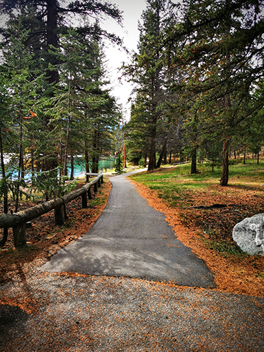
Pathways: Lake Annette Trail is a 2.4 km paved loop that follows the perimeter of the scenic Lake Annette with panoramic mountain views. There are six rest areas along the loop at 200 m to 500 m intervals (with three providing sufficient space for a mobility device). The trail is predominantly flat; however, there are a number of sections that require attentive navigation. There are multiple sloped areas throughout the trail loop, with some sections that exceed a slope of 8-10% for up to 13 m. Some edges of the trail have drop offs greater than 7.5 cm without edge protection, including one 40 m long section with an edge drop off that exceeds 60 cm. Notably, one section of the trail features a steep but wide hair-pin turn that slopes up to 16% with up to a 25% cross-slope if taken too tightly. Extra care should be taken here.
Beach: The main section of beach is accessed from the Lake Annette Trail and across an approximately 10 m wide grassy area. The beach sand is fine and soft in most places with no accessible route provided for water access.
Pyramid Lake Road
Parking: There are designated accessible parking stalls located at the main beach for Pyramid Lake (see below for details). The paved roadside pullout on Pyramid Lake Road (located across from the docks) has one designated accessible stall with an access aisle. There is one designated accessible parking stall for Pyramid Island access (see below for details).
Toilets: There is one pit toilet equipped with grab bars at the main beach of Pyramid Lake; one pit toilet equipped with grab bars at the Pyramid Lake roadside pull-off near the docks; and one pit toilet in the parking lot of Pyramid Island equipped with grab bars. All toilets have a smooth approach; however, they may not meet all accessibility standards and therefore may not be suitable for all visitors.
Pathways and trails:
- The trailhead at Pyramid Island has one designated accessible paved parking stall (with no side access aisle). The island is accessed by a gently-sloped (8%) ramp and an unpaved trail with a firm, primarily flat surface that leads to a wooden bridge in less than 100 m. From here, Pyramid Island offers beautiful panoramic views from the middle of Pyramid Lake. If visitors leave the bridge to explore the island, there is an approximately 300 m loop of unpaved trail that is primarily flat and firm with some exposed rocks and roots that will require attentive navigation. Note: There is a small step from the island path back onto the bridge to leave the island.
- Accessed from the gravel Cottonwood trailhead parking area, Cottonwood Slough Trail (Trail 8) is firm, exposed ground for the first 400 m, and follows the perimeter of a wetland known for birds, beavers and moose (after which the trail becomes rutted with exposed roots). There is no designated accessible parking in this rutted and loose gravel parking area and no accessible toilets. The closest accessible toilets are located in town (3.4 km south) or near the end of Pyramid Lake Road, at either the Pyramid Lake boat dock (6.4 km north), Pyramid Beach (6.6 km north) or Pyramid Island (7.5 km north).
Beach: There are two oversized designated accessible parking stalls without side access aisles at the Pyramid Lake main beach paved parking area, which is situated at the beach. The beach sand is fine and soft in most places with no accessible route provided for water access. The beach distance between the paved parking lot and the lake’s water edge is approximately 30 m.
Picnic site: There is one accessible picnic table on firm, stable ground at the main beach that provides a nice view of Pyramid Lake. The picnic table is accessed from the parking lot by a short (10 m or less) but steep (greater than 5% slope) paved route. Clear ground space around the picnic table is limited (less than 2 m on most sides). There is a fire pit located close to the picnic table.
Old Fort Point and Lac Beauvert
Parking: There are no designated accessible stalls at the Old Fort Point trailhead parking area, which has a surface that is unpaved and uneven with loose gravel. There is one oversized designated accessible stall without a side access aisle at the paved Lac Beauvert trailhead parking area. The Lac Beauvert trailhead parking area, located 1 km beyond Old Fort Point, is accessed by Lac Beauvert Road (closed to vehicle traffic in winter; please see the Jasper National Park Seasonal Road Updates page for details).
Toilets: There are no accessible toilets at the parking areas for Old Fort Point or Lac Beauvert, which each lack grab bars and have a step to enter. There are two public accessible toilets located on Connaught Drive in the Jasper townsite (at a distance of 1.7 km and 2.2 km from the Old Fort Point parking area).
Pathways and trails: Accessed from either the Old Fort Point parking area or Lac Beauvert parking area via the 200 m long Trail 7c, there is a 1 km stretch of Trail 7 that has a compact gravel surface along the bank of the Athabasca River. This route can be extended to a 2.1 km loop starting at either the Old Fort Point or Lac Beauvert parking areas if users incorporate the 1 km long paved Lac Beauvert Road (seasonally closed to vehicle traffic, see above for link with closure information). The location where Trail 7c connects to Lac Beauvert Road narrows and has exposed roots that may be a barrier to access. The route is otherwise an appropriate width with a compacted rock and soil surface and some loose gravel.
Maligne Valley
Maligne Canyon
Parking: There are oversized designated accessible parking stalls without side access aisles in the main parking area for Maligne Canyon.
Toilets: Indoor accessible toilets are available at the Maligne Canyon Restaurant and Gift Shop. There are some pit toilets with a smooth approach; however, none are equipped with grab bars.
Pathways: There are two trailheads that begin from either side of the Maligne Canyon parking lot. The asphalt path nearest the restaurant quickly leads to a great view of the Maligne River at the start of the gorge, along with some fossils in the rocks. The path that leads from the trailhead kiosk to the Second Bridge across the Maligne Canyon has firm, stable ground and some short (less than 10 m), steep (>10% slope) sections.
Medicine Lake North Viewpoint
Parking: There are no designated accessible parking stalls at this paved parking area.
Toilets: There are no pit toilets at this location. The closest designated accessible toilets are located at Bruce’s Picnic Site (16.5 km south) and Maligne Lake (22 km south at the
Viewpoint: This paved parking area viewpoint at the north end of Medicine Lake provides a panoramic view of the surrounding mountains, amazing views of the lake, and is a great place to see the regeneration from the 2015 Excelsior Wildfire. Eagles often nest nearby until mid-August.
Bruce's Picnic Site
Bruce’s Picnic Site is a turnoff 37 km from the start of Maligne Lake Road with picnic tables situated along the scenic Maligne River.
Parking: There are no designated accessible parking stalls at this picnic area. The surface of the parking area is unpaved but well packed.
Toilets: There is a pit toilet with a smooth approach equipped with grab bars. All accessibility standards may not be met and therefore this toilet facility may not be suitable for all visitors.
Picnic sites: There are two accessible picnic tables placed on pavement with pedestal fire pits that are accessed from the parking area by a short and narrow paved path.
Maligne Lake Day-Use Area
Parking:
- There are five oversized designated accessible parking stalls (without access aisles) in the lower main parking lot for Maligne Lake.
- There are two oversized designated accessible parking stalls (without side access aisles) and one designated accessible parking stall with an access aisle at the end of Maligne Road at the boat dock parking lot.
- There are two oversized designated accessible parking stalls (without access aisles) in the paved parking area behind the Maligne Lake Day Lodge. These stalls are managed by the company Pursuit and may be gated. Contact Pursuit for information and availability.
Toilets: There is a pit toilet with a smooth approach equipped with grab bars located at the lower main parking area for Maligne Lake. There are indoor toilets with one designated accessible stall equipped with grab bars located in the middle-tier of the main parking area for Maligne Lake. There are no designated accessible parking stalls in this paved lot. There is a slight lip in the approach to the indoor toilets. All accessibility standards may not be met and therefore these two toilet facilities may not be suitable for all visitors. Accessible indoor toilets are also available at the Maligne Lake Day Lodge.
Trail: The first 300 m of the Mary Shäffer Loop is paved with gorgeous lake and mountain views. For a further 450 m, the surface of the trail is firm ground with some loose gravel and exposed rocks and roots in some sections until a viewpoint with benches is then reached. The remainder of this 3.2 km loop is narrow, with bare ground that has sections of deeply rutted and exposed roots, among other barriers.
Picnic sites: There are two accessible picnic tables placed on pavement near the accessible parking stalls in the main parking lot for Maligne Lake.
Boat launch and docks: There are two public docks at the boat launch with barriers to access. Each dock has one high step and there is a large gap (five centimetres or more) between planks where the docks connect to a ramp.
Related links
- Date modified :