
Bullion Plateau Trail
Kluane National Park and Reserve
Distance: 24 km (15 mi) return trip
Time: 6.5 - 9 hrs
Elevation gain: 885 m (2,900')
Maximum elevation: 1,620 m (5,300')
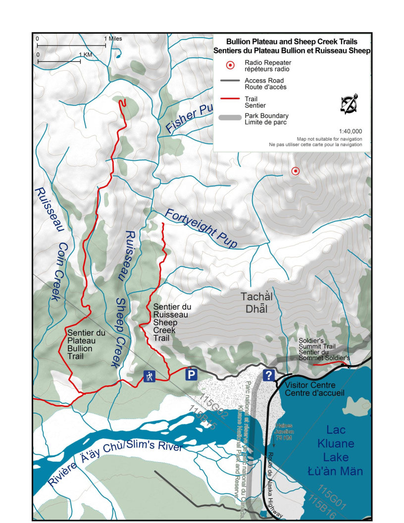
Trailhead: Thechàl Dhâl (Sheep Mountain) trailhead parking lot, 2.6 km (1.6 mi) up the Ä’äy Chù (Slim’s River) Valley from the Thechàl Dhâl Visitor Centre.
Topo maps: Destruction Bay 115 G/2 & Slim’s River / Ä’äy Chù 115 B/15
In summary
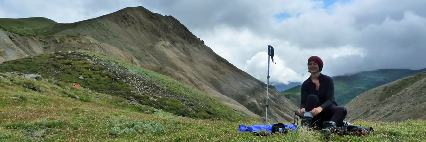
The Bullion Plateau is a great but strenuous day hike for those wanting to experience the sub alpine and alpine areas in the north end of the park. Abundant wildflowers and excellent views of the Ä’äy Chù and Sheep Creek valleys are some of the highlights of this hike. Great views of Red Castle Ridge, as well as a glimpse of the toe of the Kaskawulsh glacier can be seen. It is recommended that individuals go in groups of 4 or more people on this trail.
Download the Bullion Plateau Trail description (PDF, 636 Kb)
The details
After checking in at the Thechàl Dhâl Visitor Centre, you can drive or hike up the valley for 2.6 km. Here you will find a small parking area. The trail begins at the locked gate, and follows the old Alaska Highway for 2 km at which point Sheep Creek crosses the trail. Creek crossing shoes are recommended, as your feet will get wet crossing this small creek. Once across, continue along the trail for about 10 minutes until the trail forks at the 2.8 km signpost. The Bullion Plateau trail follows the branch to the right.
The trail climbs steadily through a forest of spruce and poplar and into the sub alpine dominated by willow thickets. It passes a 6.8 km signpost, and continues rising ultimately reaching above tree line. A signpost marks km 9.3, continuing from here the trail becomes less evident as the path is not clearly defined due to overgrowth and loose rock slides covering the trail. If you choose to continue, follow the trail leading right from the 9.3 km post. Views of the Sheep Creek valley will soon appear. The trail cuts along the side of the mountain descending gradually to a meadow where a signpost marks km 12.0, this is a beautiful spot and the end of the trail. Alpine flowers are abundant, and views of Red Castle Ridge dominate. From here you may return the way you came, or adventurous hikers may consider the following option.
-
Alternative option: Route connecting to Sheep Creek Trail
A route is not a trail
Routes are not marked with signs or maintained in any manner. The route described here is only a suggestion that may help guide you on your trip. Self-reliance and wilderness travel experience are essential, including excellent route finding skills, map and compass skills. It is the responsibility of individual hikers who choose to follow such routes to adequately prepare and be prepared to rely on themselves.
At the 12.0 km post an old overgrown road leads off to the right and descends to Sheep Creek. This can be used to connect Bullion Plateau with the Sheep Creek trail across the valley. Route finding skills will be required for this section as bushwhacking and several creek crossings are necessary.
What you need to know
The Dall sheep rely on the plants of south-facing, snow-free slopes for critical nutrition. Dall sheep are high strung and may abandon parts of their range if repeatedly disturbed. Hikers and photographers are asked to be respectful of the sheep and their fragile habitat.
Please:
- do not approach sheep closer than 50 metres (165 ft);
- hike in small, tight, slow-moving groups;
- never approach sheep from above, as it will confuse and stress them;
- put your dog on a leash, and stay far away from the sheep;
- stay on established trails or routes to prevent disturbance of the soil and fragile vegetation.
Please note that all overnight camping is prohibited on this trail. For more detailed information please contact parks staff at the Kluane National Park and Reserve Visitor Centre in Haines Junction or at the Thechàl Dhâl Visitor Centre.
Bear sightings are common in the area. Review recommendations for travel within the You Are In Bear Country brochure. All bear sightings should be reported to the staff at the Visitor Centre.
Parks Canada 24 hour emergency dispatch
1-780-852-3100
Cellular telephones do not work in most of the park. Satellite phones or satellite messaging devices are strongly recommended.
Using a topographic map at a 1:50,000 scale is highly recommended for the route: Destruction Bay 115 G/2 & Slim’s River / Ä’äy Chù 115 B/15.
Related links
- Date modified :