
 Click to enlarged image (JPEG - 1.1MB)
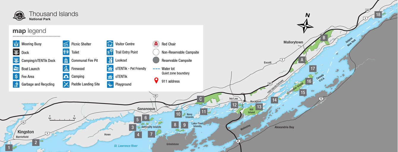
Mainland properties:
Mallorytown Landing
GPS Coordinates: 44.4523, -75.860317
Address: 1121-1000 Islands Parkway Mallorytown Landing
Click to enlarged image (JPEG - 275KB)
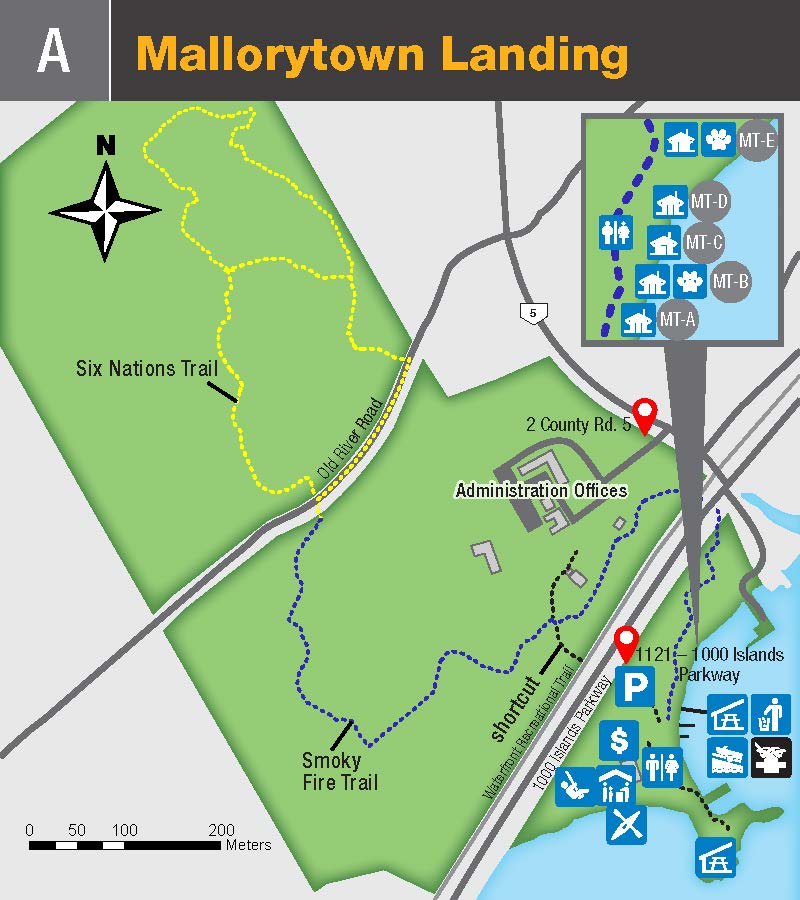
Available Docking Space: 0-100 ft.
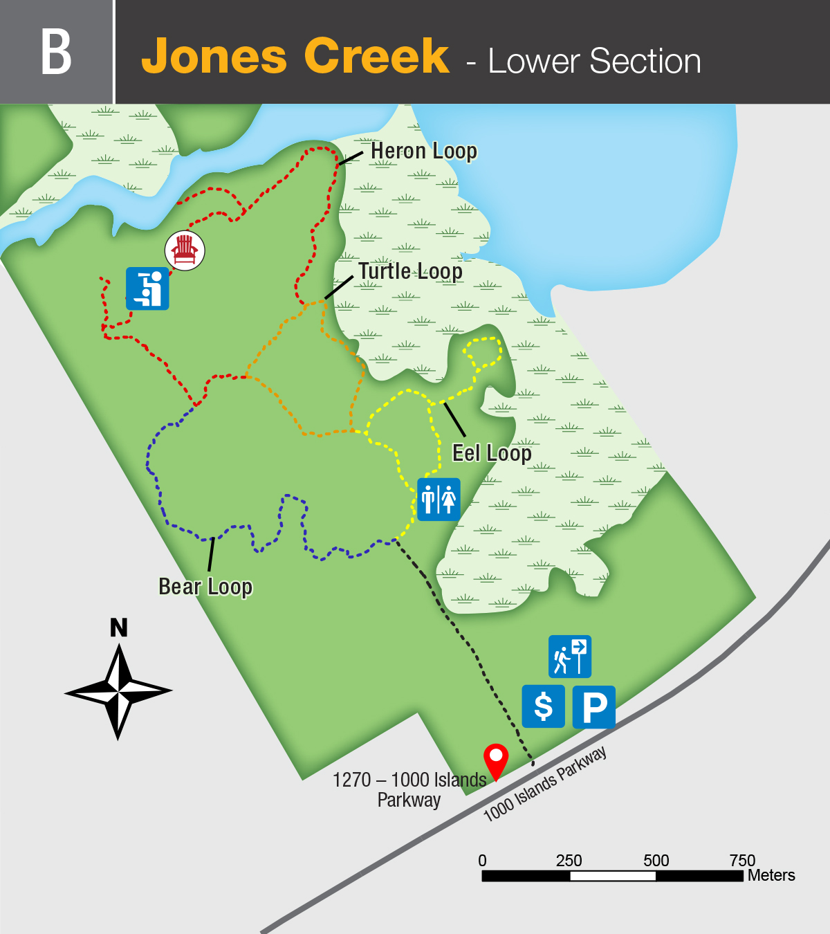
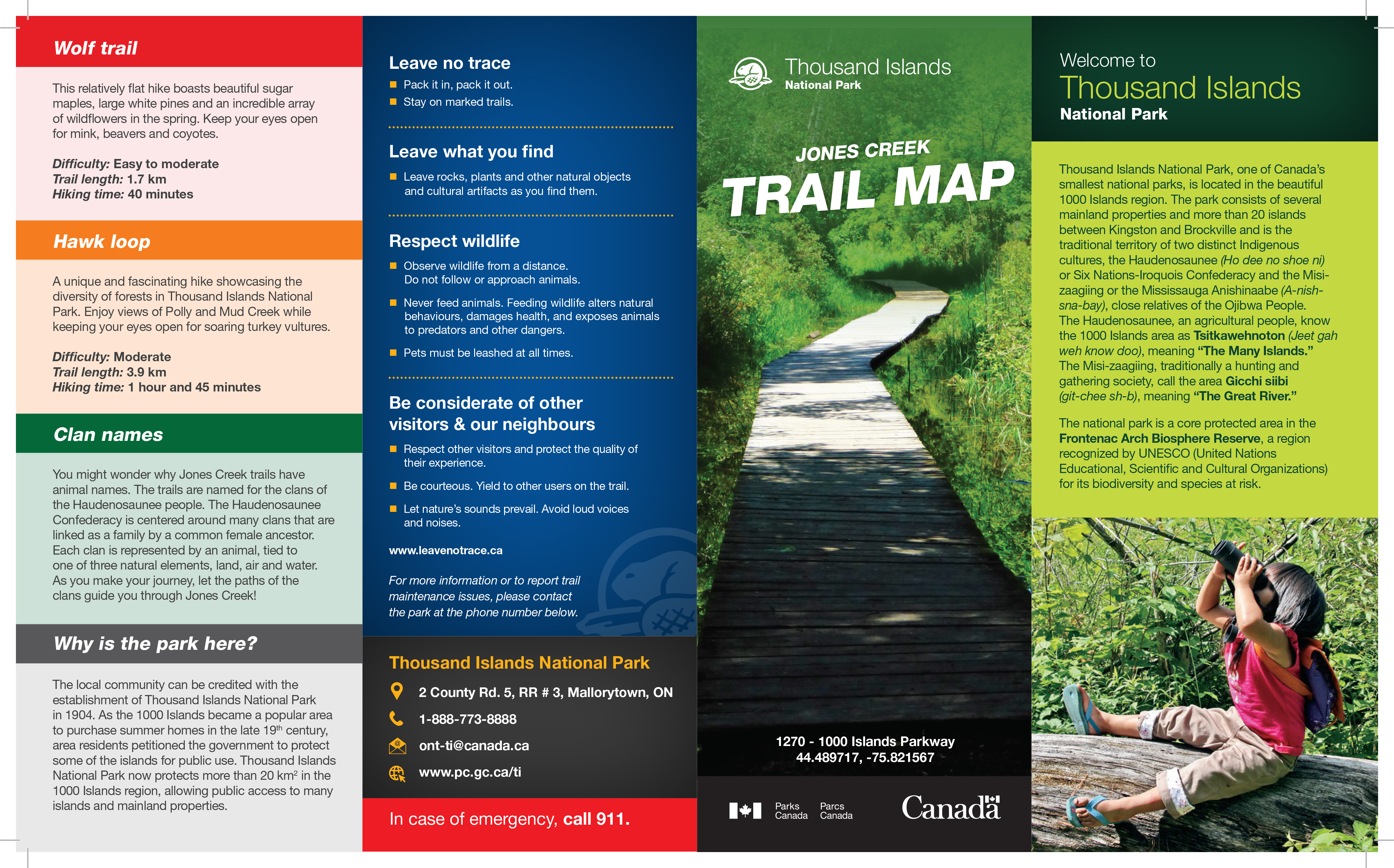
Jones Creek
GPS Coordinates : 44.489717, -75.821567
Address: 1270-1000 Islands Parkway Mallorytown
Close up map, Click to enlarged image (JPEG - 533KB)
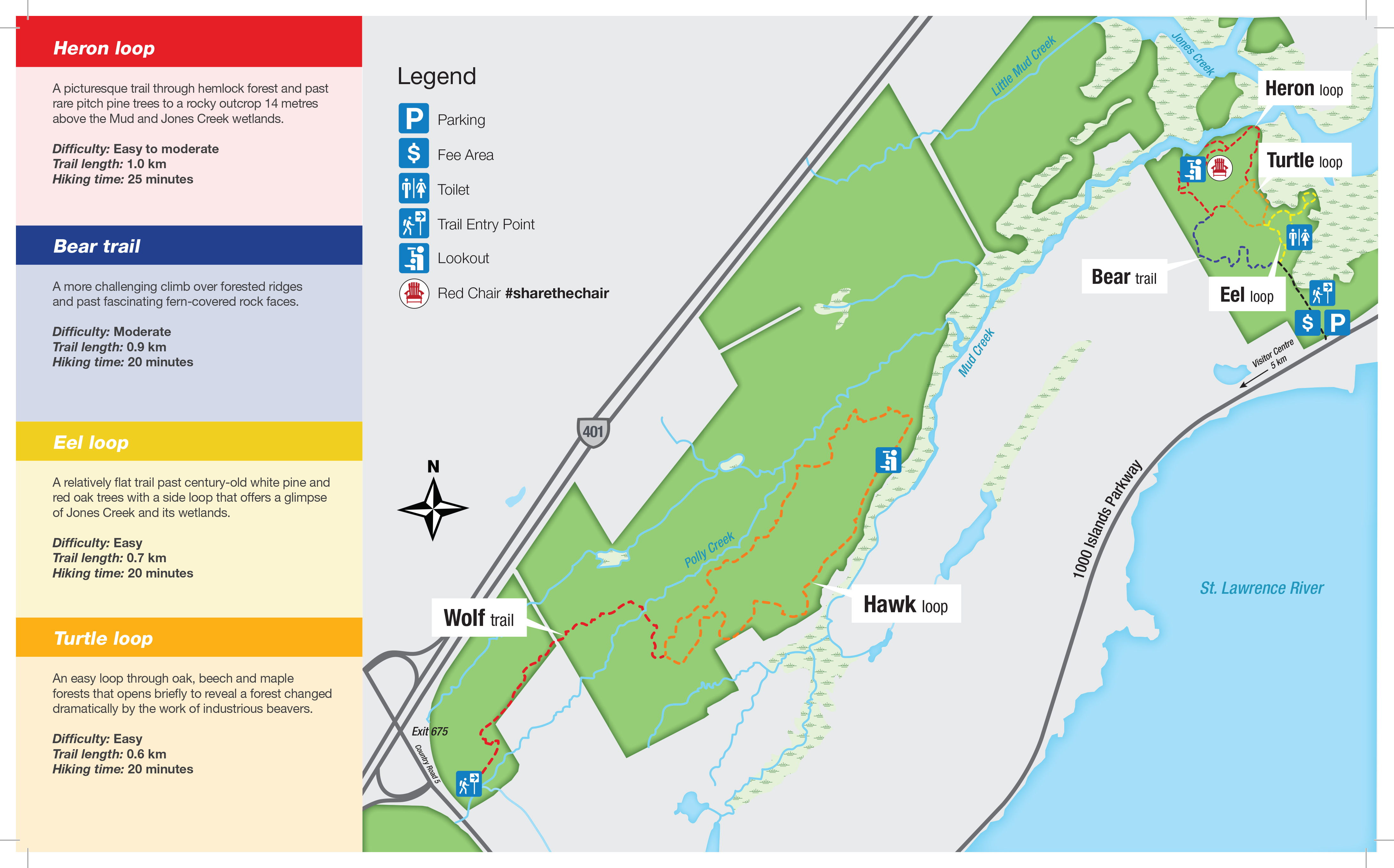
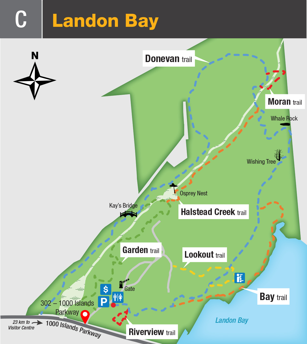
Landon Bay
GPS Coordinates: 44.353189, -76.076254
Address: 302-1000 Islands Parkway Landsdowne
Click to enlarged image (JPEG - 1.1MB)
Kingston Islands:
Cedar (1)
GPS Coordinates: 44.226825, -76.452608
Closest access point: Cataraqui Canoe Club public boat launch. Parking fees apply.
Paddlers and boaters—travel on the river requires planning and attention to weather conditions.
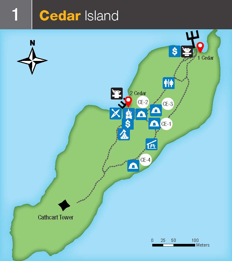
Available Docking Space >300 ft.
Milton (2)
GPS Coordinates: 44.244968, -76.398127
Closest access point: Cataraqui Canoe Club public boat launch. Parking fees apply.
Paddlers and boaters—travel on the river requires planning and attention to weather conditions.
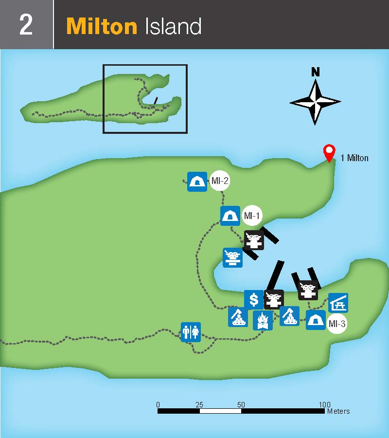
Available Docking Space 300 ft.
Admiralty Islands:
Aubrey (3)
GPS Coordinates: 44.296424, -76.193403
Closest access point: Gananoque Municipal Marina. Parking fees apply.
Paddlers and boaters—travel on the river requires planning and attention to weather conditions.
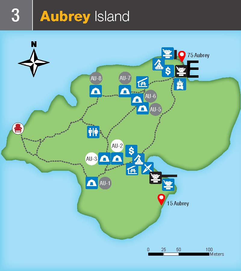
Available Docking Space at this location: >300 ft.
Mermaid (4)
GPS Coordinates: 44.295341, -76.188189
Closest access point: Gananoque Municipal Marina. Parking fees apply.
Paddlers and boaters—travel on the river requires planning and attention to weather conditions.
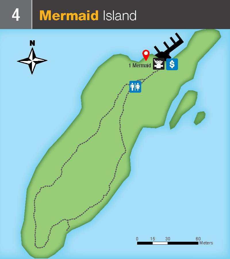
Available Docking Space at this location: 100-300 ft.
Beau Rivage (5)
GPS Coordinates: 44.303637, -76.187249
Closest access point: Gananoque Municipal Marina. Parking fees apply.
Paddlers and boaters—travel on the river requires planning and attention to weather conditions.
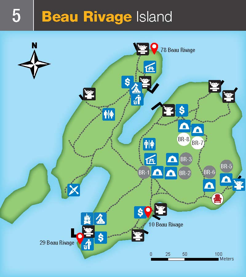
Available Docking Space at this location: >300 ft.
McDonald (6)
GPS Coordinates: 44.312212, -76.174218
Closest access point: Gananoque Municipal Marina. Parking fees apply.
Paddlers and boaters—travel on the river requires planning and attention to weather conditions.
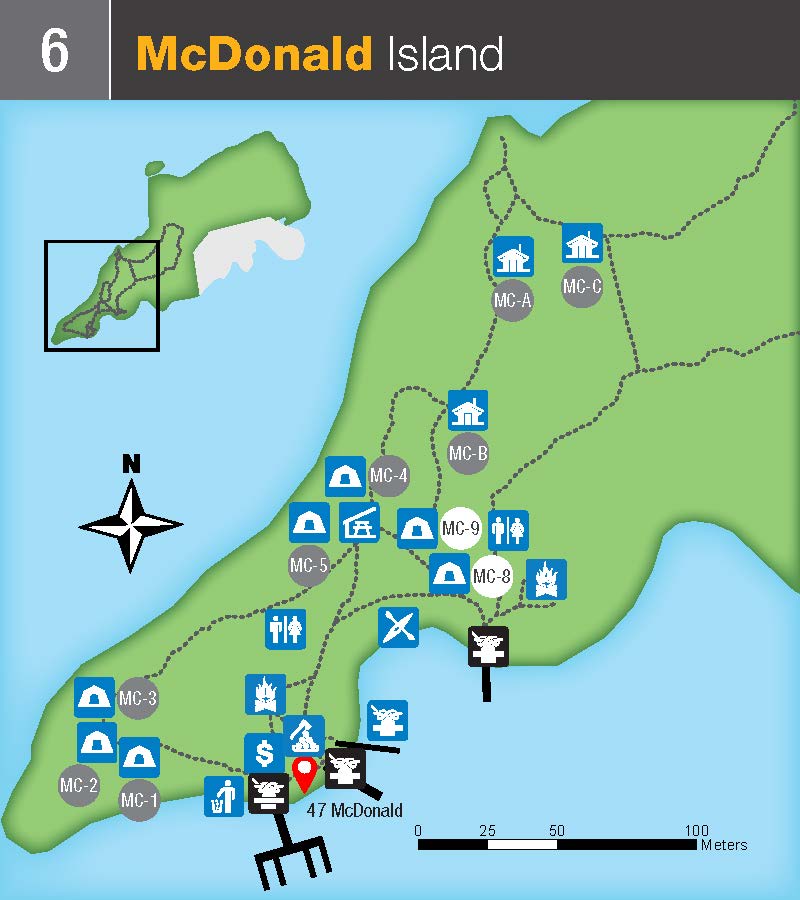
Available Docking Space at this location: >300 ft.
Thwartway (7)
GPS Coordinates: 44.291785, -76.152402
Closest access point: Gananoque Municipal Marina. Parking fees apply.
Paddlers and boaters—travel on the river requires planning and attention to weather conditions.
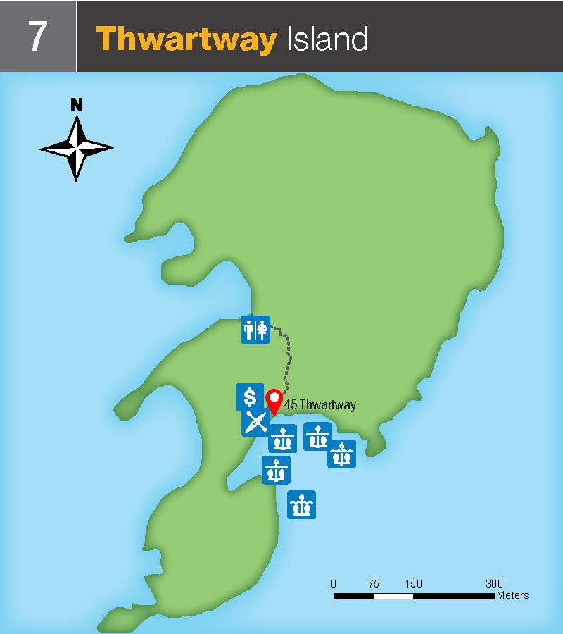
Available Docking Space at this location: 0-100 ft.
Lake Fleet Islands:
Camelot (8)
GPS Coordinates: 44.301500, -76.111012
Closest access points: Gananoque Municipal Marina, or Misty Isles Lodge. Parking fees apply.
Paddlers and boaters—travel on the river requires planning and attention to weather conditions.
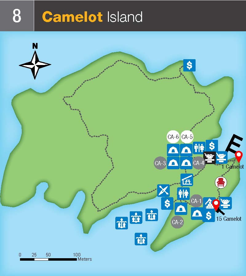
Available Docking Space at this location >300 ft.
Endymion (9)
GPS Coordinates: 44.302009, -76.097082
Closest access points: Gananoque Municipal Marina, or Misty Isles Lodge. Parking fees apply.
Paddlers and boaters—travel on the river requires planning and attention to weather conditions.
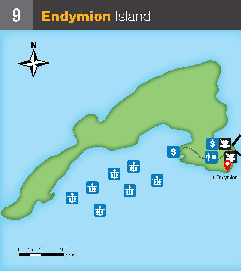
Available Docking Space at this location: 100-300 ft.
Navy Islands:
Gordon (10)
GPS Coordinates: 44.330466, -76.103106
Closest access point: Misty Isles Lodge. Parking is available through Misty Isles Lodge; fees apply.
Paddlers and boaters—travel on the river requires planning and attention to weather conditions.
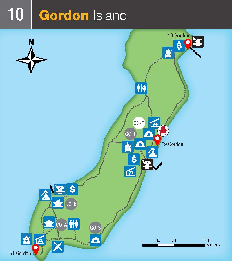
Available Docking Space at this location: >300 ft.
Mulcaster (11)
GPS Coordinates: 44.342781, -76.050551
Closest access point: Misty Isles Lodge. Parking is available through Misty Isles Lodge; fees apply
Paddlers and boaters—travel on the river requires planning and attention to weather conditions.
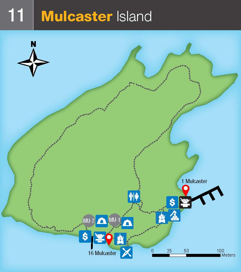
Available Docking Space at this location: >300 ft.
Middle Islands:
Georgina (12) and Constance (12)
GPS Coordinates: 44.361078, -75.984349 (Georgina), 44.359782, -75.979618 (Constance)
Closest access points: Ivy Lea public boat launch and Ivy Lea Provincial Park. Parking fees apply.
Paddlers and boaters—travel on the river requires planning and attention to weather conditions.
Paddling in this area is recommended for advanced paddlers only. The river bottlenecks here, generating strong and unpredictable currents as well as increased boat traffic.
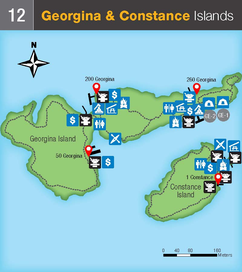
Available Docking Space at this location: >300 ft.
Hill (13)
GPS Coordinates: 44.366610, -75.953250
Closest access points: Ivy Lea public boat launch and Ivy Lea Provincial Park. Parking fees apply.
Paddlers and boaters—travel on the river requires planning and attention to weather conditions.
Paddling in this area is recommended for advanced paddlers only. The river bottlenecks here, generating strong and unpredictable currents as well as increased boat traffic.
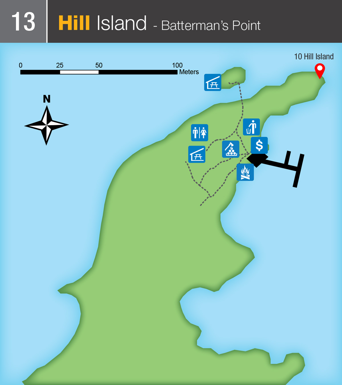
Available Docking Space at this location: 100-300 ft.
Grenadier Island:
Grenadier Island West (14)
GPS Coordinates: 44.384355, -75.906308
Closest access point: Mallorytown Landing, the mainland base of Thousand Islands National Park. Parking fees apply.
Paddlers and boaters—travel on the river requires planning and attention to weather conditions.
Paddling in this area is recommended for advanced paddlers only due to large channel with unpredictable conditions.
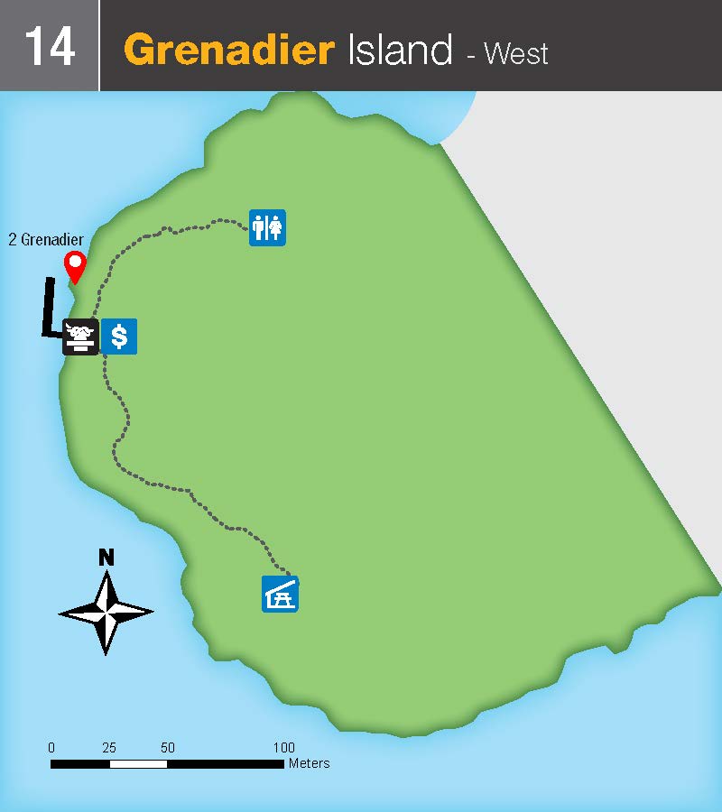
Available Docking Space at this location: 100-300 ft.
Grenadier Island Central (15)
GPS Coordinates: 44.402584, -75.875894
Closest access point: Mallorytown Landing, the mainland base of Thousand Islands National Park. Parking fees apply.
Paddlers and boaters—travel on the river requires planning and attention to weather conditions.
Paddling in this area is recommended for advanced paddlers only due to large channel with unpredictable conditions.
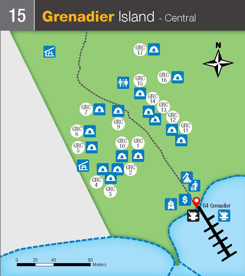
Available Docking Space at this location: 100-300 ft.
Grenadier Island East (16)
GPS Coordinates: 44.423970, -75.843665
Closest access point: Mallorytown Landing, the mainland base of Thousand Islands National Park. Parking fees apply.
Paddlers and boaters—travel on the river requires planning and attention to weather conditions.
Paddling in this area is recommended for advanced paddlers only due to large channel with unpredictable conditions.
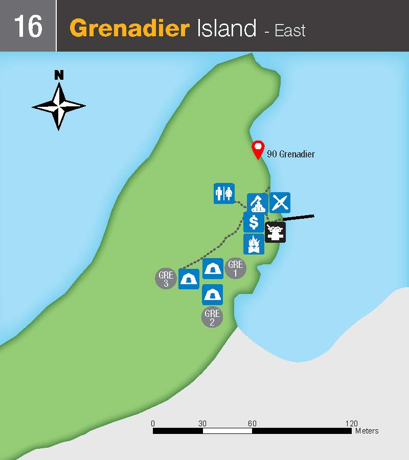
Available Docking Space at this location: 0-100 ft.
East Islands:
Adelaide (17)
GPS Coordinates: 44.434604, -75.839685
Closest access point: Mallorytown Landing, the mainland base of Thousand Islands National Park. Parking fees apply.
Paddlers and boaters—travel on the river requires planning and attention to weather conditions.
Paddling in this area is recommended for advanced paddlers only due to large channel with unpredictable conditions.
Click to enlarged image (JPEG - 52KB)
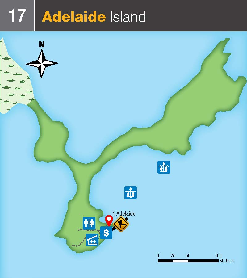
Available Docking Space at this location: 0-100 ft.
Stovin (18)
GPS Coordinates: 44.558640, -75.715078
Closest access point: Brockville Henry Street Boat Launch or paddle launch from St Lawrence Park
Paddlers and boaters—travel on the river requires planning and attention to weather conditions.
Click to enlarged image (JPEG - 409KB)
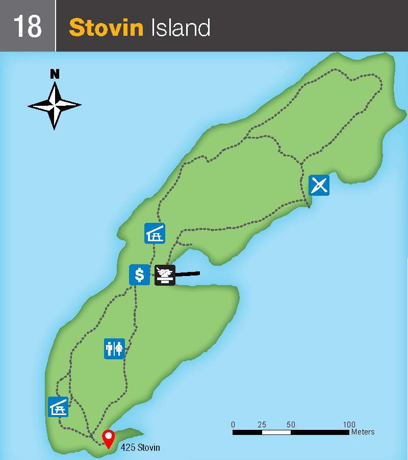
Future plans for this site in development. Available Docking Space at this location: 100-300 ft.
Related links
- Date modified :