
Photo: JD McKinnon
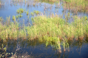
The Peace-Athabasca Delta is formed by the convergence of the Peace, Athabasca and Birch rivers at the western end of Lake Athabasca. Since the landscape is relatively flat, many of its waterways can flow in two directions depending on relative water levels in various reaches of the delta. Periodic high water events are of particular importance as they play an important role in replenishing the major delta lakes and surrounding wetlands with fresh water and nutrients. These flood events maintain a variety of plant successional stages, contributing to the high biological productivity and diversity that characterizes the delta.
Water levels on the Peace and Athabasca rivers peak during spring break-up and in the summer during sustained high flows produced by runoff from mountain snowmelt and upstream rainfall events. The rivers reach their highest levels when spring break-ups coincide with significant ice jam events. A major ice jam can constrict the river channel, causing a significant flow reversal and backwater effect. Depending on the peak water levels achieved during spring and summer high water events, water can also feed into the adjacent landscape and fill the shallow wetlands.
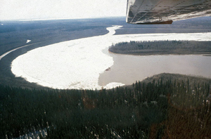
The main waters of the delta are connected to the northward-flowing Peace and Slave rivers by three major river channels – the Rivière des Rochers, the Revillon Coupé, and the Chenal des Quatre Fourches. Normally these river channels flow northward. However, when the stage of the Peace River is higher than the water level of Lake Athabasca (as can sometimes happen during a spring break-up ice jam event or during summer flood events), the water flow can reverse, flowing back south into the delta and Lake Athabasca. When it occurs, this backflooding plays an important role in maintaining water levels in the delta lakes and adjacent wetlands.
Significance of Periodic Spring Floods
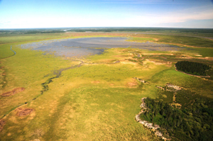
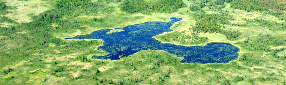
Many of the small lakes of the delta exist as “perched basins.” Isolated perched basins are at a higher elevation than the nearby rivers and can only be replenished by overland flooding. When all of the perched basins are filled with water, they contribute an estimated 19,000 km of additional shoreline, providing prime habitat for muskrats, waterfowl, and other wildlife. Periodic flooding of these perched basins (about once per decade) is essential for their survival.
In recent decades, the effects of flow regulation on the Peace River, combined with climatic drying trends, have reduced the frequency of major spring floods and subsequent flooding of perched basins. This trend has caused many of the delta’s isolated perched basins to dry up, with submergent and emergent vegetation species replaced over time by dry ground species such as grasses and willows.
- Date modified :