
Getting here
Kejimkujik National Park and National Historic Site
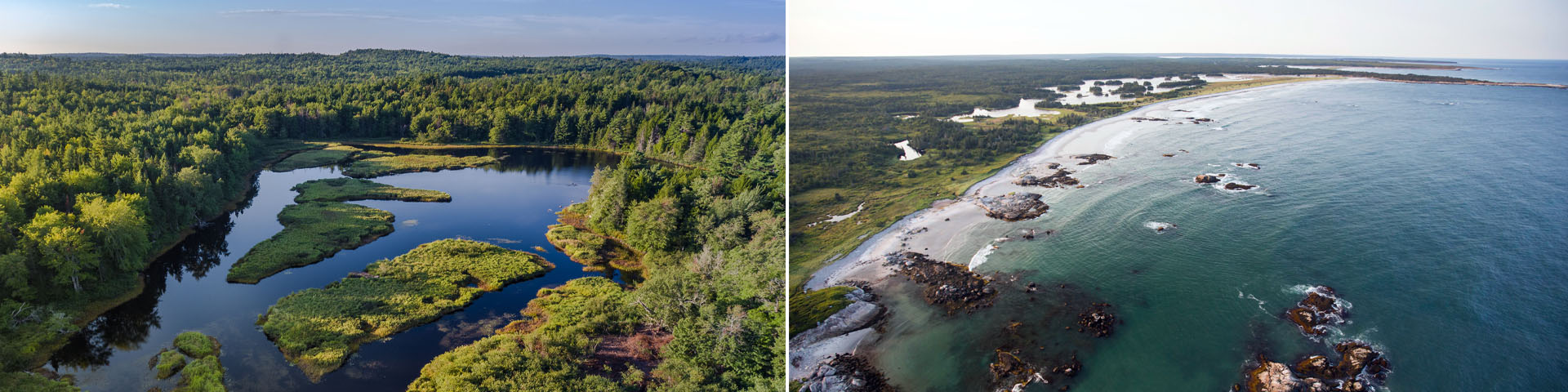
Kejimkujik includes two distinct locations: one inland (Kejimkujik National Park and National Historic Site) and one seaside (Kejimkujik National Park Seaside). The two locations are separated by 100 km and are vastly different.
Current fire danger rating and fire ban information
Motorized watercraft
As of 2026, it is prohibited to operate motorized watercraft within Kejimkujik, except with written authorization from the Superintendent and for the purpose of park administration.
On this page
- How to get to Kejimkujik National Park and National Historic Site
- How to get to Kejimkujik Seaside
- Map
How to get to Kejimkujik National Park and National Historic Site
Kejimkujik National Park and National Historic Site is the main location, nestled inland near the village of Caledonia, about 167 km from Halifax.
Civic address: 3005 Kejimkujik Main Parkway, Maitland Bridge, NS B0T 1B0, Canada
GPS coordinates: N 44.43829 W 65.20860
By bus:
By bus
Parkbus is now offering day trips from Halifax to Kejimkujik on select dates. Please visit Parkbus for more information.
By car from:
Halifax (Distance: 167 km)
Drive south on Highway 103 and take Exit 13 (Bridgewater). The park is 66 km further; signs will indicate direction and distance to Kejimkujik. Turn right onto Highway 325 and turn left when the road joins Highway 208. Continue on the 208 until the road joins Route 8. Turn right onto Route 8, proceeding through Caledonia. Kejimkujik is 18 km from Caledonia, in the community of Maitland Bridge. Driving time: approximately 2 hrs 5 minutes, based on an average driving speed of 80 km/h (50 mph).
Annapolis Valley (Distance: 60 km)
Take Exit 22 (Lequille/Annapolis Royal) off Highway 101. Turn left onto Route 8, continuing 46 km to Kejimkujik, in the community of Maitland Bridge. Driving time: approximately 45 minutes from Annapolis Royal, based on an average driving speed of 80 km/h (50 mph).
Yarmouth (Distance: 190 km) or Digby (Distance: 86 km)
Travel north on Highway 101 and take Exit 22 (Lequille/Annapolis Royal). Turn right onto Route 8, continuing 46 km to Kejimkujik, in the community of Maitland Bridge. Driving time: approximately 2 hrs 30 minutes and 1 hr 15 minutes, based on an average driving speed of 80 km/h (50 mph).
The South Shore (Distance: 80 km)
Take Exit 19 (Liverpool) off Highway 103 and travel along Route 8, continuing 66 km to Kejimkujik, in the community of Maitland Bridge. Driving time: approximately 1 hr from Liverpool, based on an average driving speed of 80 km/h (50 mph).
Electric vehicle charging stations are available at the Visitor Centre parking lot (year-round) and the Lakeview Café & Eatery in the P4 parking lot at Merrymakedge, and near the Tuck Shoppe in Jeremy’s Bay campground (seasonally). More information about the EV charging stations at Kejimkujik.
By plane
Halifax Robert L. Stanfield International Airport is the largest and most central international airport in the province. Kejimkujik is 197 km from the airport.By ferry
Ferries service southwestern Nova Scotia at Digby and Yarmouth.
By train
Passenger train service in Nova Scotia comes to Halifax, which is 174 km from Kejimkujik.
How to get to Kejimkujik Seaside
Kejimkujik Seaside is located along Nova Scotia’s coast, 99 km southeast of Kejimkujik National Park and National Historic Site.
Civic address: 1188 St. Catherines River Rd, Port Joli, NS B0T 1S0, Canada
GPS coordinates: N 43.837904 W 64.856189
By bus:
By bus
Parkbus is now offering day trips from Halifax to Kejimkujik Seaside on select dates. Please visit Parkbus for more information.
By car from:
Halifax (Distance: 180 km)
Southward along Highway 103 to turn off at Exit 22, continuing towards Port Joli and turning left onto St. Catherine's River Road while following the Parks Canada signs. Driving time: 2 hrs 15 minutes, based on an average driving speed of 80 km/h (50 mph).
Kejimkujik National Park and National Historic Site (Distance: 99 km)
Follow Route 8 for 66 km until Liverpool, and then drive west on Highway 103, as indicated above. Driving time: approximately 1 hr 14 minutes, based on an average driving speed of 80 km/h (50 mph).
Digby (Distance: 183 km)
Travel north on Highway 101 and take Exit 22 (Lequille/Annapolis Royal). Turn right onto Route 8, continuing 110 km to Liverpool, and then drive west on Highway 103, as indicated above. Driving time: approximately 2 hrs 30 minutes, based on an average driving speed of 80 km/h (50 mph).
Yarmouth (Distance: 173 km)
Drive east on Highway 103 for approximately 130 km. Continue for another 14 km past Exit 23 (Sable River). Turn right off the 103 onto St. Catherines River Road (watch for this sudden right turn). Travel another 6 km to the park entrance. Driving time: approximately 1 hr 45 minutes, based on an average driving speed of 80 km/h (50 mph).
Map
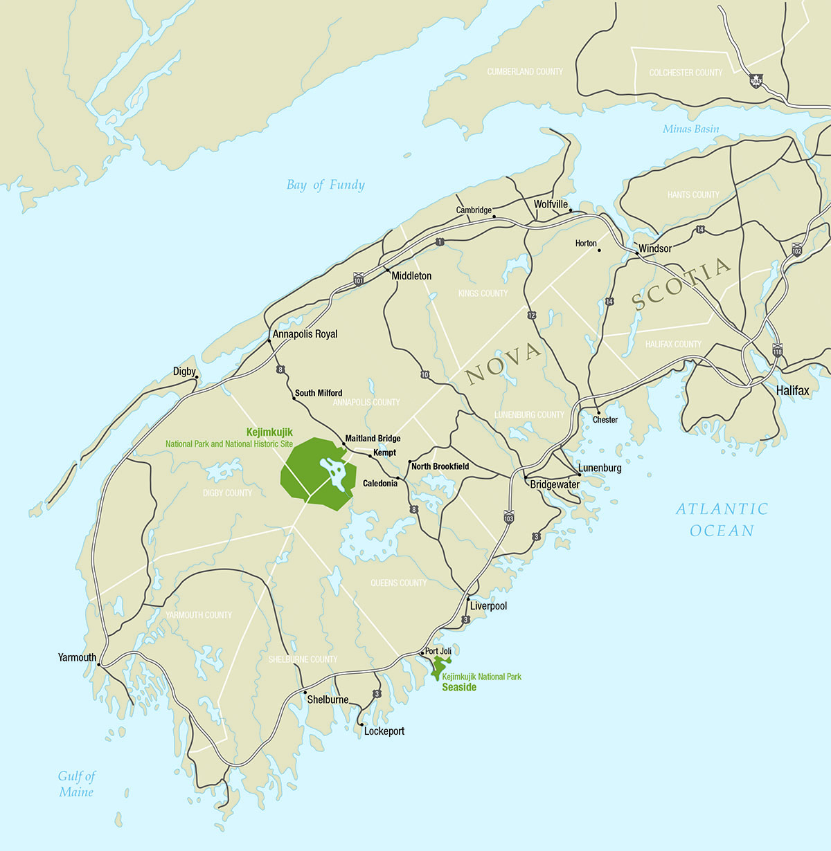
This downloadable map of Southern Nova Scotia (PDF, 564 KB) shows the main highways to Kejimkujik National Park and National Historic Site and Kejimkujik Seaside, as well as towns and larger villages.
More information
- Date modified :