
Geology
Cape Breton Highlands National Park
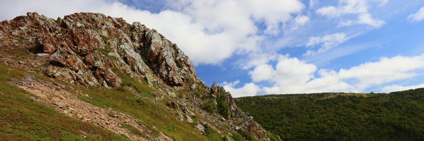
The dominant feature of northern Cape Breton is the Cape Breton Plateau, averaging 350 metres at its edges but rising to more than 500 metres at its centre. The Cape Breton Plateau is part of the worn down Appalachian mountain chain which stretches from Georgia to Newfoundland. Extending over 70% of the park, the plateau appears flat-topped but actually consists of broad, gently rolling hills, deeply cut by steep-walled river canyons and broad valleys.
On the west coast the plateau meets the Gulf of St. Lawrence in steep cliffs. On the east, the highlands border the Atlantic Ocean in a more gently sloping coastal plain with low headlands and a few long sandy beaches.
The formation of Cape Breton Island
Cape Breton Island is made up of three main groups of rocks: the Bras d'Or terrane, the Avalon terrane and the Blair River inlier. Some of the oldest rocks in the Maritime provinces are found on Cape Breton Island, in the Blair River inlier.
The formation of the Cape Breton Plateau
The plateau as we see it today is the product of millions of years of geological change, including mountain building, erosion, and glaciation.
Faults and canyons in Cape Breton Highlands National Park
Faults, glaciers and rivers have all worked the landscape over millions of years to produce spectacular river canyons.
Related links
- Date modified :