
Getting here
Akami-Uapishkᵁ-KakKasuak-Mealy Mountains National Park Reserve
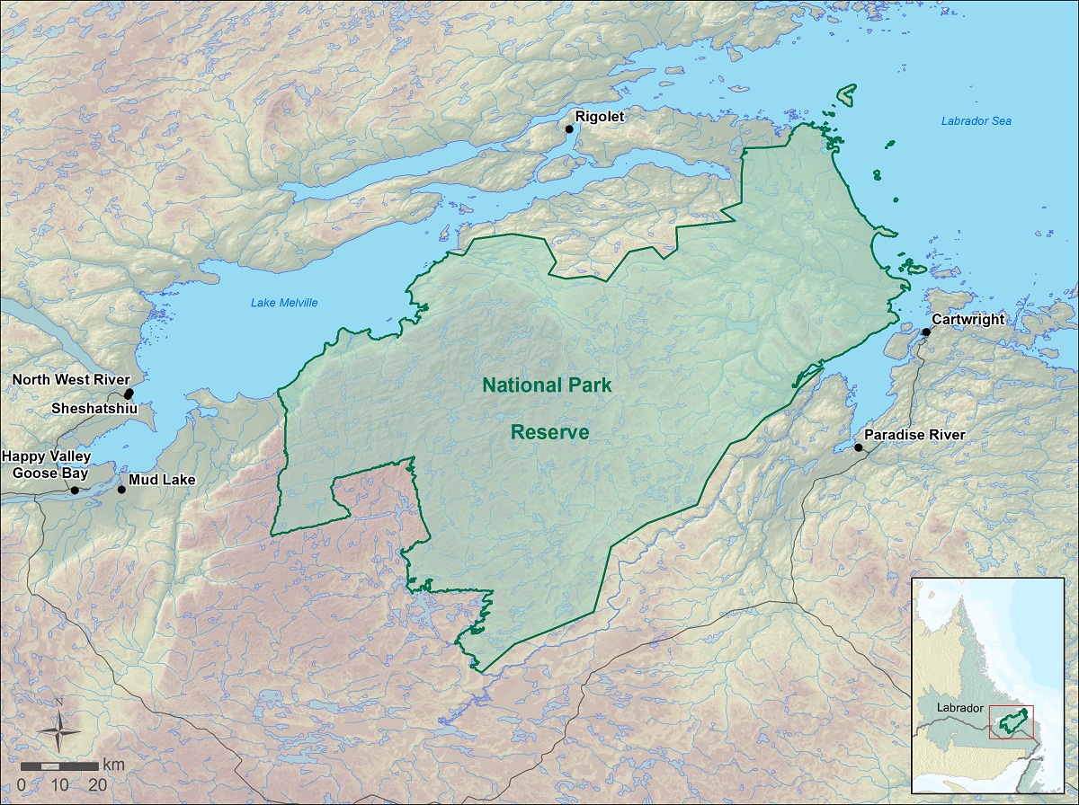
The Akami-Uapishkᵁ-KakKasuak-Mealy Mountains National Park Reserve is remote; it has no road access. The closest communities to it are: Happy Valley-Goose Bay, Sheshatshiu, North West River, Rigolet, Cartwright, Paradise River and Mud Lake. Potential visitors are encouraged to search the internet to find tourism providers and operators who are currently working in the area and offering access to the park.
Flying
The closest major airport is located at Happy Valley-Goose Bay. Direct flights into this airport are available from Deer Lake, St. John’s, Halifax and Montreal. From here, it is possible to drive to the communities of North West River, Sheshatshiu, Paradise River and Cartwright, or to fly to Rigolet aboard regional carriers. Helicopter or float plane access can also be arranged through charter companies located near this airport. More information on air access is found at NewfoundlandandLabrador.com.
Driving
From Newfoundland, the island portion of the province, the community of Cartwright can be reached by taking the Labrador ferry at St. Barbe NL to Blanc Sablon in QC. Drive the short distance eastwards on Route 138 to cross the Labrador border and take Highway (510) to Cartwright. From here it is also possible to continue on to Happy Valley-Goose Bay. For more information about driving Labrador’s roads, see the provincial government’s new online Trip Planner or visit the provincial government Web site.
Related links
- Date modified :