
Trail conditions
Riding Mountain National Park
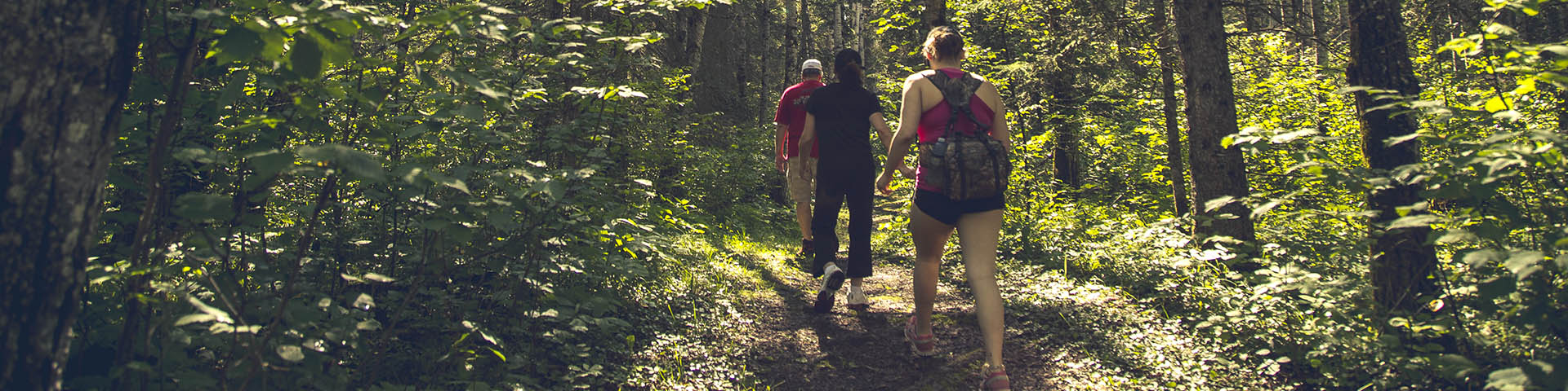
Home to a staggering diversity of living things and unique histories, Riding Mountain’s trails are the best way to connect with it all! Summer and fall you can stroll, run, pedal or trot nearly 370 km’s of trails in all areas of the Park, each with their own flavour. Cross country skiing, snowshoeing or fat biking along one of the nearly 130 km of winter trails is the best way that you can embrace Riding Mountain National Park in the winter season too. This magical time of the year won’t let you down and will warm your heart.
Visitor Safety
- Park visitors are responsible for their own safety and must be self-sufficient in dealing with any emergency that may occur. Cell phone service is unreliable in the backcountry of RMNP
- Plan your travel route
- Know the terrain and conditions
- Check the weather
- Let someone know when and where you are going and when you expect to return.
- Bring the essentials. (warm change of clothing, extra food and water, fire stating kit, first aid kit, navigation/communication device)
For more on Winter Safety
Trail difficulty rating
 Easy
Easy
• Suitable for all visitors including those with no trail experience. • Little or no elevation gain or loss.
 Moderate
• Suitable for most visitors who have some basic trail experience and basic experience in their chosen activity and are generally prepared • May experience moderate elevation gain with some short steep sections.
 Difficult
• Suitable for visitors who have trail experience and experience in their chosen activity and are prepared • May experience major elevation gain with long steep sections and a variety of terrain including wet areas and loose soil.
Legend
Map locations
| Name | Trail conditions | Image | Icon | Category |
|---|---|---|---|---|
| Arrowhead | Parking |  |  | Parking |
| Arrowhead | Moderate |  |  | Moderate |
| Aspen | Parking |  | | Parking |
| Bald Hill | Difficult |  |  | Difficult |
| Bald Hill - lookout | Difficult | |  | Lookout |
| Baldy Lake | Parking |  | | Parking |
| Baldy Lake | Easy |  |  | Easy |
| Beach Ridges | Parking | | | Parking |
| Beach Ridges | Easy |  | | Easy |
| Bead Lakes | Parking | | | Parking |
| Bead Lakes | Moderate | | | Moderate |
| Boreal | Parking | | | Parking |
| Boreal | Easy | | | Easy |
| Breezy Hill | Moderate | | | Moderate |
| Brûlé | Easy | | | Easy |
| Central West | Parking | | | Parking |
| Central West | Easy | | | Easy |
| Central West | Easy | | | Easy |
| Clear Lake east end | Parking | | | Parking |
| Clear Lake North Shore | Parking | | | Parking |
| Clear Lake North Shore - Glen Beag to Spruces | Moderate | | | Moderate |
| Clear Lake North Shore - Spruces to Aspen | Moderate | | | Moderate |
| Cowan Lake | Moderate | | | Moderate |
| Crawford trailhead | Parking | | | Parking |
| Crawford Creek | Moderate | | | Moderate |
| East Deep Lake | Moderate | | | Moderate |
| East Gate | Parking | | | Parking |
| East Gate Link | Easy | | | Easy |
| Edwards Creek | Easy | | | Easy |
| Edwards Creek | Easy | | | Easy |
| Escarpment | Parking | | | Parking |
| Escarpment | Easy | | | Easy |
| Frith | Parking | | | Parking |
| Gorge Creek | Parking | | | Parking |
| Gorge Creek | Difficult | | | Difficult |
| Grasshopper Valley | Parking | | | Parking |
| Grasshopper Valley | Moderate | | | Moderate |
| Grey Owl | Moderate | | | Moderate |
| Grey Owl trailhead | Parking | | | Parking |
| Gunn Lake | Difficult | | | Difficult |
| J.E.T. - lookout | Difficult | | | Lookout |
| J.E.T. - lookout | Difficult | | | Lookout |
| J.E.T. | Difficult | | | Difficult |
| Kinosao | Moderate | | | Moderate |
| Kippan's Mill | Parking | | | Parking |
| Kippan's Mill | Easy | | | Easy |
| Lake Katherine | Parking | | | Parking |
| Lake Katherine | Easy | | | Easy |
| Lake Tilson | Parking | | | Parking |
| Lake Tilson | Difficult | | | Difficult |
| Lake Tilson | Difficult | | | Difficult |
| Lakeshore Walk | Easy | | | Easy |
| Link | Moderate | | | Moderate |
| Long Lake | Parking | | | Parking |
| Long Lake | Easy | | | Easy |
| Long Lake campsite | Easy | | | Easy |
| Lookout | Easy | | | Lookout |
| Moon Lake | Parking | | | Parking |
| Moon Lake | Moderate | | | Moderate |
| Oak Ridge | Parking | | | Parking |
| Oak Ridge | Moderate | | | Moderate |
| Ochre River | Parking | | | Parking |
| Ochre River | Difficult | | | Difficult |
| Ominnik Marsh | Easy | | | Easy |
| Parking | Parking | | | Parking |
| Reeves Ravine | Difficult | | | Difficult |
| Scott Creek | Moderate | | | Moderate |
| South Lake | Moderate | | | Moderate |
| Spruces | Parking | | | Parking |
| Strathclair | Easy | | | Easy |
| Strathclair | Easy | | | Easy |
| Sugarloaf | Parking | | | Parking |
| Sugarloaf | Easy | | | Easy |
| Wasagaming Bike Trail | Moderate | | | Moderate |
| Wasagaming Trail Network | Moderate | | | Moderate |
| Whitewater campsite | Easy | | | Easy |
| Bald Hill | Red chairs |  | | Red chairs |
| South Lake | Red chairs | | | Red chairs |
| Deep Bay | Red chairs | | | Red chairs |
| Moon Lake | Red chairs | | | Red chairs |
| Edwards Creek | Red chairs | | | Red chairs |
| Lake Audy | Red chairs | | | Red chairs |
Map routes
| Name | Category | |
|---|---|---|
| Arrowhead | Moderate | Moderate |
| Bald Hill | Difficult | Difficult |
| Baldy Lake | Easy | Easy |
| Beach Ridges | Easy | Easy |
| Bead Lakes | Moderate | Moderate |
| Boreal | Easy | Easy |
| Breezy Hill | Moderate | Moderate |
| Brule | Easy | Easy |
| Central West | Easy | Easy |
| Central West | Easy | Easy |
| Clear Lake North Shore | Moderate | Moderate |
| Clear Lake North Shore - Glen Beag to Spruces | Moderate | Moderate |
| Clear Lake North Shore - Spruces to Aspen | Moderate | Moderate |
| Clear Lake South Shore | Moderate | Moderate |
| Cowan Lake | Moderate | Moderate |
| Crawford Creek | Moderate | Moderate |
| Deep Bay | Easy | Easy |
| East Deep Lake | Moderate | Moderate |
| East Gate Link | Easy | Easy |
| Edwards Creek | Easy | Easy |
| Edwards Creek short loop | Easy | Closed |
| Escarpment | Easy | Easy |
| Gorge Creek | Difficult | Difficult |
| Grasshopper Valley | Moderate | Closed |
| Grey Owl | Moderate | Moderate |
| Gunn Creek | Easy | Easy |
| Gunn Lake | Difficult | Difficult |
| J.E.T. | Difficult | Difficult |
| Kinosao | Moderate | Moderate |
| Kippan's Mill | Easy | Easy |
| Lake Katherine | Easy | Easy |
| Lake Tilson | Difficult | Difficult |
| Lakeshore Walk | Easy | Easy |
| Link | Moderate | Moderate |
| Long Lake | Easy | Easy |
| Long Lake campsite | Easy | Easy |
| Moon Lake | Moderate | Moderate |
| Oak Ridge | Moderate | Moderate |
| Ochre River | Difficult | Difficult |
| Ominnik Marsh Trail | Easy | Easy |
| Onanole Trail - West | Easy | Easy |
| Onanole Trail - Elkhorn | Easy | Easy |
| Reeves Ravine | Difficult | Difficult |
| Scott Creek | Moderate | Moderate |
| South Lake Trail | Moderate | Moderate |
| Strathclair | Easy | Easy |
| Sugarloaf | Easy | Easy |
| Vern Jordan Trail | Easy | Easy |
| Wasagaming Trail | Moderate | Moderate |
| Whitewater campsite | Easy | Easy |
Map areas
| Name | Description | Category |
|---|---|---|
| Burls and Bittersweet Trail CLOSED | Restricted Activity - Closed trail | Closed area |
| Edwards Creek Trail Short Loop | Area Closure - Edwards Creek Trail Short Loop | Closed area |
Wasagaming and Clear Lake
| Rating | Trail | Condition | Comment | Links |
|---|---|---|---|---|
 Easy Easy |
South Lake | Good. | 2026-07-10: Trail recently cleared of fallen trees; Wet and muddy sections; Recently mowed.; | Trail details |
| Easy |
Clear Lake North Shore - Glen Beag to Spruces - New Section (Clear Lake North Shore - Glen Beag to Spruces) | Fair. | 2026-07-17: Trail recently cleared of fallen trees; Use caution; Extensive trail erosion; Wet and muddy sections; | Trail details |
 Moderate Moderate |
Clear Lake South Shore - Frith Beach to Camp Wannakumbac | Fair. | 2026-07-02: Flooded sections; Trail recently cleared of fallen trees; Recently mowed.; | Trail details |
| Easy |
Clear Lake North Shore - Spruces to Aspen | Fair. | 2026-07-03: Trail recently cleared of fallen trees; Wet and muddy sections; | Trail details |
| Moderate |
Clear Lake South Shore - Boat Cove to Frith Beach | Fair. | 2026-07-02: Trail recently cleared of fallen trees; Wet and muddy sections; Use caution; | Trail details |
| Easy |
Ominnik Marsh | Open. | 2026-07-03: Maintenance work in progress; | Trail details |
| Easy |
Lakeshore | Good. | 2026-07-03: Trail recently cleared of fallen trees; | Trail details |
| Easy |
Wasagaming Campground Trail | Good. | 2026-07-10: Trail recently cleared of fallen trees; Recently mowed.; | Trail details |
| Moderate |
Arrowhead Trail | Good. | 2026-07-13: Trail recently cleared of fallen trees; Wet and muddy sections; Recently mowed.; | Trail details |
| Moderate |
Cowan Lake | Good. | 2026-07-14: Trail recently cleared of fallen trees; Recently mowed.; Wet and muddy sections; | Trail details |
| Moderate |
Grey Owl: Grey Owl (Kinosao intersection to trail end) | Good. | 2026-07-01: Trail recently cleared of fallen trees; Wet and muddy sections; | Trail details |
| Moderate |
Grey Owl: Grey Owl (TH to Kinosao intersection) | Good. | 2026-07-01: Trail recently cleared of fallen trees; Wet and muddy sections; | Trail details |
| Easy |
Brûlé Trail: Brûlé Trail (Kinosao Lake to TH) | Good. | 2026-07-14: Trail recently cleared of fallen trees; Recently mowed.; | Trail details |
| Easy |
Brûlé Trail: Brûlé Trail (TH to Kinosao Lake) | Good. | 2026-07-14: Trail recently cleared of fallen trees; Recently mowed.; | Trail details |
| Moderate |
Lake Katherine | Good. | 2026-07-13: Trail recently cleared of fallen trees; Recently mowed.; | Trail details |
| Moderate |
Kinosao: Kinosao (Kinosao Lake to Grey Owl intersection) | Good. | 2026-07-14: Trail recently cleared of fallen trees; Recently mowed.; | Trail details |
| Moderate |
Kinosao: Kinosao (TH to Kinosao Lake) | Good. | 2026-07-14: Trail recently cleared of fallen trees; Recently mowed.; | Trail details |
Riding Mountain Parkway
| Rating | Trail | Condition | Comment | Links |
|---|---|---|---|---|
| Easy |
Beach Ridges Trail | Fair. | 2026-07-03: Flooded sections; Wet and muddy sections; | Trail details |
| Easy |
Boreal Trail | Fair. | 2026-07-03: Water levels are high; short sections of tread erosion; | Trail details |
| Moderate |
Bead Lakes Trail | Fair. | 2026-07-14: Flooded sections; Wet and muddy sections; | Trail details |
 Difficult Difficult |
Crawford Creek | Fair. | 2026-07-08: Numerous trees down on trail; Wet and muddy sections; | Trail details |
| Easy |
Edwards Creek Trail: Edwards Creek Trail - Short loop (EK) | Closed. | 2026-07-10: Closed ; Caution; Extensive trail erosion; | Trail details |
| Difficult |
Edwards Creek Trail: Edwards Creek (EK) | Unknown conditions. | 2026-06-30: Warning; Water levels are high; Stream levels are high; Flooded sections; | Trail details |
| Easy |
Kippan's Mill | Unknown conditions. | 2026-06-30: Warning; Water levels are high; Stream levels are high; Flooded sections; | Trail details |
| Difficult |
Moon Lake | Unknown conditions. | 2026-06-30: Warning; Water levels are high; Stream levels are high; Flooded sections; | Trail details |
| Difficult |
Ochre River | Unknown conditions. | 2026-06-30: Warning; Water levels are high; Stream levels are high; Flooded sections; | Trail details |
West Side and Lake Audy
| Rating | Trail | Condition | Comment | Links |
|---|---|---|---|---|
| Moderate |
Strathclair | Unknown conditions. | 2026-06-30: Warning; Water levels are high; Stream levels are high; Flooded sections; | Trail details |
| Moderate |
Central - Gunn Lake junction to Sugarloaf junction | Unknown conditions. | 2026-06-30: Warning; Water levels are high; Stream levels are high; Flooded sections; | Trail details |
| Moderate |
Central - Sugarloaf junction to West trailhead | Fair. | 2026-06-30: Wet and muddy sections; Trail recently cleared of fallen trees; | Trail details |
| Moderate |
Central - East trailhead to Gunn Lake junction | Fair. | 2026-07-08: Trail recently cleared of fallen trees; Recently mowed.; Wet and muddy sections; | Trail details |
| Moderate |
Sugarloaf | Poor. | 2026-07-03: Extensive trail erosion; Use caution; | Trail details |
| Difficult |
Gunn Lake | Good. | 2026-07-08: Trail recently cleared of fallen trees; | Trail details |
| Moderate |
Baldy Lake Trail | Fair. | 2026-07-08: Trail recently cleared of fallen trees; Wet and muddy sections; | Trail details |
| Moderate |
Link | Closed. | 2026-07-08: Flooded sections; | Trail details |
| Moderate |
Long Lake | Poor. | 2026-07-03: Impassable due to high water; High water levels at stream crossings; Wet and muddy sections; Recently mowed.; Trail recently cleared of fallen trees; | Trail details |
| Moderate |
Grasshopper Valley | Closed for maintenance. | 2026-07-08: Flooded sections; Trail washed out in sections; Maintenance work in progress; | Trail details |
| Difficult |
Tilson Lake: Tilson Lake (East Section) | Unknown conditions. | 2026-06-30: Warning; Water levels are high; Stream levels are high; Flooded sections; | Trail details |
| Difficult |
Tilson Lake: Tilson Lake (South Boundary) | Good. | 2026-07-10: Trail recently cleared of fallen trees; | Trail details |
| Difficult |
Tilson Lake: Tilson Lake (West Section) | Unknown conditions. | 2026-06-30: Warning; Water levels are high; Stream levels are high; Flooded sections; | Trail details |
East Escarpment
| Rating | Trail | Condition | Comment | Links |
|---|---|---|---|---|
| Difficult |
Bald Hill: Bald Hill - Reeve Ravine to J.E.T. | Unknown conditions. | 2026-06-30: Warning; Water levels are high; Stream levels are high; Flooded sections; | Trail details |
| Difficult |
Bald Hill: Bald Hill (Jet intersection to Escarpment intersection) | Fair. | 2026-07-10: May have fallen trees; Trail overgrown with vegetation; Use caution; Extensive trail erosion; | Trail details |
| Difficult |
Bald Hill: Bald Hill (Lookout) | Fair. | 2026-07-10: Use caution; Trail recently cleared of fallen trees; Trail overgrown with vegetation; | Trail details |
| Moderate |
Gorge Creek | Caution. | 2026-07-21: Extensive trail erosion; May have fallen trees; | Trail details |
| Moderate |
Reeve Ravine - Jct to Bald Hill | Good. | 2026-07-10: Trail recently cleared of fallen trees; Use caution; | Trail details |
| Moderate |
Reeve Ravine - Trailhead to Jct | Good. | 2026-07-10: Use caution; Trail recently cleared of fallen trees; | Trail details |
| Moderate |
Reeve Ravine - Jct to J.E.T. | Unknown conditions. | 2026-06-30: Warning; Water levels are high; Stream levels are high; Flooded sections; | Trail details |
| Moderate |
Escarpment: Escarpment | Unknown conditions. | 2026-06-30: Warning; Water levels are high; Stream levels are high; Flooded sections; | Trail details |
| Moderate |
Escarpment: Escarpment (1- TH to Bald Hill Intersection) | Fair. | 2026-07-10: Wet and muddy sections; Trail recently cleared of fallen trees; | Trail details |
| Moderate |
Escarpment: Escarpment (2- Bald Hill interestion to JET intersection) | Unknown conditions. | 2026-06-30: Warning; Water levels are high; Stream levels are high; Flooded sections; | Trail details |
| Moderate |
Escarpment: Escarpment (3- JET Intersection to Breezy Hill intersection) | Unknown conditions. | 2026-06-30: Warning; Water levels are high; Stream levels are high; Flooded sections; | Trail details |
| Moderate |
Escarpment: Escarpment (4- Breezy Hill intersection to end of trail) | Unknown conditions. | 2026-06-30: Warning; Water levels are high; Stream levels are high; Flooded sections; | Trail details |
| Easy |
Scott Creek | Unknown conditions. | 2026-06-30: Warning; Water levels are high; Stream levels are high; Flooded sections; | Trail details |
| Moderate |
Whirlpool Lake Trail | Unknown conditions. | 2026-06-30: Warning; Water levels are high; Stream levels are high; Flooded sections; | Trail details |
| Moderate |
Breezy Hill Trail | Unknown conditions. | 2026-06-30: Warning; Water levels are high; Stream levels are high; Flooded sections; | Trail details |
| Difficult |
J.E.T | Unknown conditions. | 2026-06-30: Warning; Water levels are high; Stream levels are high; Flooded sections; | Trail details |
| Moderate |
Oak Ridge: Oak Ridge (loop) | Good. | 2026-07-08: Trail recently cleared of fallen trees; Beware of Poison Ivy; | Trail details |
| Moderate |
Oak Ridge: Oak Ridge (TH to Scott Creek Intersection) | Fair. | 2026-07-02: Warning; Stream levels are high; Trail recently cleared of fallen trees; | Trail details |
Fire danger rating
| Rating | Trail | Condition | Comment | Links |
|---|---|---|---|---|
| Easy |
Riding Mountain National Park | Low | 2026-07-16: Not applicable; | Trail details |
Related links
- Date modified :