
Timeline of the Jasper Wildfire Complex
Jasper National Park
Thank you
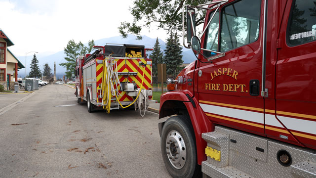
Thank you to all first responders who fought to protect Jasper. They worked tirelessly day and night, to protect this community, which to many, is their home. Their selflessness and bravery are truly commendable – we will always remember the extraordinary dedication they displayed during the challenging early days of this wildfire response.
The wildfire and its timeline
In mid July 2024, the region had extremely hot and dry weather. The fire danger rating was extreme beginning on July 10, 2024, and a fire ban was in effect beginning on July 12, 2024. Jasper National Park had two Type 1 crews and two Type 2 crews based in the park that were working on the Utopia and Needle Peak wildfires. Initial attack crews were conducting daily patrols for smoke and illegal fires.
During the late afternoon of July 22, 2024, a fire was reported near the Jasper Transfer Station. Thirty minutes later, another wildfire was reported near Kerkeslin Campground. Another ten minutes later, two more wildfires were reported near campgrounds south of Jasper. Wind gusts 20 to 30 kilometres an hour merged the three wildfires south of town into one and became too big for firefighters alone to handle.
 Fire east of the Jasper townsite
 Fire south of the Jasper townsite
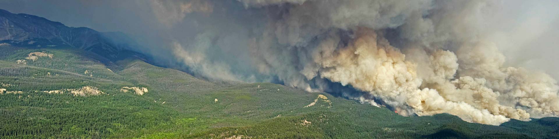
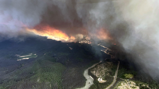
Within the first hours after the wildfires started the combined area of the fires grew to over 6,000 hectares. With flames 30-50 m high, new fires starting up to 500m ahead of the fire, and enormous smoke columns, all aerial and ground suppression efforts had limited success. These fires became the Jasper Wildfire Complex.
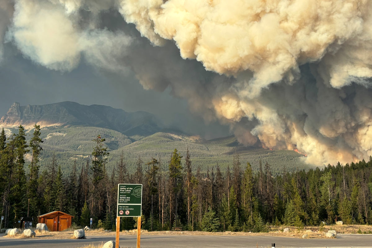 Valley of the Five Lakes, July 24, 2024
The quick actions taken by incident management staff on July 22 helped save lives. They moved quickly to evacuate the town and national park. Within an hour of the wildfire starting, they had evacuated several facilities, including three big campgrounds and two smaller ones outside the town. That same night, within just two hours, some of areas that had been evacuated, like Whirlpool and Kerkeslin campgrounds, were already burning.
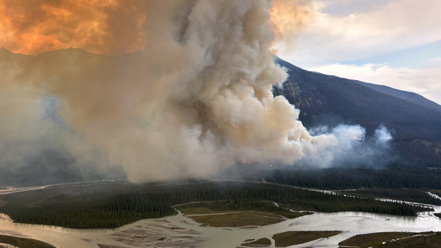
Hundreds of firefighters and resources, including state-of-the-art structure protection equipment for the town were called in and had arrived or were enroute before and on July 24. This included air tankers that did multiple retardant drops, but they did not reduce wildfire activity.
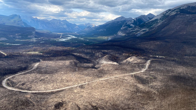 View from Maligne Valley looking towards the Athabasca Valley. August 21, 2024
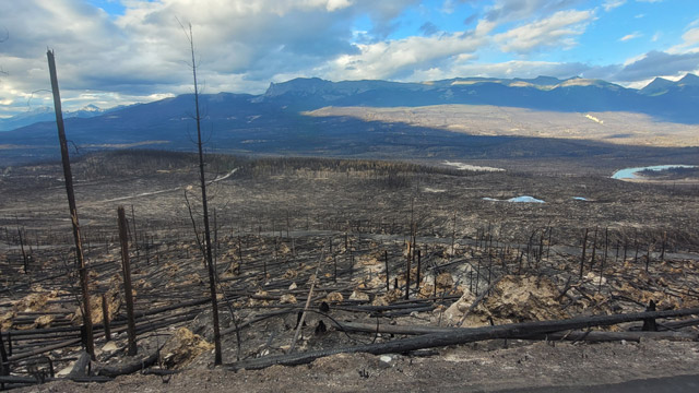 View of Mount Tekarra from the 93A area. July 30, 2024
As the wildfires continued to grow, they generated internal winds that accelerated wildfire growth at an aggressive rate. The shear strength of fire-generated convective winds uprooted healthy, mature trees including their entire root systems and threw large embers, sometimes up to a kilometer ahead of the fire.
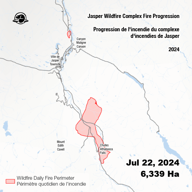
Jasper Wildfire Complex fire progression
Support from above
Air tankers (also known as water bombers) were requested on July 22 however support was not available. On July 23, air tankers were dispatched and made multiple drops on the wildfire complex with little impact on fire activity. Fire retardant was deployed multiple times but because of the wildfire severity, it proved ineffective. Further air tanker support was requested again on July 24, but strong winds, unstable air, and very poor visibility made it unsafe for airplanes to fly.
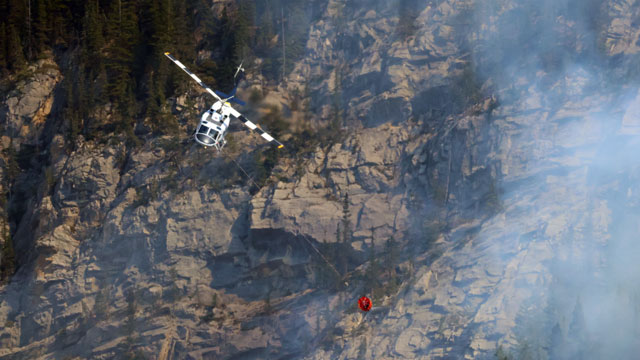
All available helicopters were utilized for bucketing operations and evacuating visitors from the backcountry. Alberta had provided a heavy lift Blackhawk helicopter for the fire that remained on the incident for the next 3 weeks.
Support on the ground
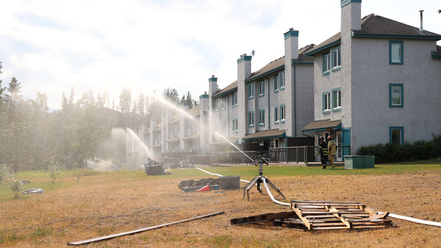
Within two hours of the wildfire starting, a 12” high volume sprinkler system was ordered for deployment south of the community of Jasper. Structure protection was set up on critical infrastructure on July 22. On July 23, structural protection high volume sprinklers were set up south and west of the community of Jasper and on additional critical infrastructure.
Bulldozers and heavy machinery were deployed on July 23 but had to be moved out of the fire’s path when conditions became unsafe for them to remain on the fire line.
Ignition specialists continuously assessed potential locations for strategic, landscape-level fuel removal. They were able to do tactical ignition operations on the east side of the Athabasca River, south of the Old Fort Point area that helped reduce fire intensity toward the north end of the Jasper townsite.
For the most up-to-date map of areas in Jasper National Park that are open and those areas that remain closed for public safety, visit parks.canada.ca/jasper-alerts.
- Date modified :