
Geology
Jasper National Park
Jasper National Park is an area of dramatic mountain peaks and expansive valleys. Many of the mountains rise to elevations above 3000 metres. Mt. Columbia, the highest peak in Alberta, is 3782 metres. The lowest point in the park, 985 metres above sea level, lies near the park's east gate.
The mountains in Jasper National Park form ranges running parallel to one another in a northwest to southeast alignment. The westernmost range in this series is the highest. It also forms the continental divide, separating streams that flow east and north to the Arctic Ocean or Hudson Bay from those which drain westward to the Pacific Ocean.
In places, gaps or passes form breaks in the steep-walled ranges and allow travel from one watershed to another. Rivers have also eroded passages through this otherwise rugged and precipitous land.
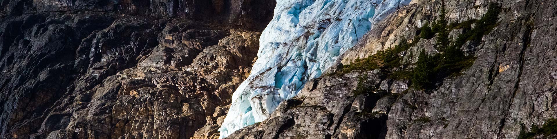
To remember Rockies geology, take it range by range. The main ranges are the highest ranges (they include Mt. Robson and the group of mammoth peaks surrounding the Columbia Icefield). The main ranges form the continental divide, which splits North America into eastern and western slopes. In Jasper National Park, the main ranges are largely coarse sandstone, limestone, shale, and a somewhat metamorphic rock called quartzite, in particular, 'Gog' quartzite.
East of the main ranges are the front ranges of the Rockies. The sea allowed for the profusion of a great many plants and animals here, probably because of its shallowness. The organic material that resulted contributed lime mud, which thickened and hardened into massive amounts of limestone. The front ranges are pale grey (from the lime) and distinct from the reddish/brownish main ranges. Typical front-range peaks in Jasper are the Colin Range and Roche Miette. Farther east, out of the park, we get to the foothills, those gentle mounds that appear just before the flatness of the plains.
You will not see the western ranges in Jasper National Park. They are located south of here, in Kootenay and Yoho national parks.
The Athabasca River and its tributaries drain more than four-fifths of the park. From the toe of the Columbia Glacier the Athabasca flows north and east through the park for nearly 150 kilometres. Ten other moderately-sized rivers and countless smaller creeks augment its volume over this distance. The Athabasca is one of the more significant rivers which flow from the mountain barrier toward the Arctic Ocean. The portion of the Athabasca which lies within Jasper National Park has been designated as a Canadian Heritage River.
Part of the north end of Jasper National Park lies in a different drainage basin than that of the Athabasca. The Smoky River, which originates in the extreme northwest corner of the park, courses northward to the Peace River in northern Alberta.
Water from the most southeasterly corner of the park is discharged via the Southesk and Brazeau rivers, which exit from the mountains and join the North Saskatchewan River.
These watercourses collect the runoff from an area of over 10,000 square kilometres. Peak flow begins in late June, when snowmelt and rainfall combine to fill the river channels to capacity. Melting glaciers keep the water levels high through July. In midsummer, these rivers contribute significantly to the water supply required for municipal and agricultural needs farther downstream.
- Date modified :