
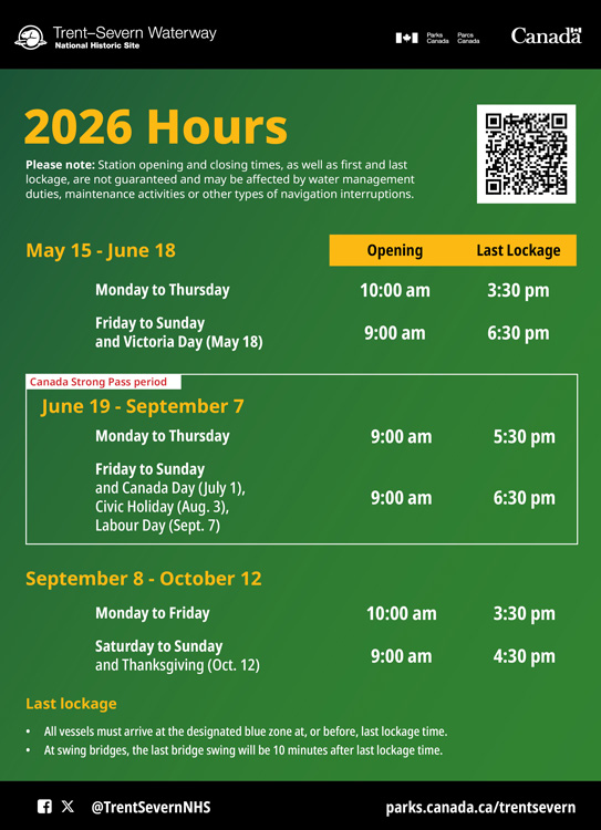
Brochures and publications
Trent-Severn Waterway National Historic Site
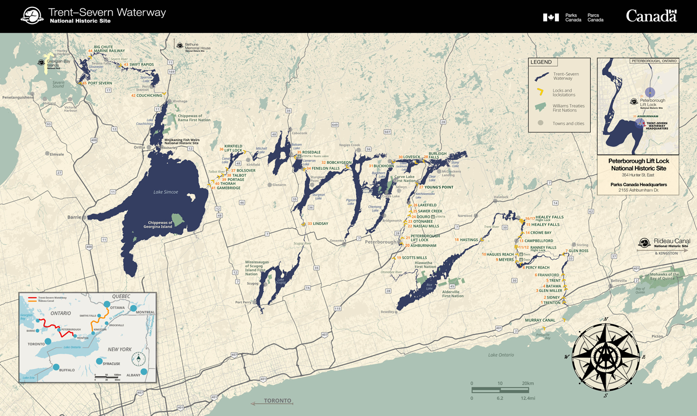
Please note: This map is for reference purposes only. It is not intended to be used for navigation. Please refer to Nautical charts, produced annually by the Canadian Hydrographic Society (CHS), for navigating the waterway by boat.Visitor map
- Date modified :