
Getting lost in the reeds
Lake Superior National Marine Conservation Area

By Ryan Wilkie
Nestled on the northwest shore of Lake Superior is Hurkett Cove, a diverse and key habitat for migratory birds, attracting enthusiasts who flock to catch glimpses of species as they travel through the cove each spring and fall. The open wetland of the freshwater estuary provides spawning beds for walleye and northern pike, and is home to reptiles, amphibians, mammals, insects, and many other invertebrates. This complexity is being monitored to study how cumulative factors, like climate change and invasive species, affect the ever-changing landscape.
Last summer, Parks Canada, Lakehead Region Conservation Authority, and the Nature Conservancy of Canada joined together to map and inventory stands of broadleaf cattail and wild rice in the cove. Also present was narrowleaf cattail, an invasive species that outcompetes native species like wild rice, by growing in more dense patches. It thereby changes the structural characteristics of the wetland, making it more challenging for wildlife to find food, escape predators, and simply move about.
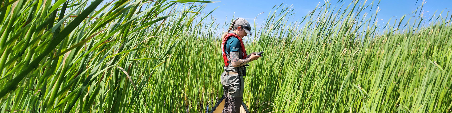
So how do we measure changes in plant communities like this? Well dear reader, over three weeks in August, with GPS units in hand, we set out in small teams to paddle the shallow waters and survey the cove. We identified the many different native plant species such as bull rush, floating reed, broad leaf cattail, wild rice, and others. We recorded plant height, community compositions, and boundaries of plant stands. We were on the hunt for invasive plant species, including the narrowleaf cattail and European phragmites. The cove is quite large, and the plant density makes for a challenging paddle at times. It would take too long to survey the whole site and map every individual plant community. Instead, we recorded samples of the different plant communities, collecting locations and data for long-term studies, and to help inform the image classifications of the aerial photos collected via drones.
Using drones in monitoring efforts helps staff expand our understanding of what’s happening on the landscape. In about 4 hours, the entire 3.5 square kilometers of area was flown and photographed with a drone, mapping the vegetation within the cove. This was done twice, using two different cameras; first a standard colour camera and second, a larger, 10-colour band, or multispectral camera initially designed for agricultural health assessments. The two sets of photos were then used to create a georeferenced mosaic image, or what’s called an orthomosaic.
By overlaying the GPS points and tracks collected by canoe over the orthomosaic, we match the data collected “on the ground” to the colour and texture information captured by the photos. We can then use the confirmed mosaic information to look at the places we couldn’t get to and identify plant communities for the entire cove locating invasive plant stands. When we go back again this summer, we will be re-flying the cove, mapping the vegetation again to see how rapidly the plant communities are changing. Repeat monitoring gives staff and partners an idea of where we need to focus our efforts to be most effective in protecting the native plants and animals in the cove.
Back to shoreLINES
- Date modified :