
© Markus Thompson / Thalassia
Central Coast of BC: Mia-yaltwa Ha’lidzogm hoon National Marine Conservation Area Reserve and Indigenous Protected and Conserved Area
Establishment agreement complete
An establishment agreement for the Mia-yaltwa Ha’lidzogm hoon National Marine Conservation Area (NMCAR) on the Central Coast of British Columbia is complete. Mia’yaltwa Ha’lidzogm hoon has also been declared as an Indigenous Protected and Conserved Area (IPCA) by the six partnering Nations.
How to pronounce Mia-yaltwa Ha’lidzogm hoon
Project description
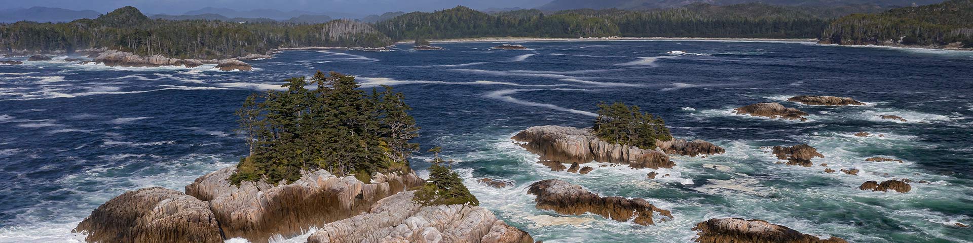
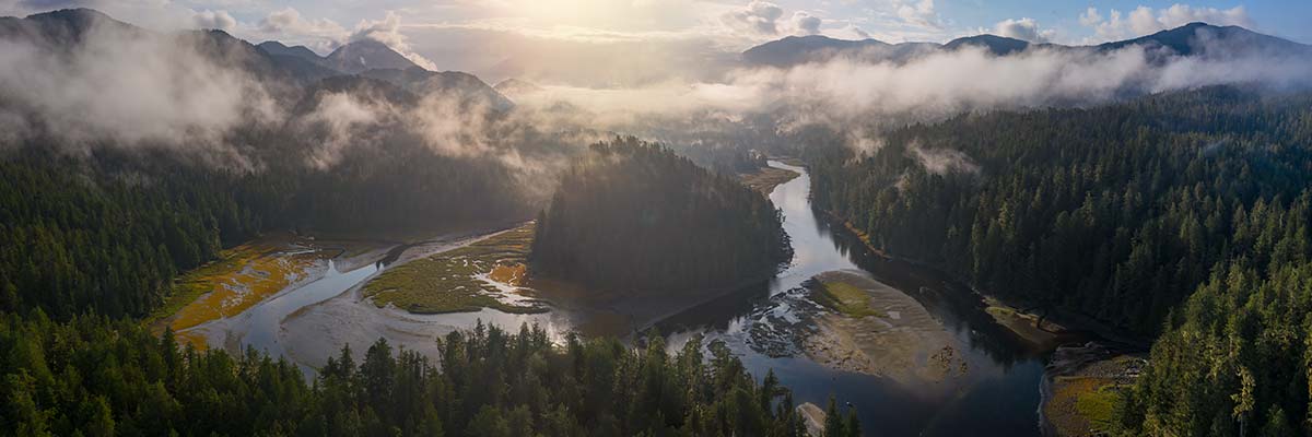
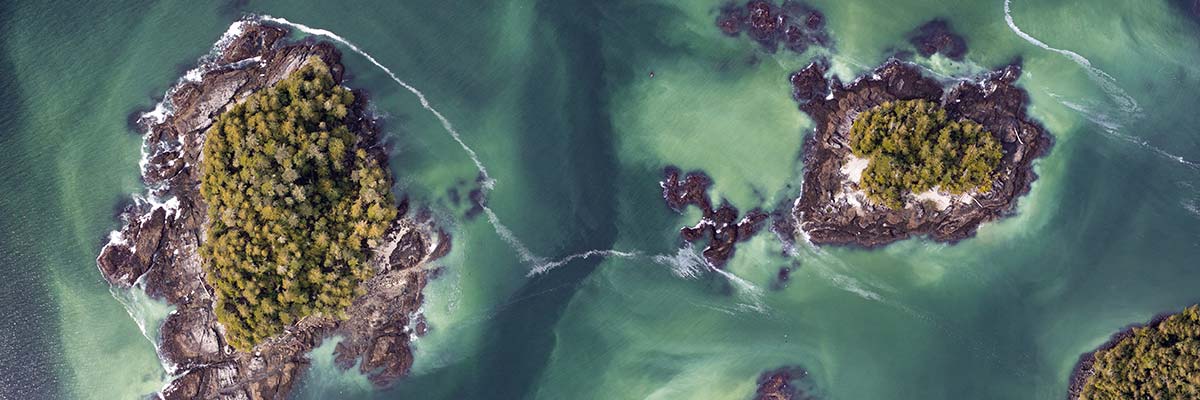
The Central Coast of British Columbia, nestled within the Great Bear Sea/Northern Shelf Bioregion, is one of the richest marine environments in the world. For millennia, the wellbeing of the Wuikinuxv, Nuxalk, Kitasoo Xai’xais, Heiltsuk, Gitxaala, and Gitga’at Nations has been linked to the health of this marine environment, and remains so today. This area is characterized by islands, rocky headlands and steep fjords. It is home to extraordinary ecological features including coral and sponge reefs, kelp forests and eelgrass beds that support salmon, eulachon and herring, whales and other marine mammals. The area is critical for community members’ cultural, spiritual and economic well-being, including food security.
The Mia-yaltwa Ha’lidzogm hoon (phonetically: Me-ah-yall-twa Ha-lee-joh-gom hOH-own) National Marine Conservation Area Reserve (NMCAR) and Indigenous Protected and Conserved Area (IPCA) uplifts the generational work of First Nations who have been stewarding the marine environment of the Central Coast for millennia. It will help marine ecosystems, biodiversity, and culturally important values to flourish. In turn, establishing Mia-yaltwa Ha’lidzogm hoon NMCAR-IPCA will support the well-being of First Nations and coastal communities, as well as the many marine sectors that depend on a healthy ocean.
Partners
In August 2021, the Wuikinuxv, Nuxalk, Kitasoo Xai’xais and Heiltsuk Nations signed a Memorandum of Understanding (MOU) with Parks Canada and the Province of British Columbia. This MOU launched a feasibility assessment for a proposed National Marine Conservation Area Reserve on the Central Coast of British Columbia. In fall 2023, following a request from Gitga’at and Gitxaała Nations to include key areas of their traditional territories in the National Marine Conservation Area Reserve feasibility assessment, the proposed boundary was expanded further north.
Wuikinuxv Nation
Nuxalk Nation
Kitasoo Xai’xais Nation
Heiltsuk Nation
Gitxaała Nation
Gitga’at Nation

Wuikinuxv Nation
Nuxalk Nation
Kitasoo Xai’xais Nation
Heiltsuk Nation
Gitxaała Nation
Gitga’at Nation
Current project stage
The establishment of a new NMCA generally follows a 5-step process. The establishment process for each NMCA is as unique as its features and considerations. This project is currently at Step 5 of 5 – Designate and protect NMCA in legislation. In this step, project partners will prepare for the initial stages of management planning, including zoning.
-
Completed1 Identify representative marine areas
-
Completed2 Select a candidate NMCA
-
Completed3 Assess feasibility of an NMCA
-
Completed4 Negotiate establishment agreement(s)
-
Current step5 Designate and protect NMCA in legislation
The Wuikinuxv, Nuxalk, Kitasoo Xai’xais, Heiltsuk, Gitxaała and Gitga’at Nations, the Government of Canada, through Parks Canada and Fisheries and Oceans Canada, and the Province of British Columbia have successfully negotiated and signed an establishment agreement for the Mia-yaltwa Ha’lidzogm hoon NMCAR-IPCA in the Central Coast region of British Columbia. This initiative is a testimony to the spirit of collaboration. It is an example of a multi-government, tripartite approach to marine protection. The finalized establishment agreement marks the joint commitment of partners to the shared cultural, ecological and economic values in the Central Coast region. It also marks a joint commitment to protect and manage the area in a way that meets the needs of present and future generations.
The simultaneous declaration of Mia-yaltwa Ha’lidzogm hoon as an IPCA will support marine stewardship by the 6 partner Nations, rooted in traditional practices and in accordance with Nations’ responsibilities to the land, ocean and the life they support. Together, IPCA and NMCAR designations can create a strong, layered approach to marine protection that allows partners and neighbours to walk alongside each other in caring for this special place.
Partners look forward to working with interest holders — including residents, stakeholders, and municipal governments — to shape how the future NMCAR-IPCA will be managed.
NMCAR-IPCA boundary
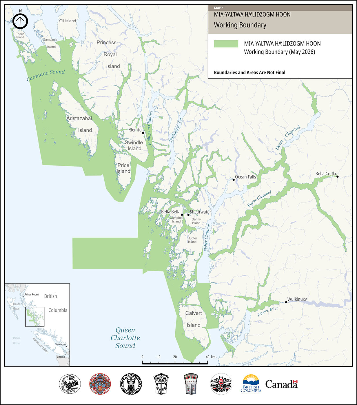
The green area on the Mia-yaltwa Ha’lidzogm hoon NMCAR-IPCA Working Boundary map (Map A) illustrates the working boundary for the NMCAR as of May 2026. This boundary has been developed through consultations and negotiations.
For example, some areas next to communities are excluded from the NMCAR-IPCA. In these community areas, activities will continue to be managed as they currently are. Excluding these areas from the NMCAR-IPCA will allow for future community growth and development of necessary marine infrastructure. The working boundary (Map A) has a smaller overall footprint than what was originally proposed for the NMCAR-IPCA, but it continues to align with priority areas identified to be of high ecological and cultural value by the Great Bear Sea Marine Protected Area Network.
Map A: Mia-yaltwa Ha’lidzogm hoon working boundary
Map A: Mia-yaltwa Ha’lidzogm hoon working boundary — Text description
This map is centered on the central coast region of British Columbia, Canada. The map area extends from the waters near Trutch, Gil, and Campania Islands in the north, southward to Calvert Island and includes portions the waters of Queen Charlotte Sound. A title in the upper right identifies the map as “Mia-yaltwa Ha’lidzogm hoon Working Boundary” with a note indicating that boundaries and areas are not final.
A legend box in the upper right contains one feature – the Mia-yaltwa Ha’lidzogm hoon Working Boundary (green shaded area).
The map contains a ‘key map’ in the lower left corner locating the extents of the primary map in the broader context of British Columbia and portions of the United States, including both Washington State and a portion of the Alaska pan handle. The key map also includes all of Vancouver Island and the Haida Gwaii archipelago.
A 0 to 40 km scale bar is included along the bottom of the main map, and a north arrow appears in the upper left corner. The logos of the Heiltsuk, Kitasoo Xai’xais, Wuikinuxv, Nuxalk, Gitga’at and Gitxaala First Nations, along with those of the governments of the Province of British Columbia and Canada are displayed across the bottom of the map.
The working boundary is shown on the map in green. The irregular western extent of the working boundary encompasses Calvert, Hunter, Campbell, Price, and Aristazabal Islands and extends out approximately 45 km into Queen Charlotte Sound at one point to capture a portion of Goose Bank beyond a cluster of islands known as the Goose Group. The northern extent of the working boundary includes the western side of Trutch Island, extends eastward midway across Campania Island and the southern tip of Gil Island. The eastern extent of the working boundary is delineated by a portion of Rivers Inlet and discontinuous sections of various inlets and channels northward including Fisher, Burke, Dean, Mathieson, and Finlayson Channels. There are large sections in many of these channels that are not included in the working boundary, up to approximately 60 km in length in the case of Fisher. To the south, the boundary includes waters and shorelines around Calvert Island and sections of water on the west and east coast of Penrose Island, extending south into Goose Bay.
The coastal communities of Klemtu, Oceans Falls, Bella Bella, Bella Coola, Shearwater, and Wuikinuxv are shown.
Rationale for this location

An NMCAR-IPCA on the Central Coast of BC was being considered for many reasons, including:
- high biodiversity and ecological values in the region
- cultural significance of the area
- opportunity for tourism and recreation
- this marine region is not currently represented in the Parks Canada national marine conservation area system plan.
Marine biodiversity is threatened by multiple stressors including habitat alteration, resource use pressure, and climate change. Culture, food security, ecosystem health, and economic opportunities in the Central Coast all depend on healthy marine ecosystems. The establishment of an NMCAR-IPCA aims to reduce localized stressors and protect important ecosystems to safeguard lasting social, economic, and cultural benefits for coastal communities.
Background
The Mia-yaltwa Ha’lidzogm hoon National Marine Conservation Area Reserve and Indigenous Protected and Conserved Area represents a core component of the Great Bear Sea Marine Protected Area Network in the Northern Shelf Bioregion. The governments of seventeen coastal First Nations, Canada and British Columbia endorsed a Network Action Plan for the Marine Protected Area (MPA) Network in February 2023. This plan provides a roadmap for protecting the marine environment in the region for current and future generations. The plan identified the establishment of a National Marine Conservation Area Reserve on the Central Coast as a priority.
From 2021 to 2024, the Wuikinuxv, Nuxalk, Kitasoo Xai’xais and Heiltsuk Nations (Central Coast Nations) worked together with the governments of Canada and British Columbia to determine whether establishing a National Marine Conservation Area Reserve on the Central Coast was feasible, and if so, under what conditions. This assessment was informed by previous planning initiatives, engagement with First Nation members, and feedback received through open houses, bilateral meetings, a public survey, and emails.
The feasibility assessment was completed in September 2024. All partners — including Gitga’at and Gitxaała Nations, as observers to the process — agreed that establishing an NMCAR on the Central Coast of BC was both feasible and desirable.
An establishment agreement was successfully completed in May 2026, setting out the terms and conditions under which the Mia-yaltwa Ha’lidzogm hoon NMCAR will be collaboratively managed.
Did you know?
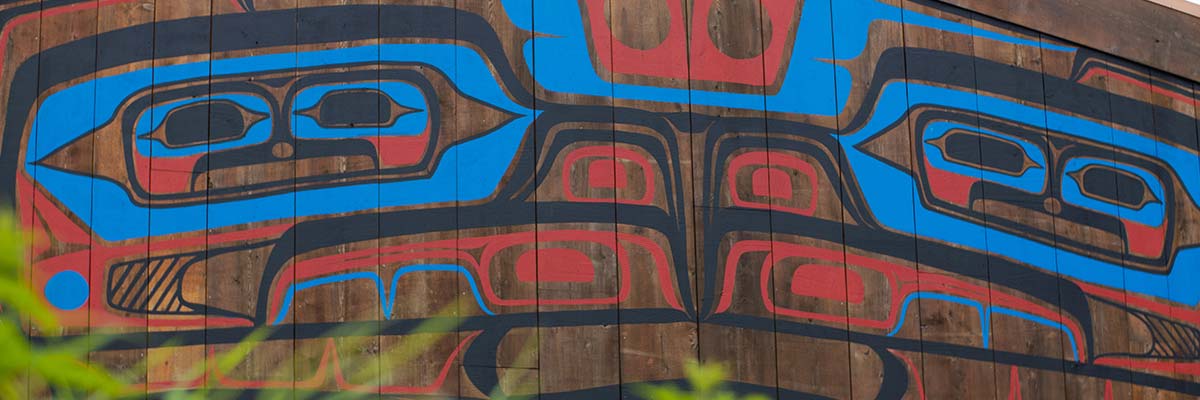
- The name Mia-yaltwa Ha’lidzogm hoon is a hybrid composite place name drawn from the Indigenous languages of the partner Nations, meaning “Realm of the Salmon, Home of the Salmon”.
Possible outcomes
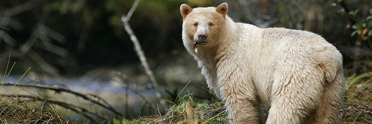
© Markus Thompson/Thalassia
Through the establishment of the Mia-yaltwa Ha’lidzogm hoon NMCAR-IPCA, the Government of Canada and the Province of B.C. can support the longstanding work by First Nations to build a strong, conservation-based economy that protects the Central Coast. Once implemented, the NMCAR-IPCA will protect up to 6,700 square kilometres of coastal waters that closely align with areas recommended for protection in the endorsed Network Action Plan.
NMCARs provide high ecological and cultural protections while also allowing ecologically sustainable activities and diversification of the local economy. The establishment of the Mia-yaltwa Ha’lidzogm hoon NMCAR-IPCA will protect important habitats, species, and ecosystems on which First Nations, coastal communities, and a diverse range of marine sectors rely. Human activities in the NMCAR-IPCA will be carefully co-governed between First Nations, the Government of Canada, and the Province of BC, based on Indigenous knowledge, local perspectives, and science. NMCARs can have different zones of activity that range from “strict protection” to “multiple use” areas, which allow for ecologically sustainable activities.
Establishing the Mia-yaltwa Ha’lidzogm hoon NMCAR-IPCA will help support an ecologically sustainable ocean economy on the Central Coast that includes activities such as commercial and recreational fishing, aquaculture (marine plants, shellfish), local tourism, recreation, and research. First Nations’ food, social, and ceremonial activities can continue in all NMCAR-IPCA zones.
Timeline and next steps
Partners have successfully negotiated an establishment agreement for an NMCAR on the Central Coast. The Establishment Agreement for the Mia-yaltwa Ha’lidzogm hoon NMCAR marks the beginning of a new and exciting chapter for the Central Coast. Governance partners and interest holders share an opportunity to work together to shape how the future NMCAR-IPCA will be managed.
Next steps towards making the Mia’yaltwa Ha’lidzogm hoon NMCAR-IPCA a reality include:
- Creating a collaborative management board with representation from partnering Nations, Canada, and British Columbia.
- Establishing an advisory committee, spanning a range of marine sectors and interests, to ensure voices of residents, stakeholders and municipal governments are heard.
- Preparing for the initial stages of management planning, including a zoning process that will be informed by previous plans and input from residents, stakeholders and municipal governments.
Related links
- Date modified :