
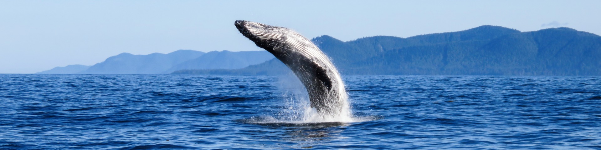
A humpback whale breaches in the ocean waters of Gwaii Haanas National Park Reserve, National Marine Conservation Area Reserve, and Haida Heritage Site. Photo: Niisii Guujaaw/Parks Canada
More national marine conservation areas for healthier environments, communities, and livelihoods
Parks Canada is leading and supporting the creation of 10 new national marine conservation areas (NMCAs) by 2025. These areas will contribute to Canada’s commitment to the international goal to protect 25% of marine and coastal areas by 2025, and 30% by 2030. That’s a lot of new NMCAs!
National marine conservation areas offer a ton of benefits. They’re a winning combination of healthy marine environments, communities, and livelihoods. There are a number of steps involved in creating new NMCAs. Leadership from Indigenous nations and support from coastal communities are important for creating successful NMCAs… for building better health for us, and for the planet. Watch this video to learn more:
More national marine conservation areas for the benefit of all
Transcript
[A series of aerial shots of Gwaii Haanas]
[Text: Gwaii Haanas National Park Reserve, National Marine Conservation Area and Haida Heritage Site]
This is Gwaii Haanas.
[An illustrated map of the National Marine Conservation Area and Marine Park Network appears.]
It's part of a rapidly growing system of national marine conservation areas, or NMCAs across Canada.
[Scenic shots of many plants and animals that are native to the Gwaii Haanas area.]
The protections provided by an NMCA make Gwaii Haanas a refuge where biodiversity, ecosystems and people can all thrive together.
[A member of the Council of the Haida Nation speaks to a group of tourists.]
They protect cultural practices and resources, too.
[A member of the Council of the Haida Nation carves a canoe using traditional methods.]
What makes these waters different from some other protected places is that they're managed not just by the Government of Canada, but together with the Haida Nation.
[Scenic shots of Gwaii Haaas.]
[A boat floats in the water, featuring both the Government of Canada and the Haida Nation logos.]
Also, people here can continue to earn a living from things like sustainable fishing and other commercial activities inside the conservation area.
[Members of the Haida Nation talk amongst one another. Someone cleans a fish outside near the water. Someone canoes near the shore in Gwaii Haanas.]
[A seal plays in the water near a school of fish.]
The protections of the NMCA make sure that these things happen in a way that keeps ecosystems balanced and healthy.
[An illustrated timeline appears, indicating the “Haida Nation Designation of Gwaii Haanas as Haida Heritage Site” in 1985. Then, the “Creation of the National Marine Conservation Area Reserve” in 2010.]
Now, it's important to know that the Haida Nation has been stewarding these lands and waters since time immemorial.
They designated Gwaii Haanas as a Haida Heritage Site back in the eighties, and the federal government then followed with the co-creation of the National Marine Conservation Area Reserve in 2010.
[Resource conservation staff from both Parks Canada and the Council of the Haida Nation conduct research and monitoring work from a boat in Gwaii Haanas.]
Gwaii Haanas is an example of how governments at all levels can work together to strengthen marine protection.
[Fish swim amongst the seaweed underwater. A Parks Canada staff member looks through binoculars at an iceberg in the distance.]
At Parks Canada, we want to keep working with people who are already connected to Canada's waters to create more of these NMCAs.
[A group of people look out over the water in Tallurutiup Imanga National Marine Conservation Area. Fishermen remove crabs from crab traps on a boat.]
Ten more, to be exact.
[Diane speaks directly into the camera, standing in front of a body of water.]
[Name Tag: Diane Blanchard, National Marine Conservation Areas Establishment Program Manager]
This is Parks Canada marine ecologist Diane Blanchard.
She's been working hard behind the scenes with community partners for years now to establish these new NMCAs.
[Images of underwater creatures flash across the screen.]
Maintaining healthy ecosystems within national marine conservation areas is important for everyone. Oceans give us so much in our daily lives. The main part of the oxygen we breathe comes from the oceans. It is produced by microorganisms. that we call phytoplankton. They are microscopic marine algae that float on the ocean surface, and one out of two breaths comes from the oceans.
[A crab walks along the ocean floor. A seal swims underwater. A beluga swims underneath the water.]
Aside from being important for humans in general, NMCAs also protect major habitat for lots of species at risk.
[An illustrated narwhal swims beneath the water. The narwhal swims up above the water and the camera moves backward, revealing two people standing at the edge of the ice. An image of a person ice fishing appears.]
Yep, that's a narwhal. They also support Indigenous rights and traditional harvesting practices, which is a vital means of access to healthy, sustainable food sources and is essential to Indigenous cultures.
[Fishers process lobsters on a fishing boat.]
These are just some of the many reasons we're working with partners to create more NMCAs.
[A Parks Canada employee and community members hug.]
I'm really happy to be part of this project
[Lawrence speaks directly into the camera.]
[Name Tag: Lawrence Martin, Mushkegowuk Council, Proposed NMCA in Western James Bay and Southwestern Hudson Bay]
because it allows me to get reconnected back to the land, to the waters of the area where I grew up in.
[Aerial footage of a vast wetland. People walk along the shore of a large body of water. People stand on a rocky shore, watching a whale surface.]
The Mushkegowuk people have always lived in harmony with the earth and with all living things within the earth, and they often talk about the interconnectivity between the land and the water. That there is not a line between there's actually just a continuation.
[People sit on a shore, removing the meat from a piece of fish. Fishers float in a fishing boat and remove lobster from a trap.]
Canada's oceans and Great Lakes have supported Indigenous and coastal communities for centuries, and they continue to be hugely important to people who are connected to these marine areas.
[Many different people from diverse backgrounds smile into the camera.]
[Water crashes down a waterfall. An iceberg stands tall in the water. Water tumbles down the sides of a rock wall and people stand underneath it, catching the water with their tongues.]
So we know why protecting waters along with the ecosystems, biodiversity and people that they support is important. And that's especially true for Canada.
[An illustrated map of Canada appears. An orange dotted line appears along the coastline of Canada, emphasizing that Canada has the longest coastline of any country in the world.]
We actually have the longest coastline of any country.
[An illustrated earth appears, emphasizing that Canada manages 20% of the world’s fresh water.]
We're also responsible for around 20% of the world's freshwater. No pressure.
[An illustrated graph appears, titled “Marine and Coastal Area Protected”. The graph compares the contrast between 14% of Canada’s currently protected water and Canada’s goal of protecting 30% of Canada’s water by 2030.]
Canada's goal is to protect 30% of its waters by 2030. Otherwise referred to as 30 by 30. That's nearly 3 million kilometres squared of protected water,
[36 illustrated Lake Superiors appear, stacked on top of one another.]
which is more than 36 times the size of Lake Superior.
That's a lot of H2O.
[Scenic shots of various national marine conservation areas and proposed national marine conservation areas. Children run around on a beach. Fishers stand in a boat on a body of water.]
At Parks Canada, collaborating with Indigenous governments and coastal communities to create new national marine conservation areas is our way of contributing to that goal.
[Orange location markers appear along an illustrated coastline, indicating new national marine conservation areas to be established.]
And like we said, we're planning for ten new ones. This is really exciting news.
[A seal twirls around underwater, beneath green seaweed hanging from the water’s surface.]
Well, we're excited anyway.
[Dolphins swim alongside a boat. People kayak in an open body of water. A whale tail flaps on top the water.]
Our aim is to have one NMCA to represent each of Canada's 29 unique marine regions.
[Various different bodies of water flash across the screen.]
These areas are hand-picked to showcase the huge diversity of marine and freshwater habitats that Canada has to offer
[A lady crouches down on a beach with a mother and small child who are visiting the park.]
[Une femmes'accroupit sur une plage avec une mère et son jeune enfant qui visitent le parc.]
and important cultural and historical features, too.
[A man applauds a friend and they hug.]
By integrating Indigenous leadership in the creation and management of NMCAs,
[A woman looks into the camera. Parks Canada employees and members of the Haida Nation stand at the bow of a boat and retrieve a crab trap from the water.] we can make sure this work is grounded in Western science,
[Seals jump out of the water alongside a boat.]
Indigenous knowledge and other local perspectives.
[Scenic images of Parks Canada places flash across the screen. A Parks Canada research boat heads out into the ocean.]
Establishing new national marine conservation areas takes time, but when everything falls into place, they're an exciting blueprint for a future
[Water falls off a waterfall.] where we work together to protect and manage Canada's waters
[A person wearing a bright pink parka stands at the edge of a body of ice, overlooking the ocean.]
in a way that benefits both people and the planet.
[An otter floats in the water eating a sea urchin.]
Follow along on our journey to more NMCAs at the link on your screen.
[Text: parks.canada.ca/nmca-expansion]
[Text: Images provided by …]
[Parks Canada branding]
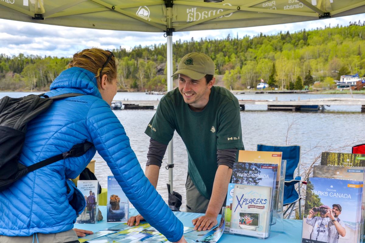
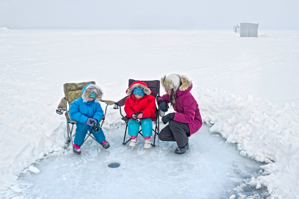
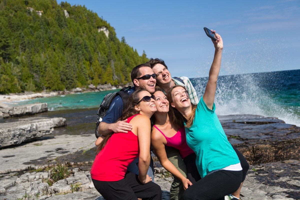
Iconic coastal and cultural places
Canada has the longest coastline in the world at 243,042 kilometers. More than one quarter of Canadians live in coastal areas. There are countless ways that Canadians use and enjoy marine and freshwater places in every season.
The marine environment is core to the social, cultural and economic well-being of coastal communities. Indigenous Peoples have cared for and been sustained by these areas for millennia.
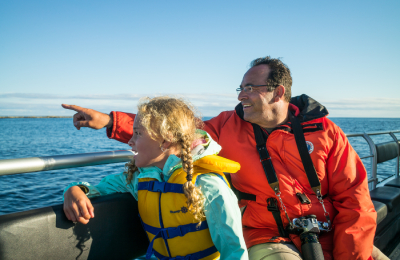
National marine conservation areas create opportunities for Canadians to appreciate and enjoy their natural and cultural marine heritage.

Select images to enlarge
National marine conservation areas
Parks Canada has over 30 years of experience creating marine and freshwater NMCAs. Strong Indigenous leadership, and a close collaboration with other partners, have been key to protecting and conserving these areas.
Together, we have protected and conserved 5 NMCAs in 6 unique marine regions across 3 provinces and 1 territory. Another 7 proposed sites are in different phases of a feasibility assessment to become an NMCA.
Zoning
Zoning is a collaborative process that determines where various activities and uses are allowed within an NMCA. All NMCAs are divided into zones that allow for ecologically sustainable uses of marine resources. Every NMCA needs at least one zone that fully protects special marine ecosystem features.
Each NMCA also needs at least one multiple-use zone. These zones allow different activities that don’t compromise the health of the ecosystem. Zoning is a key feature of NMCAs.
Based on sightings of Beluga groups, Parks Canada staff implemented zoning at Saguenay–St. Lawrence Marine Park in Quebec to help protect this species at risk.
Watch how an area closure is reducing human disturbance for St. Lawrence Estuary Belugas:
Transcript
Parks Canada Beaver Logo
A dark green illustrated map of Quebec shows an orange place marker over a light green shape of Saguenay–St. Lawrence Marine Park. The map zooms in to focus on Sainte-Marguerite Bay and the Saguenay River.
The date “2016” is indicated in the top left corner. A dense cluster of green lines and blue dots appear throughout the Saguenay River. An illustration of a St. Lawrence Beluga along with a label at the bottom indicates that this data represents “beluga and boat distribution pre-area closure”. The blue dots are clustered where Sainte-Marguerite Bay meets the Saguenay River. The green lines are spread widely throughout the Saguenay River. A legend in the top right corner reveals that each dot represents a “Beluga group sighting” and each green line represents a “boat passage”. An asterisk appears at the bottom with text that reads “Boat passages have been reduced to 10%. The data is showing that the boat passages are forcing Beluga groups to stay concentrated in a small area.
The date changes to 2018. A red outline appears where Saine-Marguerite Bay meets the Saguenay River. This is the same area where the beluga group sightings are concentrated. The red outline indicates an area closure that is off-limits to boat passages.
The date changes to 2022, four years after the area closure. Boat passages are now more concentrated at the side of the Saguenay River opposite to Sainte-Marguerite Bay. The blue dots representing Beluga group sightings are now more spread across the Saguenay River.
Building blocks to create new NMCAs
No two NMCAs are the same. Each NMCA will vary depending on who is creating it, where it’s being created, and the different building blocks used to create it. While every NMCA is unique, there are common pieces that go into creating all NMCAs.
Some of the building blocks used to create new NMCAs include:
- a marine or freshwater area that:
- represents 1 of Canada’s 29 unique marine regions
- is rich in marine features, like wildlife, archaeological treasures, islands, special oceanographic processes
- does not contain oil and gas exploration and development, mineral mining, or bottom trawling, and has strict limits on the disposal of substances
- leadership and Traditional Ecological Knowledge from Indigenous nations
- marine users, like fishers, shippers, and tourism operators, that can continue their uses sustainably and respectfully
- feasibility assessments, consultations, and negotiations with partners. They include a mix of:
- other federal departments, and provincial, territorial and Indigenous governments
- stakeholders, including different industries, tourism operators, recreationalists, academia, and non-governmental organizations
- coastal communities and the public
- visitors to come enjoy the NMCA and learn about its natural and cultural treasures
Parks Canada, Indigenous nations, and key stakeholders draw on these pieces as building blocks to create new NMCAs in Canada.
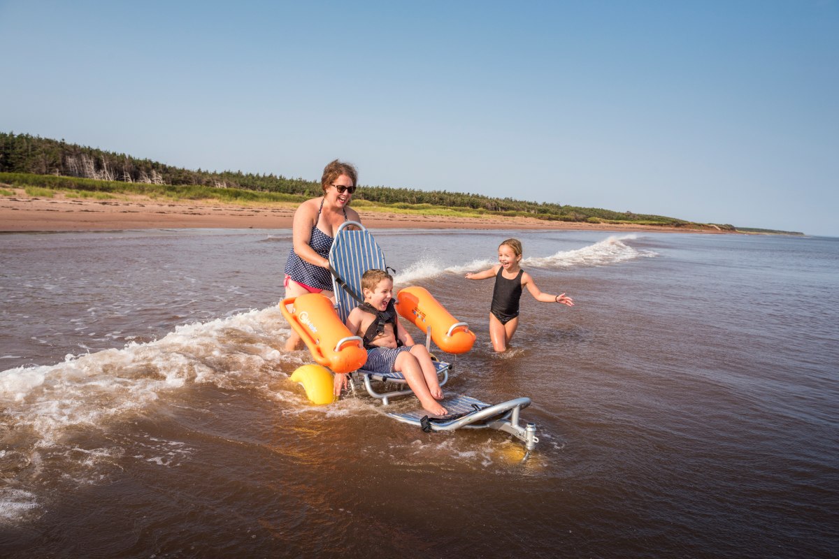
Creating NMCAs means building better health
Creating new NMCAs offers heaps of value. Spending time in NMCAs can improve our health and wellbeing. All coastal communities rely on these areas for social and economic benefits. Marine and freshwater areas provide everyone with:
- a sense of identity
- prosperity and a means of survival
- a sense of place
- connection to nature
Indigenous people and communities are especially connected to these areas. They have long-standing connections to the lands and waters of NMCAs. These are places where Indigenous people continue their traditional and cultural practices.
Marine wildlife, like whales, fish, turtles and seabirds, rely on healthy food supply and habitats found in NMCAs. Many economies that depend on marine areas can only continue if the ocean and its wildlife are flourishing. Creating NMCAs can even mitigate the effects of climate change.
.jpg)
That’s why it's so important for our health—and the planet—to work together to protect more of these marine areas. By doing so, current and future generations can continue to use, better understand and enjoy them.
Creating NMCAs help make healthy wildlife, communities, and livelihoods.
-
Healthy water, healthy wildlife
Saguenay St—Lawrence Marine Park, Quebec
Watch a video from Saguenay St—Lawrence Marine Park about their efforts to protect the St. Lawrence Estuary Beluga.
Text transcript
Parks Canada beaver logo
[Aerial view of the Alliance research boat leaving the Tadoussac Marina.]
[Host speaks directly into the camera with the research boat docked behind her.]
[The Resource Conservation team is preparing the boat for a day of research on the water.]
[Name Tag] Sarah Duquette, Resource Management Officer, Saguenay–St. Lawrence Marine Park
[Name Tag] Research Team, Saguenay–St. Lawrence Marine Park
Good morning, here is the Tadoussac Marina.
We have a really beautiful day!
The sea conditions are ideal, there is no wind, so it's perfect for operations in the upper estuary.
[Beluga whales are swimming together in the water.]
[Text] The Saguenay–St. Lawrence Marine Park is in the heart of critical habitat for at-risk St. Lawrence Estuary Belugas.
An aerial view of the Saguenay River coastline.
[Text] Parks Canada and Sépaq work closely with several partners and coastal communities to protect the belugas.
[Sarah prepares a smaller Zodiac boat that will accompany the Alliance on the research expedition.]
So today on the Alliance, it’s a big day.
[There are many people on board, so we will accompany them.]
In fact, we're going to join them using our Zodiac, the Uapameku.
[Name Tag] Chloé Chartrand, Resource Management Officer, Saguenay–St. Lawrence Marine Park
[Title] Studying Habitats to Better Protect Belugas, Saguenay–St. Lawrence Marine Park
[Both boats leave the marina and head to the research location.]
Today, the work will be carried out in a really particular sector, the upper estuary, which is a very important sector, especially for belugas.
[A map of Saguenay–St. Lawrence Marine Park appears and a dotted outline shows the location of the upper estuary in the St. Lawrence River, south of the Saguenay River mouth.]
[Belugas swim in the distance and a close-up image of a beluga whale appears, giving a closer look at the whales.]
[Text] The upper estuary is a critical habitat for St. Lawrence Belugas. Females use it as a nursery to birth and care for their young.
[A Parks Canada scientist uses binoculars to study the coastline in the Saguenay River.]
[Text] In the Marine Park, Parks Canada scientists and their partners study things like food availability, underwater noise, contamination levels, and the presence of aquatic invasive species.
[The Alliance research boat floats in the distance. Sarah, the host, approaches the Alliance with the Zodiac.]
Our research vessel, the Alliance, is about to arrive, so, we’ll wait here in this enchanting environment.
[Name Tag] Samuel Turgeon, Resource Conservation Manager, Saguenay–St. Lawrence Marine Park
[Name Tag] Eliza-Jane Morin, Resource Management Officer, Saguenay–St. Lawrence Marine Park
[Name Tag] Simon Bouchard, Alliance Captain, Saguenay–St. Lawrence Marine Park
[Simon tosses a rope to Sarah so they can tether the two boats together.]
So, we just joined the Alliance in the middle of the river, in the upper estuary.
We will come on board, or even a little closer, to the operations
[Name Tag] Nathalie Simard, Biologist, Marine Aquatic Invasive Species, Fisheries and Oceans Canada
[Name Tag] Nadia Dalili, Resource Management Technician, Saguenay–St. Lawrence Marine Park
Nathalie, a researcher with Fisheries and Oceans Canada, and Nadia work together to collect and test water samples aboard the Alliance.
[Text] The aquatic invasive species project is conducted in collaboration with Fisheries and Oceans Canada.
[A montage shows Parks Canada scientists collecting a variety of water samples and recording the findings.]
This is equipment that measures the physicochemical properties of the water where the net was sent.
So we see information like temperature, salinity, conductivity and the depth.
Parks Canada scientists lower a fine-mesh net into the water to collect a phytoplankton sample.
Aquatic invasive species are species that are not native to the environment.
To measure the presence of these aquatic invasive species, we used a variety of techniques.
[Text] Monitoring indicators like aquatic invasive species helps us track changes to beluga habitat so we can implement measures to minimize their impacts.
[The fine-mesh net has been retrieved from the water and a Parks Canada scientist is spraying the net with a hose. There is a collection bucket at the bottom of the net where the water and samples flow.]
[Eliza will rinse well to make sure that everything flows into the bucket.]
[A Parks Canada scientist pours the phytoplankton sample into a collection container.]
We have a sample of phytoplankton.
Scientists label small sample containers with the date and the location that the samples were collected.
So from this water sample that was collected, we will find DNA particles that can come from secretions, fish scales, and feces from different organisms.
To date, no aquatic invasive species have been found in the marine park.
[The Alliance floats in the blue water with a blue sky above.]
[Text] Climate change and an increase in maritime transport create favorable conditions for aquatic invasive species to establish, meaning it’s essential to continue this monitoring.
[The camera dips below the water and when it emerges, a lighthouse on the coastline of the St. Lawrence River is visible.]
[Text] The knowledge gained through this research and ecological monitoring since the creation of the marine park has made it possible to adapt protection measures for belugas.
[An aerial view of the Saguenay Fjord.]
[Text] See how Parks Canada protects endangered whales: parks.canada.ca/whales
Saguenay–St. Lawrence Marine Park logo
Parks Canada logo
Canada wordmark
Many different species of whales come to Saguenay–St. Lawrence Marine Park to feed, rest, birth and care for their young. The unique marine features found in the marine park are essential for supporting plenty of marine biodiversity.
Yet, the marine park is also one of the busiest areas for ship and boat traffic. This causes hazardous conditions for whales, like the St. Lawrence Estuary Beluga.
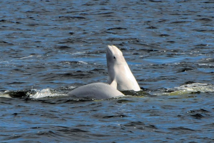
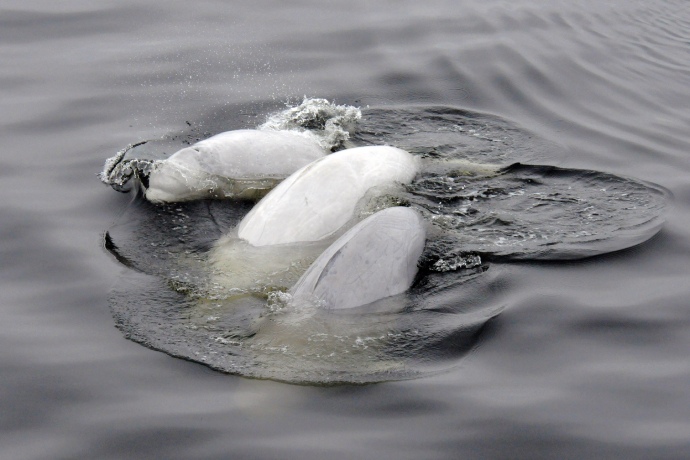
Beluga whales in Saguenay–St. Lawrence Marine Park. Photo: Renaud Pintiaux/Parks Canada 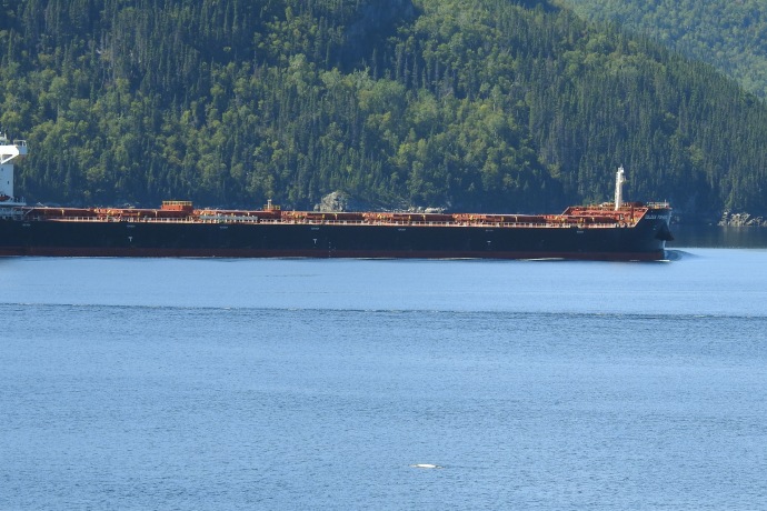
A ship and a beluga on the St. Lawrence River Establishing the marine park was necessary for providing a safe place for the Beluga whales. Creating zones throughout the park with different protection measures and rules was very important for many reasons.
These include navigation closure areas and ship slow downs. These special zones reduce disturbance, providing tranquil havens for whales.
Slower ships reduce underwater noise that whales are exposed to and they reduce the risks of collisions with ships. The shipping industry is also voluntarily reducing ship speeds in whale feeding grounds.
St. Lawrence Estuary Belugas at Saguenay–St. Lawrence Marine Park 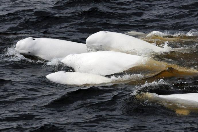
Photos: Renaud Pintiaux/Parks Canada By protecting a healthy marine habitat, whales and other marine life are able to thrive. Whales also help reduce the impacts of climate change! So we all have a lot to gain from protecting them.
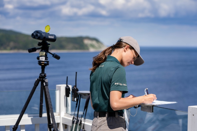
A Parks Canada staff member doing a visual survey for beluga whales from shore. Photo: Michael Lecchino/Parks Canada 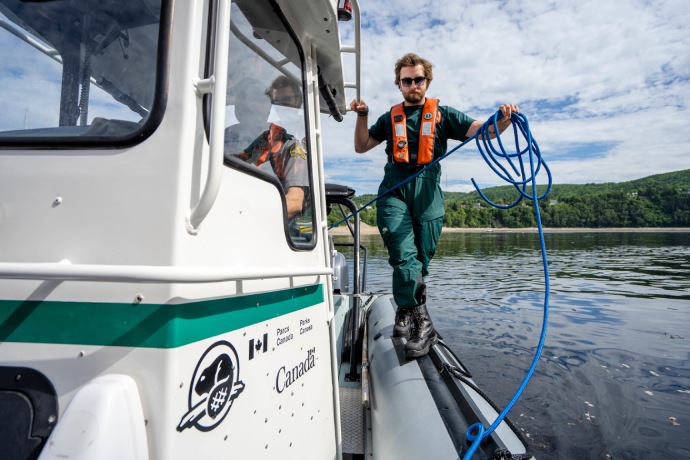
A Parks Canada resource management technician onboard a research vessel that monitors whale activity in Saguenay—St. Lawrence Marine Park. Photo: Michael Lecchino/Parks Canada .jpg)
A Beluga whale in Saguenay—St. Lawrence Marine Park. Photo: Renaud Pintiaux/Parks Canada -
Healthy water, healthy communities
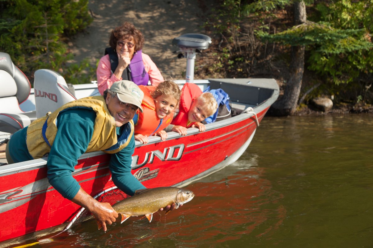
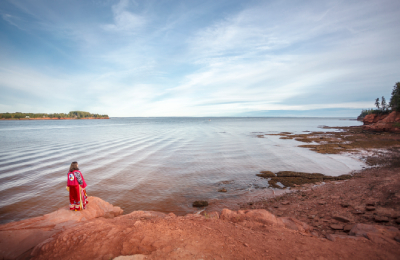
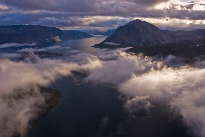
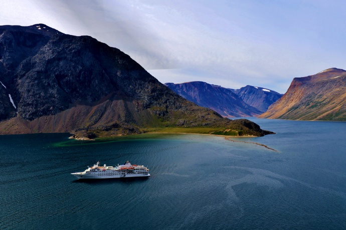
Gwaii Haanas National Park Reserve, National Marine Conservation Area Reserve, and Haida Heritage Site, British Columbia
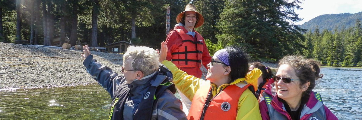
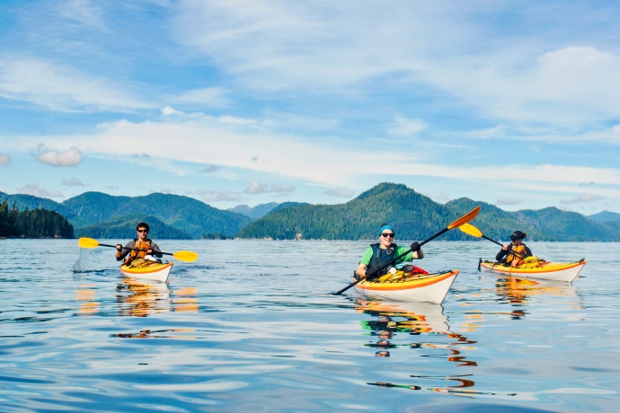
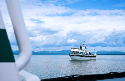
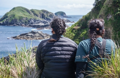
Visitors on a zodiac boat at Gwaii Haanas National Park Reserve, National Marine Conservation Area Reserve, and Haida Heritage Site. Photo: Christine Pansino/Parks Canada The land, sea and people are interconnected in Gwaii Haanas. Oral histories and recent archaeological work attest to the fact that the Haida have been living on the Haida Gwaii archipelago for 13,000 years.
Haida place names for land and ocean features in Gwaii Haanas illustrate the interconnection between land, sea and people.
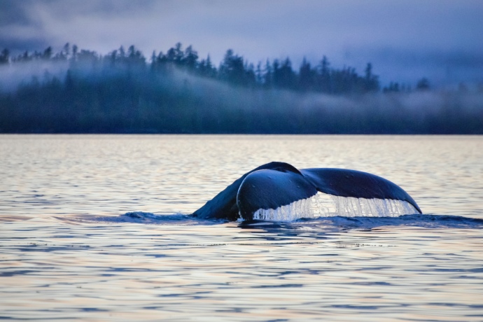
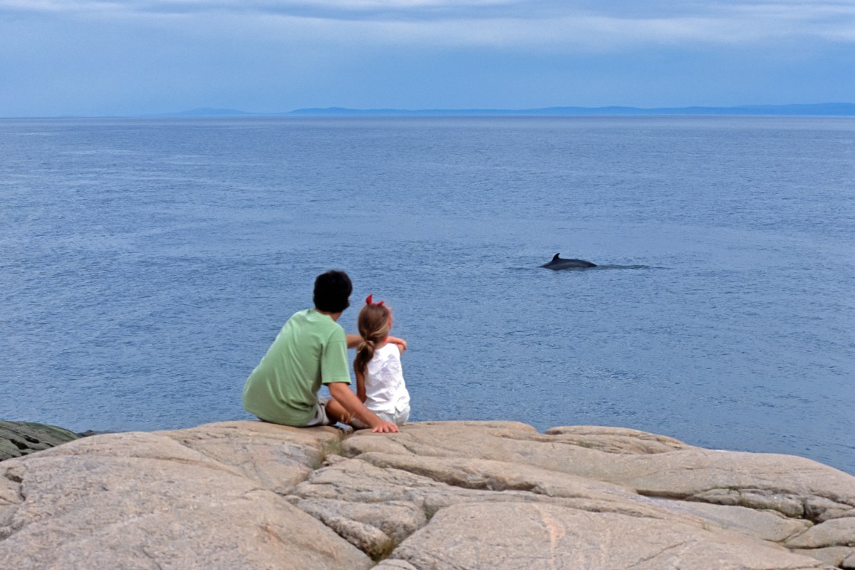
A whale’s tail breaching in Gwaii Haanas. Photo: Charlotte Houston/Parks Canada 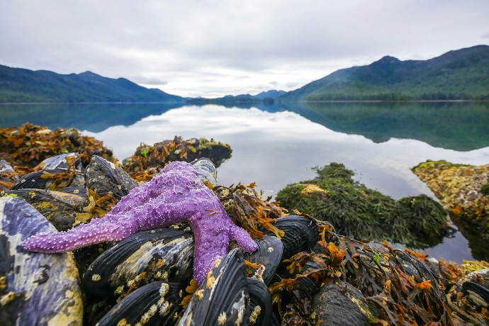
An intertidal scene from Gwaii Haanas including a purple sea star, mussels and kelp. Photo: Stephanie Fung/Parks Canada 
A mountain range sunset on Mount Yatza. Photo: Benson Hilgemann/Parks Canada For 30 years, Parks Canada and the Council of the Haida Nation have cooperatively managed and protected the area’s natural, cultural and marine treasures. They are guided by principles based on ethics and values from Haida law, including balance and respect.
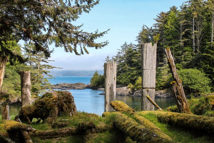
The remains of ancient totem poles on the shores of Gwaii Haanas National Park Reserve, National Marine Conservation Area Reserve, and Haida Heritage Site. Photo: Brady Yu/Parks Canada 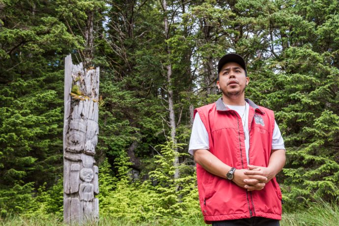
A Haida Watchmen shares stories with visitors at SG̱ang Gwaay. Photo: Scott Munn/Parks Canada Together, Parks Canada, the Haida Nation, and local partners create employment opportunities. They establish long-term monitoring programs. These track and protect ecosystem health and cultural resources.
Visitors connect with the Haida Gwaii Watchmen, who welcome them to their ancestral villages. Haida citizens are engaged in the management of the NMCA Reserve.
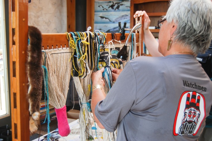
A Haida Gwaii Watchwoman working on a Chilkat weaving on Gandll K’in Gwaay.yaay Island 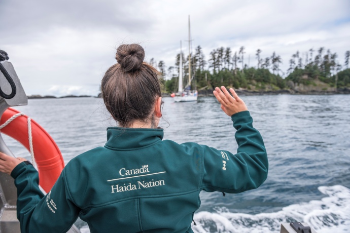
Gwaii Haanas staff waves to passing sailboaters on their way to SG̱ang Gwaay (Anthony Island). Photo: Scott Munn/Parks Canada The site is a model for how those with differing worldviews and cultures can work together. From the mountain tops, to the coast, to the seafloor, this sacred space is well protected, understood and celebrated—and that helps make thriving, healthy communities.
-
Healthy water, healthy livelihoods
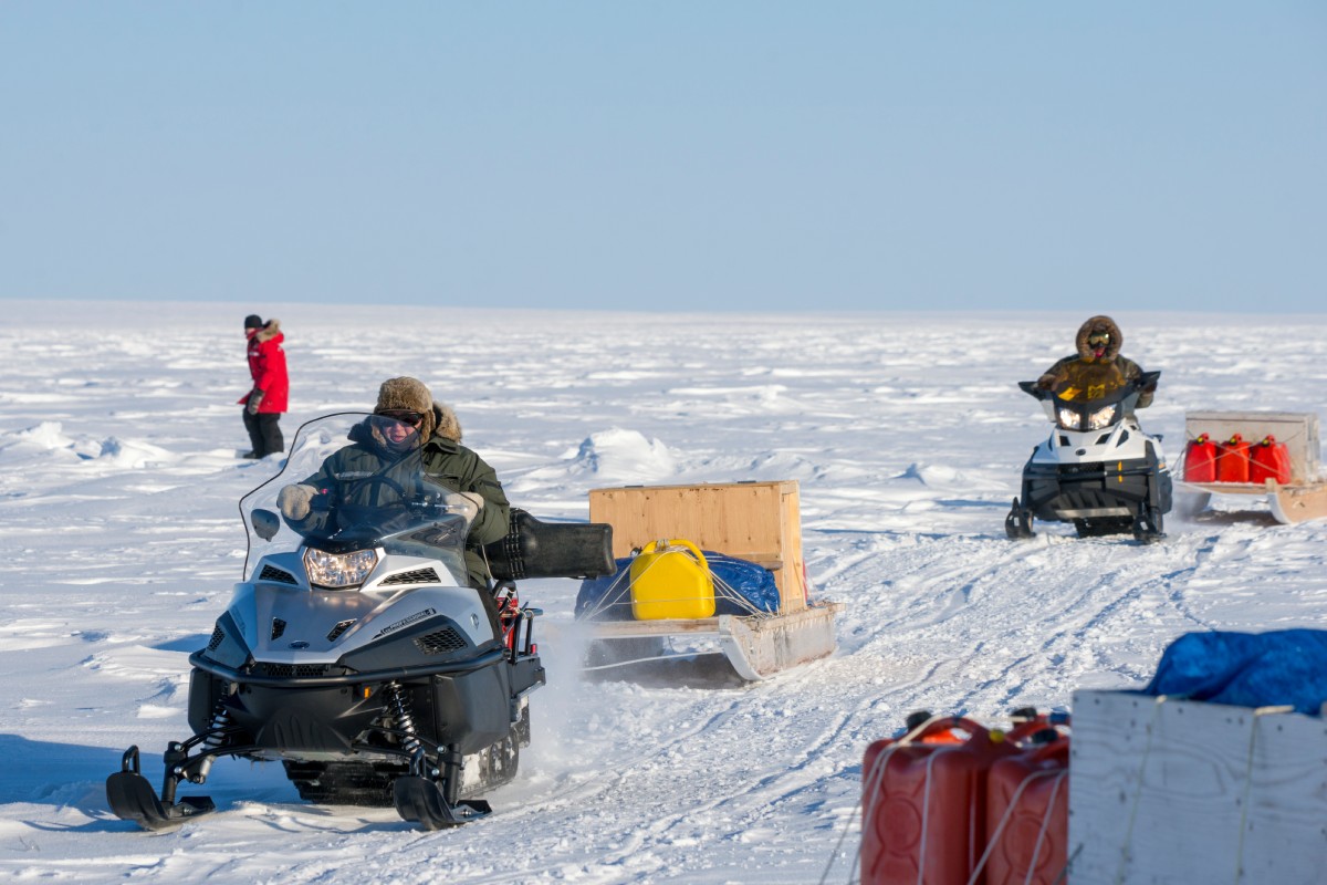
Tallurutiup Imanga National Marine Conservation Area, Nunavut
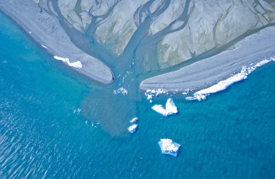
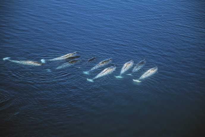
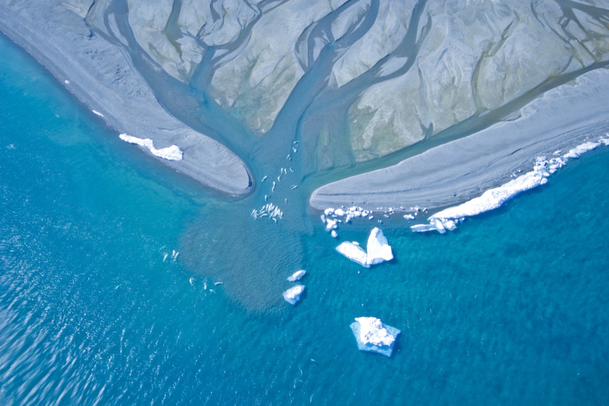
Tallurutiup Imanga National Marine Conservation Area. Photo: Mark Mallory Tallurutiup Imanga National Marine Conservation Area is one of the most significant ecological areas in the world.
One reason for this is the presence of polynyas—open water areas surrounded by ice. Warm water currents in polynyas mix with sunlight to create lots of plankton. These large Arctic oases attract feeding narwhals, belugas, polar bears, and seabirds.
Narhwals at Tallurutiup Imanga NMCA. Photo: Mark Mallory 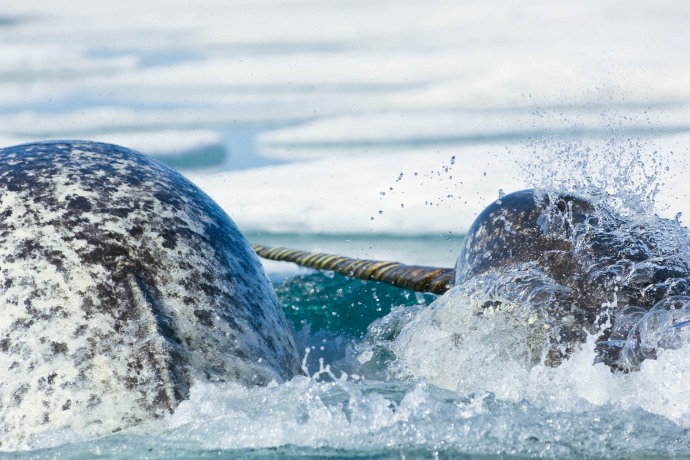
Narwhals swimming in icy waters in Tallurutiup Imanga NMCA. Photo: Mario Cyr/Parks Canada Inuit in Nunavut continue to rely on Tallurutiup Imanga for their traditional lifestyles, including harvesting. These practices have significantly influenced a modern and sustainable fishing industry.
Upholding these rights is key for the health and wellbeing of Inuit. A conservation economy can exist in tandem with the creation of the NMCA through zoning, which allows for multiple uses.
Belugas at Tallurutiup Imanga NMCA. Photo: Mario Cyr/Parks Canada One reason that this model has been successful is the use of Inuit traditional knowledge (Inuit Qauijimajatuqangit) to inform management decisions in the NMCA.
Inuit have a longstanding relationship and understanding of the land, sea, and ice. Their knowledge is used alongside scientific research to ensure the sustainable use of marine resources, now and into the future.
-
A site in the making
An Inuit Protected Area under the Canada National Marine Conservation Areas Act, next to Torngat Mountains National Park, Labrador
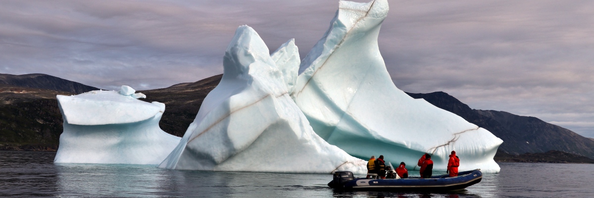
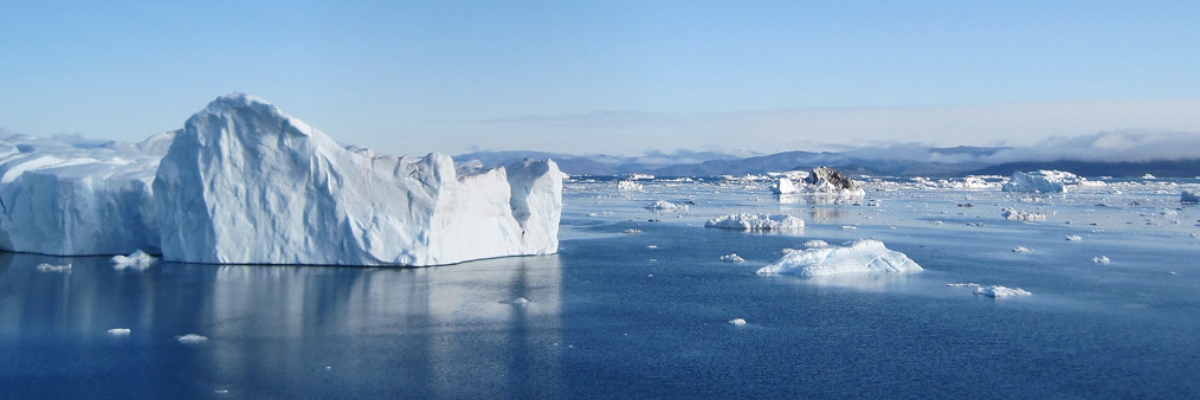
An iceberg floats in the Torngat-Area of Interest in Northern Labrador. Photo: Gary Baikie/Parks Canada A large area off the coast of Torngat Mountains National Park within the Labrador Shelf Marine Region is a proposed Inuit protected area.
Inuit have been stewards of this area since time immemorial. They continue to keep their practices and traditions alive today on its lands and waters.
Ugjuktok Fjord in the Torngat-Area of Interest . Photo: H. Wittenborn/Parks Canada 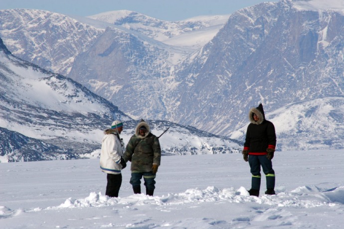
Inuit hunters using their ancestral land. From left to right: Wayne Broomfield, Jacko Merkuratsuk, Joey Merkuratsuk. Photo: Gary Baikie/Parks Canada This would be the first time that a marine area in Canada is being studied as a potential Inuit protected area. It would set precedence if an Inuit Protected Area were established under the Canada National Marine Conservation Areas Act.
Generally Indigenous Protected Areas share three essential elements. They:
- are Indigenous-led
- represent a long-term commitment to stewardship
- elevate Indigenous rights and responsibilities
This area is a place of cultural significance. Protecting it would contribute to the vitality of Inuit culture and traditions, and the well-being of Labrador Inuit.
This is a unique ecosystem that transitions between Arctic and Atlantic habitats. Protecting the area would also help conserve the marine wildlife that use, live and travel in these waters.
Nachvak Fjord in the Torngat-Area of Interest. Photo: Gary Baikie/Parks Canada .jpg)
Polar bears swim in the Torngat-Area of Interest. Photo: Gary Baikie/Parks Canada That’s why Parks Canada and Labrador Inuit are leading a feasibility assessment for the site, guided by Inuit Knowledge and science. Together, they’ll discuss whether the area of interest meets the criteria to become an NMCA.


.jpg)


.jpg)
Actions needed now
Marine and Great Lakes environments in Canada are vital for sustaining diverse marine life and ecosystems. The ocean, land, and all living things are influenced by one another in marine ecosystems. The health of the environment is a reflection of our own health.
Yet, the state of the oceans, lakes, and rivers is in crisis. Climate change, intensive use, pollutants, and invasive species are some of the pressures on marine wildlife and habitats.
We need to improve the health of our planet to continue benefiting from these environments. To do this, we need to protect and conserve marine and freshwater areas.
We need to create more NMCAs.
One destination—many ways to get there
All of the building blocks used to create NMCAs are different, including the site location, local partners, and marine users. This makes each NMCA very unique. Yet all NMCAs offer common benefits.
From healthy marine wildlife, to vibrant coastal communities, to sustainable livelihoods… NMCAs in Canada are like building blocks for creating better health.
Select images to enlarge
Related links
- Policy on the Establishment and Management of National...
- Canada National Marine Conservation Areas Act
- Implementing the United Nations Declaration on the Rights...
- Connecting with the ocean
- IMPAC5
- Protection Standards to better conserve our oceans
- Parks Canada Guiding Principles and Operational Policies
- Date modified :