
Area Closures
Mountain safety
Avalanche Closure Zones
When avalanche control is indicated in the avalanche forecast headline, the areas listed are closed. These are legal closures and violators may be charged under the Canada National Parks Act.
Use the following maps to see the closure locations.
93 North
93 North - Overview
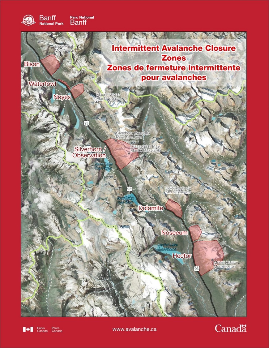
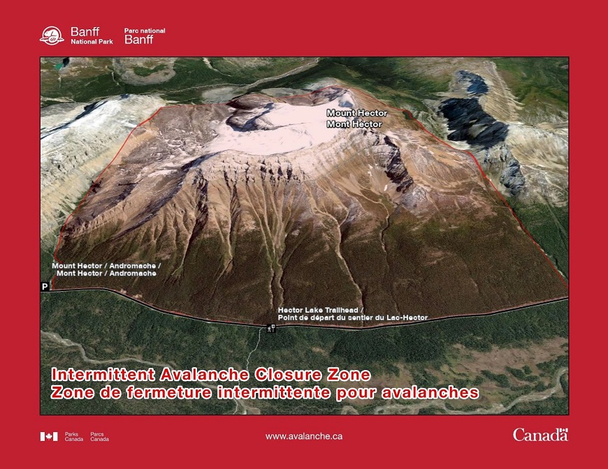
Mount Hector
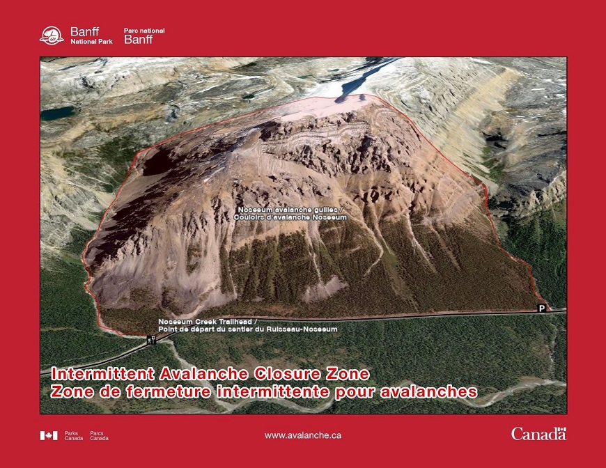
Noseeum Peak
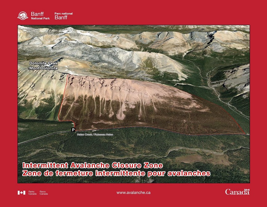
Dolomite Peak
Silverhorn Mountain / Observation Peak

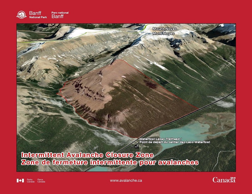
Mt. Noyes
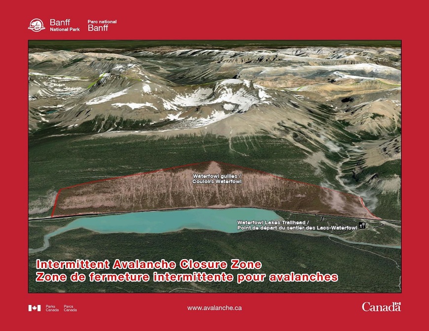
Waterfowl Gullies
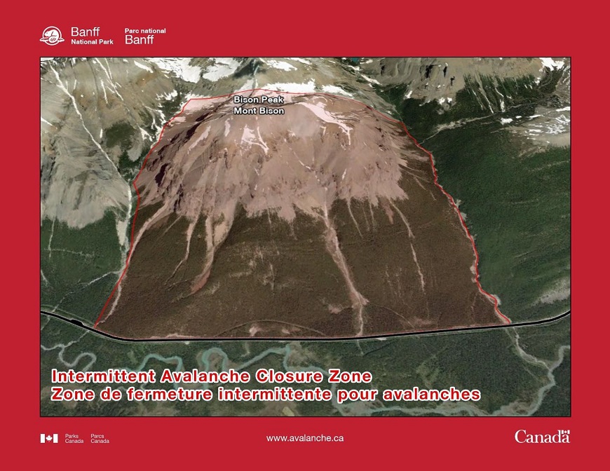
Bison Peak
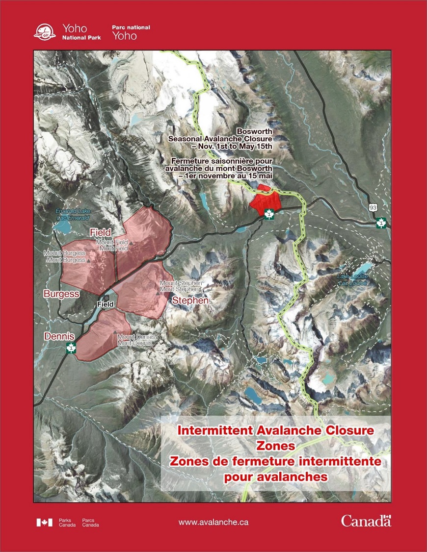
Yoho
Yoho - Overview
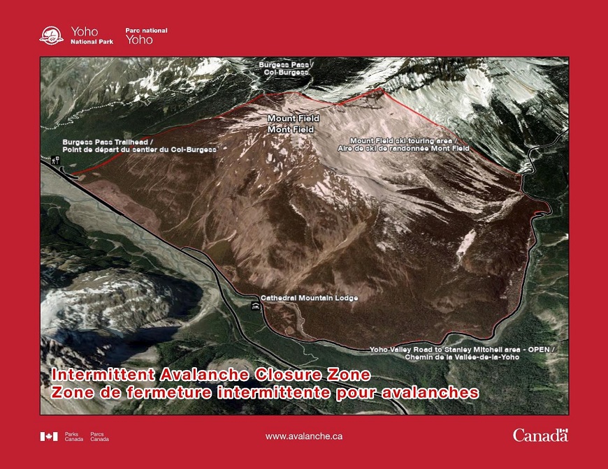
Mount Field
Notes: Yoho Valley Road to the Stanley Mitchell Area is not in the closure zone
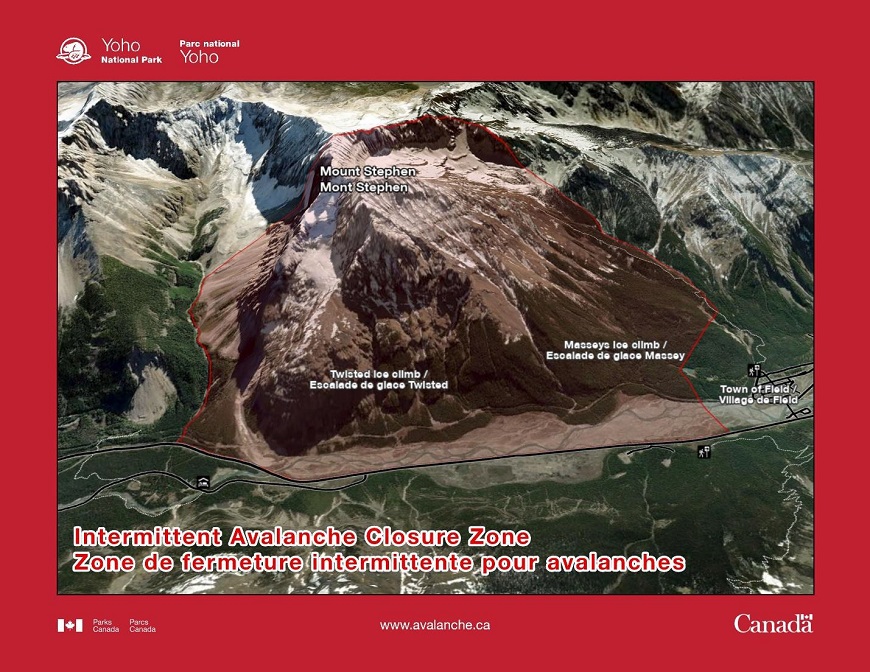
Mount Stephen
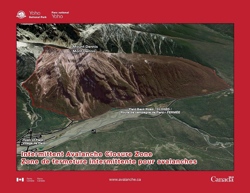
Mount Dennis
Notes: This closure zone includes all of the ice climbs on Mt. Dennis
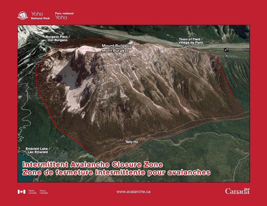
Mount Burgess
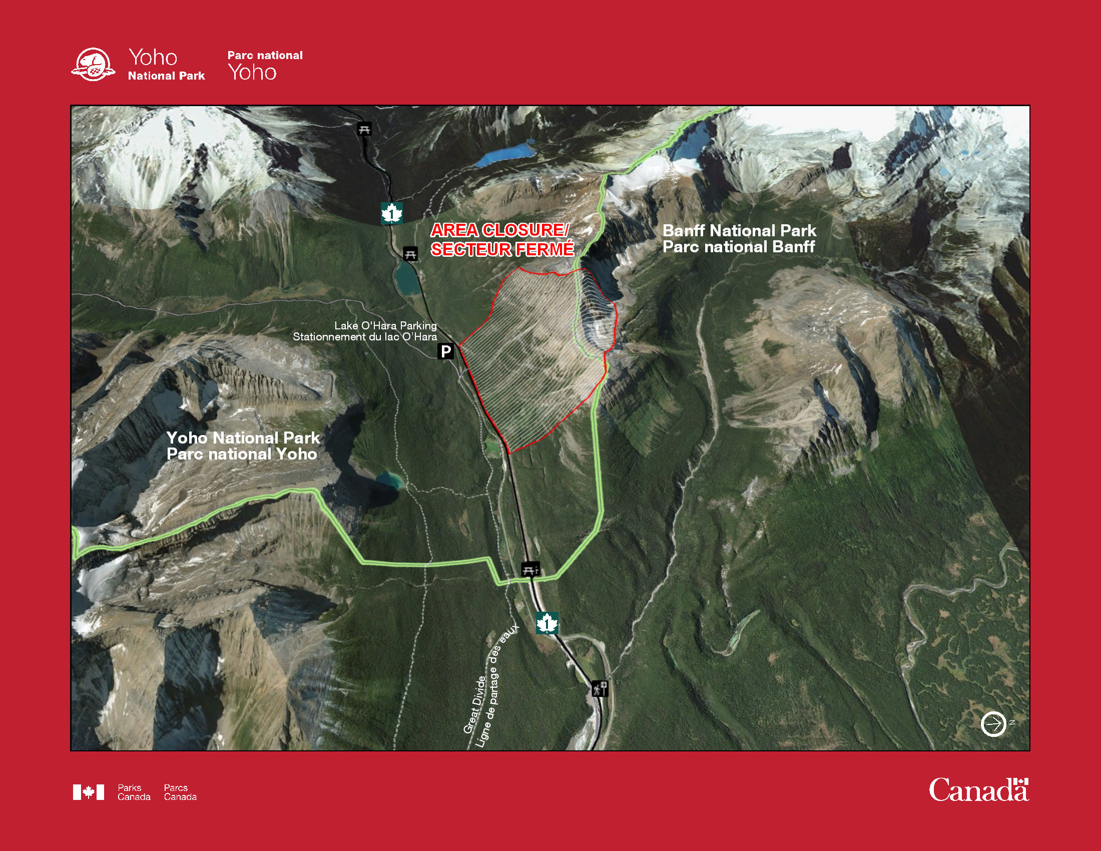
Mt. Bosworth (Seasonal Avalanche Closure Zone)
Notes: Mt. Bosworth is closed annually between November and May.
This is a legal closure and violators may be charged under the Canada National Parks Act.
Use the following map to see the closure location.
Kootenay
Kootenay - Overview
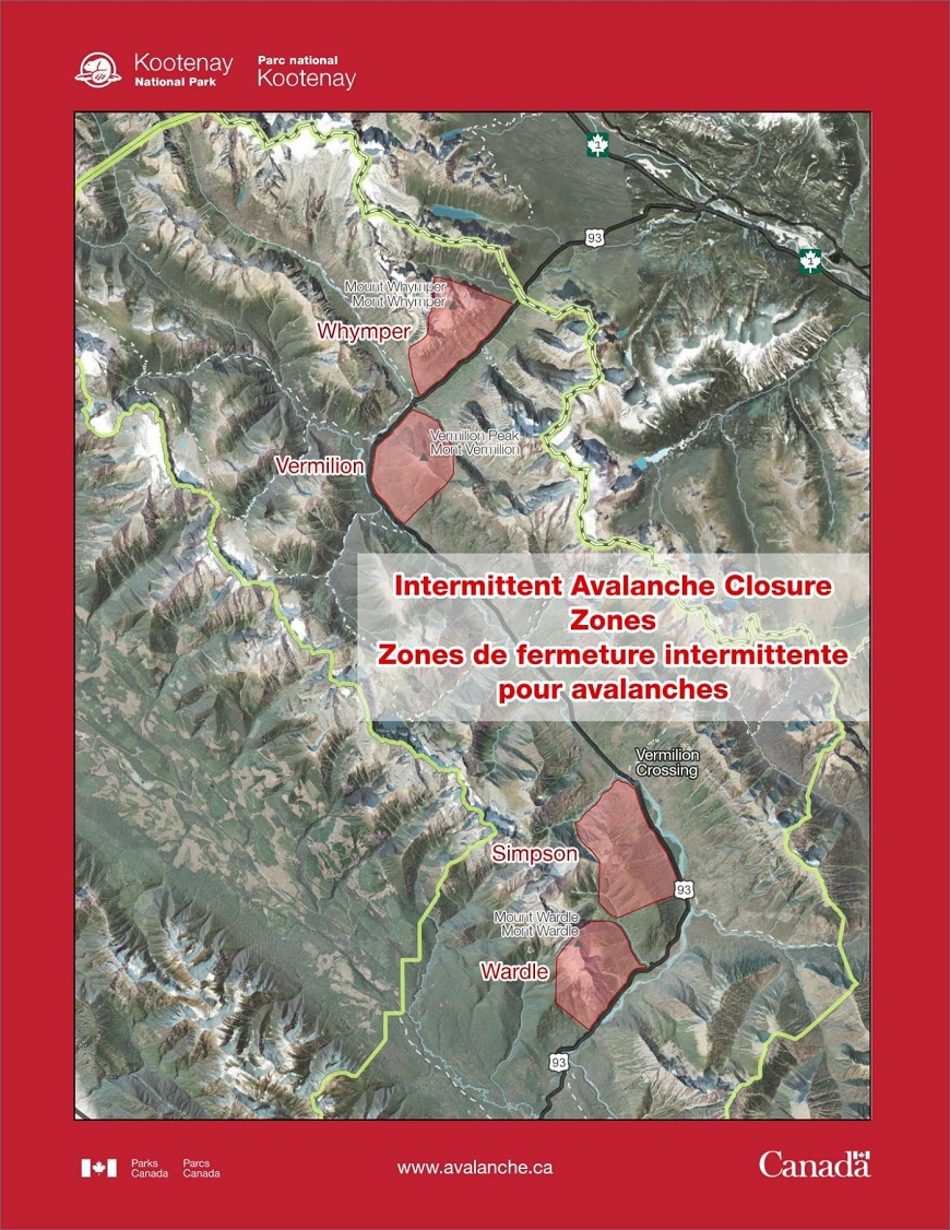
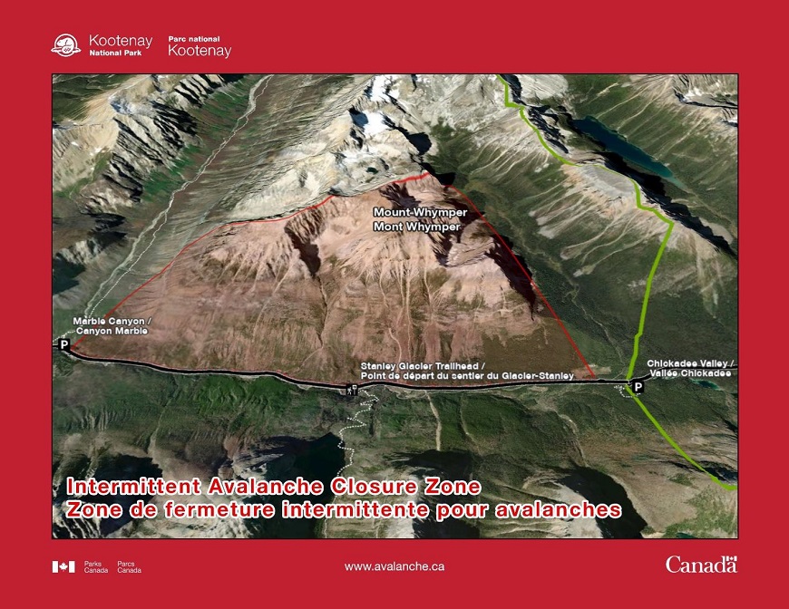
Mount Whymper
Notes: Stanley Glacier trail and access to the Stanley Headwall not in the closure zone. Marble Canyon not in the closure zone
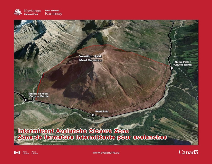
Vermillion Peak
Notes: Access to Haffner Creek ice/mixed climbing area not in the closure zone
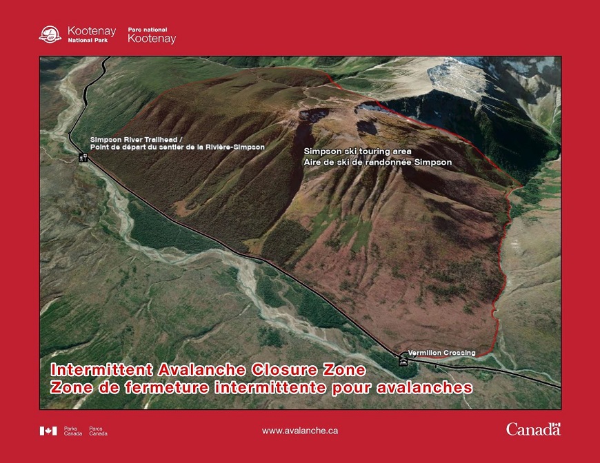
Simpson Area
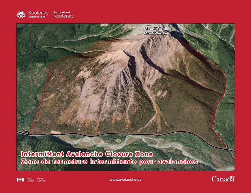
Mount Wardle
Sunshine Ski Area Access Road
Sunshine Ski Area Access Road - Overview
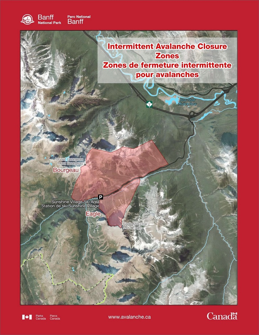
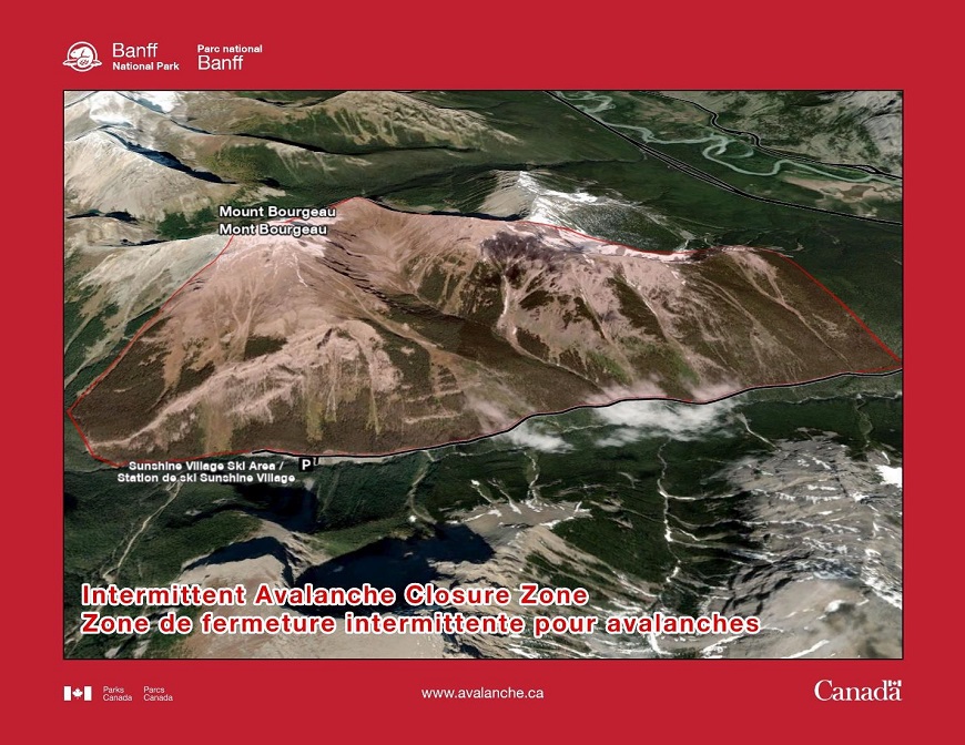
Mount Bourgeau
Notes: The closure zone includes the ice climbs “Bourgeau Left” and “Bourgeau Right”
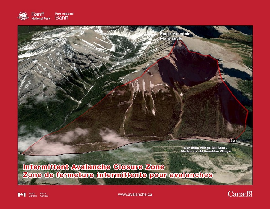
Eagle Mountain
- Date modified :