
© Parks Canada / C. Houston
Maps, tide tables & charts
Gwaii Haanas National Park Reserve, National Marine Conservation Area Reserve, and Haida Heritage Site
Maps


Canada’s marine conservation area reserves help protect marine species and their habitat from the threat of human activities. As of May 1, 2019, commercial and recreational fishing is prohibited in the strict protection zones of Gwaii Haanas National Marine Conservation Area Reserve and Haida Heritage Site. Full co-ordinates here.
Tide Tables
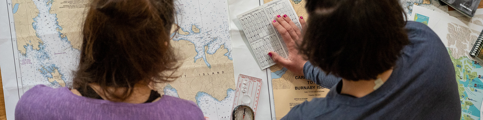
Tide tables are essential for exploring Gwaii Haanas. Booklets published annually by the Hydrographic Service provide instructions on the use of tables to determine daily tides (time and height) for specific locations.
For Haida Gwaii you should obtain:
- Canadian Tide & Current Tables Volume 7
- Queen Charlotte Sound to Dixon Entrance
Learn to read tide tables before travelling in Gwaii Haanas. Tide tables provide information on the time and height of the tide. It's important to remember there are factors that can increase the effects of the tides, such as your location and storms.
On the islands, tide tables are available at the following locations:
- Port Clements: Resource Management Services
- Masset: North Coast Supply
- Sandspit: Visitor Centre and Bridgeview Marina
Marine Charts
Marine charts © Parks Canada / L. Leong
Up-to-date charts at the largest scale are indispensable in this area. The charts listed here cover the most frequently travelled part of Gwaii Haanas (east coast and south end).
| Area | Number | Scale |
|---|---|---|
| Houston Stewart Channel | 3855 | 1:20,000 |
| Selwyn Inlet-Lawn Point | 3894 | 1:73,026 |
| Atli Inlet-Selwyn Inlet | 3807 | 1:37,500 |
| Juan Perez Sound | 3808 | 1:37,500 |
| Carpenter Bay- Burnaby Island | 3809 | 1:37,500 |
| Houston Stewart Channel/ Cape St. James | 3825 | 1:40,000 |
| Cape St. James/Cumshewa and Tasu ** | 3853 | 1:150,000 |
Chart 3853 provides a useful view of the entire Gwaii Haanas area and its upper reaches but the scale is not suitable for navigation.
For a complete list of charts for Haida Gwaii and the rest of the BC Coast, check the Canadian Hydrographic Services (Pacific Region) website.
There is a lot of other good information at this site, including chart prices and lists of authorized dealers in Canada, the USA and other countries.
Charts can be purchased directly from:
Canadian Hydrographic Service
Institute of Oceans Sciences
Box 6000
Sidney, BC V8L 4B2
Phone: 1-250-363-6358
Fax: 1-250-363-6841
Email: chartsales@pac.dfo-mpo.gc.ca
Sailing Directions
Sailing directions are the indispensable companions to charts. Sailing directions is a great tool for planning and assisting in navigation because they provide information that cannot be shown on a chart.
Available for purchase from an authorized chart dealer.
- Date modified :