
An exceptionally
beautiful backpack
on the highest
trail in Jasper
National Park.
Skyline trail
Jasper National Park
 Skyline trail Backcountry Guide (PDF, 1,644 KB)
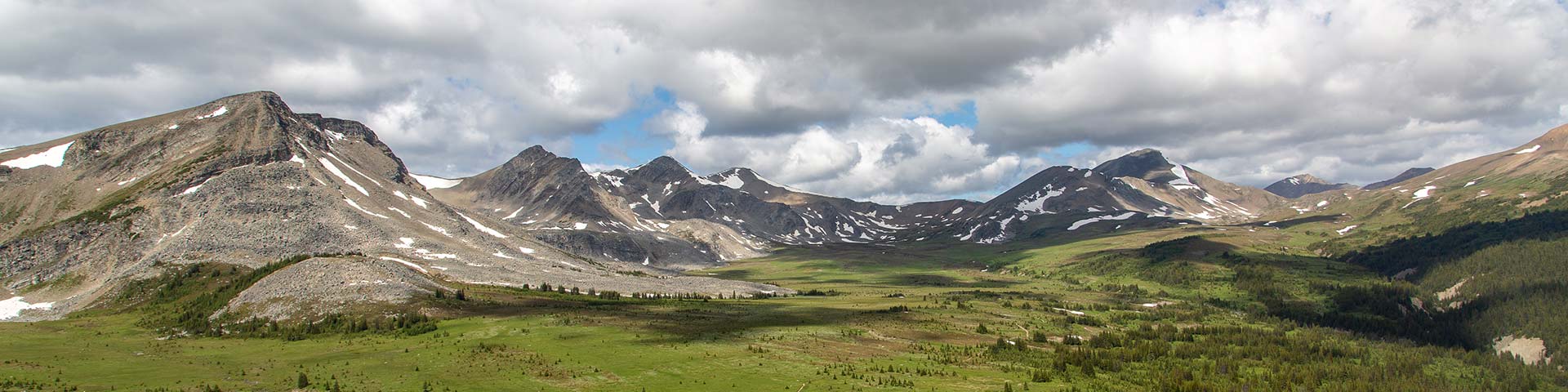
With almost 25 km of this trail hiked above treeline, the Skyline is Jasper’s highest and possibly most scenic trail. The high elevation allows for amazing views that extend over much of the park, encompassing vast meadows and windswept ridges. Crossing three mountain passes, the Skyline Trail offers a variety of flora, fauna and scenery unique to Jasper National Park. The section of trail called “The Notch” can be impassable early in the season.
Planning considerations
- Maintained trail: High priority
- 44.1 km one-way
- Trail #100: 2 - 3 days
- No dogs
- No bikes
The details
The Skyline Trail is Jasper’s most popular backcountry hiking trail and books up quickly. The most popular direction to hike the Skyline is from south (Maligne Lake) to north, since you lose more elevation that you gain. Most hikers travel the Skyline Trail in 2 – 3 days, though it’s nice to have an extra day to explore the alpine areas along the way. Highlights include Little Shovel Pass at km 10.3, Big Shovel Pass at km 17.5, the high col named “The Notch” and the alpine ridge hiking beyond. Snow can persist late into the summer season on this high elevation trail.
During poor weather, the 15 km Wabasso Trail can be used as an escape route. It has a steep descent of 1100 m ends on the Icefields Parkway 14 km south of Jasper.
- Fires are not permitted at any of the campgrounds.
- Dogs are not permitted on the Skyline Trail between Maligne Lake and the Signal Campsite.
- No bikes are permitted between Maligne Lake and Signal Fire Road.
- This trail can typically only be hiked between early July and early October. Snow can fall any time of the year.
- The Watchtower trail intersects the Skyline Trail. There is no bridge across the Maligne River near the Watchtower trailhead. In high water, the river can be impassable.

Elevation profile

Text version
- The elevation profile shows the trail beginning at the Maligne trailhead at 1690 m.
- The trail climbs gently over the next 4.8 km to Evelyn Creek campground (1825).
- The next 3.5 km to Little Shovel campground (2095 m) climbs steadily.
- The trail climbs over the next 2 km to Little Shovel Pass (2240 m) then mainly descends to Snowbowl Campground (2095 m) at kilometre 12.2.
- There is a steady, gentle climb over the next 5.3 km to Big Shovel Pass (2320 m), then a gentle decent for 2 km to the Curator Campground junction (2210 m).
- The trail climbs very steeply for 2.6 kilometres to the top of The Notch (2510 m).
- There is no significant elevation change for nearly three kilometres along the ridge, then the trail descends steadily for 5.5 kilometres to Tekarra campground (2060 m).
- Tough there are short ascents and descents, there is no significant elevation gain or loss over next 5.3 kilometres to the Signal Campground junction (2010 m).
- The final 8.4 kilometres to the Signal trailhead (1160 m) descends steadily and steeply.
Campground information
| Campground | Elevation | Description | # of sites | Toilet type | Food storage | UTM |
|---|---|---|---|---|---|---|
| Evelyn Creek #27 |
1824 m | A small, quiet campground by a creek, good for hikers getting a late start in the day. | 4 | Throne | Lockers | 11U 452481 5843006 |
| Little Shovel #28 |
2233 m | A campground with beautiful views over Maligne Lake and the Bald Hills, situated below Little Shovel Pass. This campground is great for campers who want to avoid the busier Snowbowl Campground. | 8 | Barrel | Lockers | 11U 450945 5842879 |
| Snowbowl #29 |
2094 m | Popular campground located in a spectacular meadow, sheltered by trees, with easy access to water. | 8 | Barrel | Lockers | 11U 447486 5844389 |
| Curator #30 |
2070 m | Popular with hikers taking 2 days to hike the Skyline Trail. This campground is situated 0.8 km off trail and 1.2 km from spectacular Curator Lake. | 8 | Barrel | Lockers | 11U 442160 5848882 |
| Tekarra #31 |
2062 m | A beautiful campground with great views, located next to a fast moving creek. | 8 | Barrel | Lockers | 11U 437972 5855684 |
| Signal #32 |
2014 m | A quiet campground at the top of the Signal Fire Road. There are great views over Jasper and surroundings from the hills above the campground. | 8 | Barrel | Lockers | 11U 433941 5858434 |
How to get there
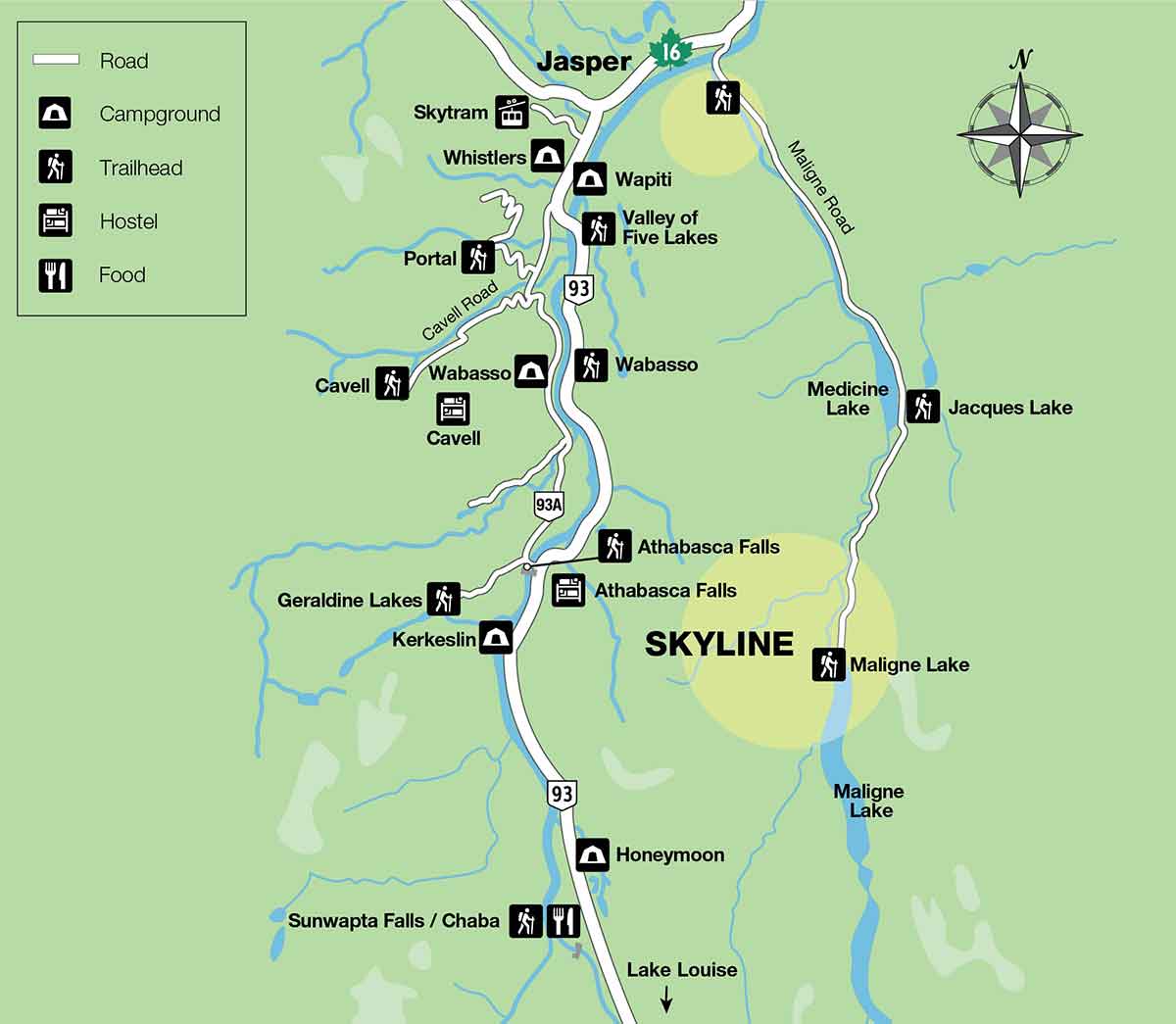
Maligne Trailhead (south)
- Take Highway 16 east towards Edmonton. Turn right 2 km from Jasper and cross the bridge onto Maligne Road.
- Continue for 46 km south on the Maligne Road to Maligne Lake.
- Continue on the road past the chalet and across the bridge to the parking lot on the west side of the lake.
- The trailhead is on the right-hand side of the road, just before you reach the parking lot.
Signal trailhead (north)
- Drive 8 km south on the Maligne Lake Road (as above). The parking area is on the right. Overflow parking can be found in the Maligne Overlook parking lot, 500 m beyond.
Are you prepared?

Safety is your responsibility
Refer to the Jasper National Park Backcountry Planning Guide:
- descriptions of trail types and campground facilities;
- equipment checklists;
- responsible camping practices;
- safety information.
Before heading out, check trail, weather and road conditions at: parks.canada.ca/jaspertrails.
Maps
| NTS | National Geographic | Gem Trek |
|---|---|---|
| Medicine Lake 83 C /13 Athabasca Falls 83C/12 |
Jasper South | Jasper and Maligne Lake |
Permits
A backcountry camping permit is mandatory for all overnight trips and can be obtained online at reservation.pc.gc.ca or by calling 1-877-737-3783.
- Date modified :