

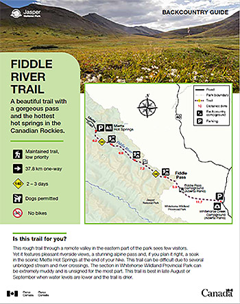
A beautiful trail with a gorgeous pass and the hottest hot springs in the Canadian Rockies.
Fiddle River Trail
Jasper National Park
 Fiddle River Backcountry Guide (PDF, 772 KB)
This rough trail through a remote valley in the eastern part of the park sees few visitors. Yet it features pleasant riverside views, a stunning alpine pass and, if you plan it right, a soak in the scenic Miette Hot Springs at the end of your hike. This trail can be difficult due to several unbridged stream and river crossings. The section in Whitehorse Wildland Provincial Park can be extremely muddy and is unsigned for the most part. This trail is best in late August or September when water levels are lower and the trail is drier.
Planning considerations
- Maintained trail: low priority
- 37.8 km one way
- Trail #140: 2-3 days
- Dogs permitted
- No bikes
The details
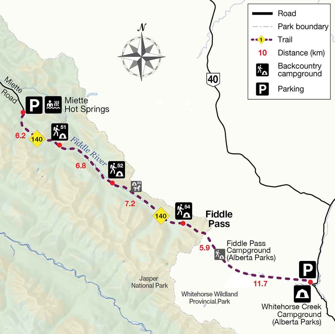
This is a trail that can be thru-hiked starting at either Miette Hot Springs (Jasper National Park) or Whitehorse Creek Campground in Whitehorse Wildland Provincial Park (AB). From Miette Hot Springs, the trail begins at the Source of the Springs trailhead and follows the paved trail and boardwalk to the old aquacourt. After this, the trail becomes rougher and climbs steadily to the mostly forested Utopia Pass. The trail then descends steeply to the Fiddle River. Just above the shore, a large landslide has taken out part of the trail. You need to work your way down to the bank of the river, and through the land slide back to the trail. From here onwards, the trail is rough and overgrown in places. Sightlines can be poor. Make ample noise to warn bears and other wildlife of your presence. Utopia Campground (#51) is 1.2 km beyond the landslide.
After the campground, the trail follows the river and crosses Slide Creek just before Slide Creek Campground (#52). The trail makes several more crossings of the Fiddle River between Slide Creek Campground (#52), Whitehorse Campground (#54) and Fiddle Pass. Fiddle Pass marks the boundary between Jasper National Park and Whitehorse Wildland Wilderness Provincial Park. From here the trail continues to Fiddle Pass Campground (AB Parks) and onwards to Sawmill and Trappers Campgrounds (AB Parks) and the trailhead at Whitehorse Creek Campground.
- Multiple creek / river fords are required. These can be difficult in high water.
- Horse are not permitted from Miette Hot Springs trailhead to Slide Creek campground. The trail beyond Slide Creek is no longer maintained for horses.
- Some corduroys in boggy sections have been removed.
Elevation profile
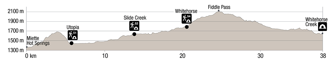
Text version
- The elevation profile shows the trail beginning at the Miette Hot Springs trailhead at 1367m
- Over the next 6.2 km, the trail ascends over Utopia Pass, (1645 m) then descends to Utopia Campground (1444 m)
- There is a gradual climb over 6.8 km to Slide Creek Campground (1614 m)
- There is a gradual climb over 7.2 km to Whitehorse Campground (1789 m)
- The 4.3 km climb to Fiddle Pass (2120 m) is steady and steeper
- The trail descends into the Province of Alberta and ends 13 km beyond at Whitehorse Creek Campground (1625 m)
Campground information
| Campground | Elevation | Description | # of sites | Toilet type | Food storage | UTM |
|---|---|---|---|---|---|---|
| Utopia #51 |
1444 m | A pleasant campground by a creek, only 6.5 km from the trailhead. It makes for a perfect one-night getaway. | 4 | Throne | Lockers | 11U 451970 5883747 |
| Slide Creek #52 |
1614 m | A simple campground in the forest with some mountain views through the trees. | 4 | Throne | Cable | 11U 456952 5880414 |
| Whitehorse #54 |
1789 m | A pleasant campground in the forest. | 4 | Throne | Cable | 11U 462424 5876790 |
How to get there
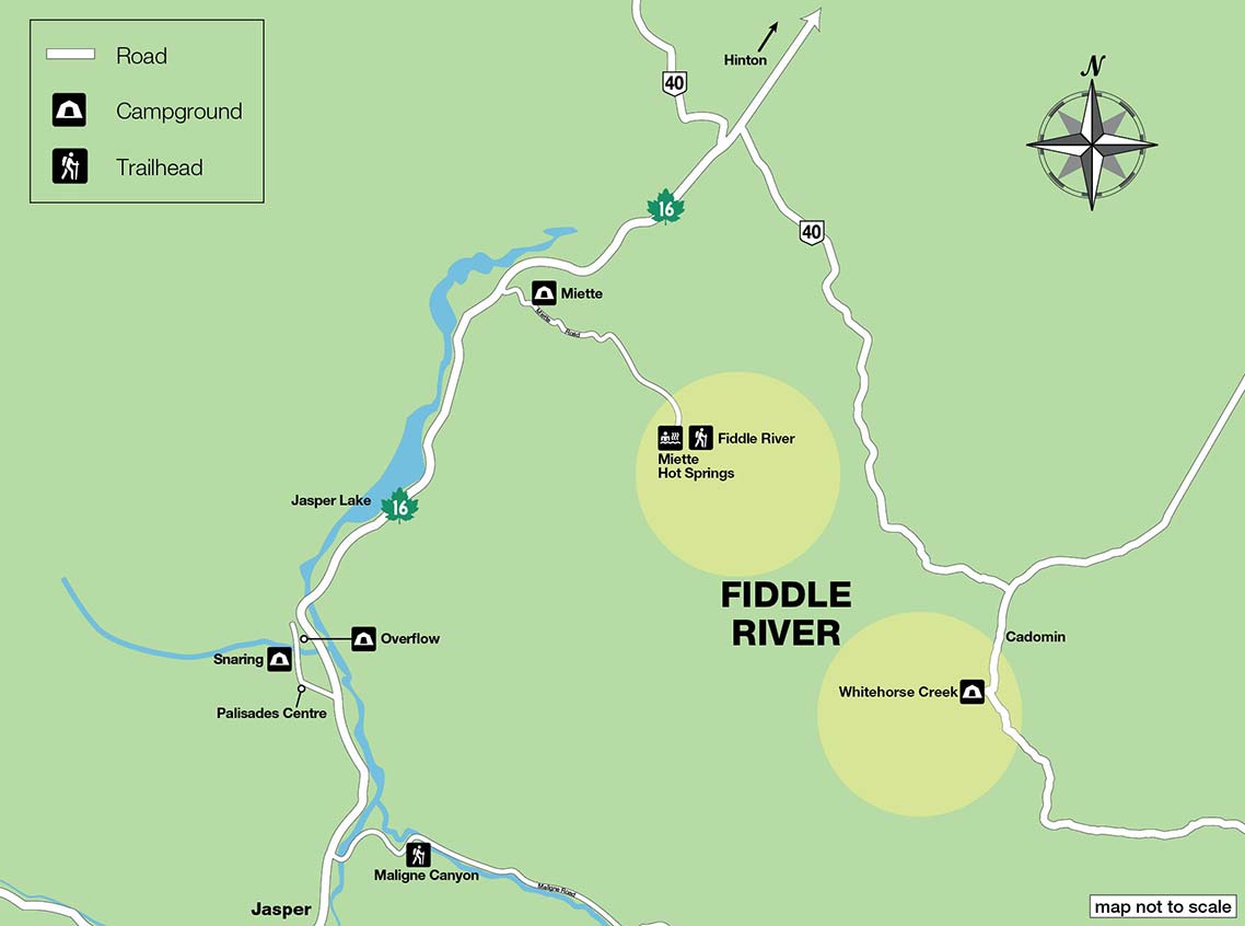
From Jasper to Miette Hot Springs
- Take Highway 16 towards Hinton, and turn onto the Miette Road at Miette Mountain Cabins (49 km from Jasper). It is 17 km from the turn off to the hot springs.
- In the hot springs parking lot, drive straight to the parking lot by the picnic area past the outhouse. The trailhead, named Source of the Springs, is straight ahead.
From Jasper to Whitehorse Creek
- From Jasper take Highway 16 east towards Hinton, out of the park.
- After 70 km from Jasper, turn right onto Highway 40 towards Cadomin.
- Drive 48 km to a T-junction. Turn right towards Cadomin.
- Drive through the village (2.5 km), and another 6 km to the campground. After the village of Cadomin, the road becomes gravel, but is passable by cars. The road now parallels a large haul road for the nearby Cheviot coalmine.
- Look for signs to the campground; the entrance road to the campground turns off from the through road on the left, and swings right through a tunnel underneath the haul road. The trailhead is at the far end of the campground.
Are you prepared?

Safety is your responsibility
Refer to the Jasper National Park Backcountry Planning Guide:
- descriptions of trail types and campground facilities;
- equipment checklists;
- responsible camping practices;
- safety information.
Before heading out, check trail, weather and road conditions at: parks.canada.ca/jaspertrails.
Maps
| NTS | National Geographic | Gem Trek |
|---|---|---|
| Medicine Lake 83C/13 Athabasca Falls 83C/12 |
Jasper North | Jasper and Maligne Lake |
Permits
A backcountry camping permit is mandatory for all overnight trips and can be obtained online at reservation.pc.gc.ca or by calling 1-877-737-3783.
- Date modified :