
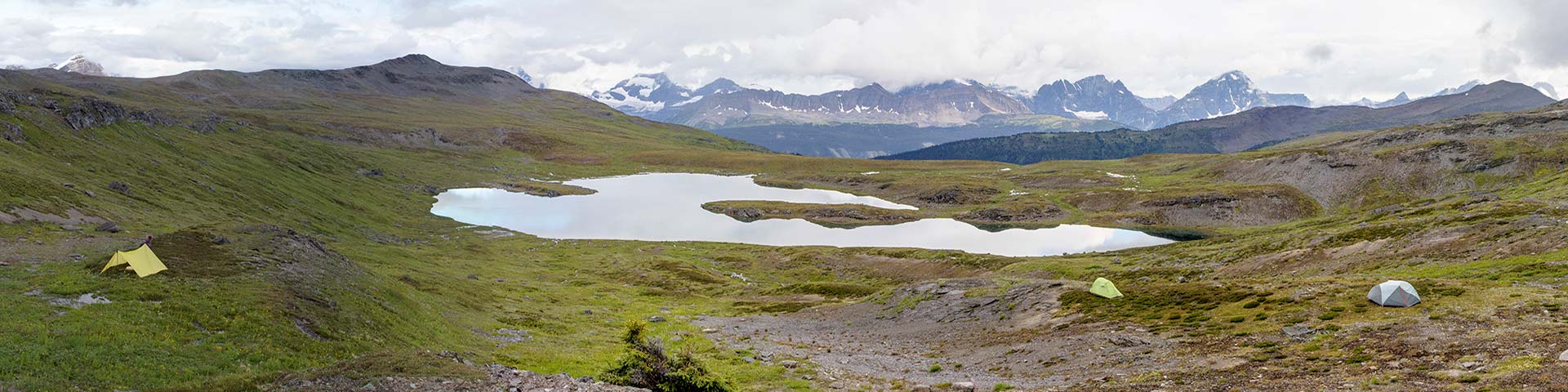
Wild and remote, for experienced backcountry travellers to immerse themselves in pristine mountain landscapes.
Random camping
Jasper National Park
 Random Camping Guide (PDF, 795 KB)
In Jasper National Park, random camping is permitted in designated areas only and must be a full day’s travel from trails or roads (approximately 5 km in non-technical terrain) and 70 metres from water bodies. Random camping is not an alternative to backcountry campgrounds that are fully booked.
- No maintained trails: Route finding required
- No dogs Dogs are not permitted in certain Random Camping areas
- No fires No fires permitted
- No bikes No bikes permitted
Is backcountry random camping for you?
Random camping in Jasper National Park’s backcountry requires a specific set of knowledge, experience and equipment. There are no trails, signs, or facilities such as privies, or food storage. Visitors must be able to route find, be prepared to travel in remote and rugged wilderness, manage their human waste and secure their animal attractants.
How to obtain a random camping permit
A backcountry camping permit is mandatory for all overnight backcountry use, including random camping. Permits for random camping can be obtained by calling Jasper Information Service at 780-852-6177 ext 2.
Step 1: Determine your route / itinerary
Jasper National Park has 29 distinct random camping areas in the park. Each random camping area has a daily group quota, and a maximum group size. Some random camping areas also have a monthly group quota. These quotas are in place to maintain the wilderness values visitors seek and provide for secure habitat use by large, wide-ranging carnivores (e.g. grizzly bears).
Determine which random camping area(s) you will be camping in and if you will be overnighting at one or more of the unmaintained campgrounds within the random camping areas. You may need to use maps and guide books to cross-reference your route with Jasper National Park’s Random Camping Area map. Some unmaintained, historic routes in the park are described in The Canadian Rockies Trail Guide by Brian Patton and Bart Robinson (trails and facilities will likely be very different than described).
View larger map
PDF version, 7.75 MB)
Text version
- This map is titled Jasper National Park Random Camping at the top and shows the entire Jasper National Park and its boundary. It contains shaded areas with different colours for each designated random camping area within the park. These areas are one full day’s travel from trails or roads (approximately 5 km in non-technical terrain).
- There is a Share button to the right of the title, that provide an option to copy link, or share with Facebook, Twitter or LinkedIn.
- On the top left corner of the map, there are buttons to click on a Default map view, zoom in and zoom out.
- On the top right of the map are buttons to Find my location and Open Measure. The overall map also shows the areas with dog restrictions in a golden-coloured cross-hatch. These areas overlap with the Campus Pass random camping area and slightly into the Henry McLeod and Southesk / Brazeau areas.
- On the far left navigation, users can click on two different options. The top option hides/shows the legend. The option below hides/shows all map layers on a vertical navigation bar. This vertical navigation bar can be expanded or collapsed.
- With the legend feature clicked on, a list of all Random camping areas shows vertically between the far left navigation bar and the map. They are listed alphabetically: Brûlé, Calumet, Campus Pass, Chaba, Colonel Pass, Dean Meadows, Elysium Pass, Fiddle, Geraldine, Henry McLeod, Icefields, Jacques, Kerkeslin, Lick Creek, Maligne Lake, Miette Lake, Miette River, Moosehorn, Mt. Alberta, Needle, North Boundary, Resthaven, Snaring, South Boundary, Southesk Lake, Southesk/Brazeau, Sundial, Whirlpool.
- With the layers’ feature clicked on, a list of all layers shows vertically between the far left navigation bar and the map. Layers can be toggled on or off. Available layers are: Trail, highway and general, Athabasca River, unmaintained backcountry campgrounds, campgrounds and day use areas, passes, mountains, trailheads, backcountry accommodations, roads, dog restrictions, park boundary and random camping areas.
- There is an option to toggle the base map on the bottom right by clicking on a 2 cm x 2 cm square. The two base map options are satellite and topographical map backgrounds.
- Upon zooming into a specific area, the map shows details including mountain names and passes, elevation contours, highway and road names, day use areas, front country campgrounds, trailheads, official trails and trail labels, designated backcountry campgrounds and other accommodation, and unmaintained backcountry campgrounds.
Considerations
Party size
Maximum group size in random camping areas is between 4 – 6 persons per group.
Length of stay
Within a random camping area, there is a maximum two-night stay at each camping location. Make note of your dates and your party size.
| Random campging area | Daily quota | Monthly quota | Group size |
|---|---|---|---|
| North Boundary - Area north of the North Boundary main trail, between the North Boundary side trails. | 4 | - | 6 people |
| Resthaven - Area between the North Boundary trail and the park boundary. | 2 | - | 6 people |
| Calumet - Area between Snake Indian Pass, the Smoky river and Moose Pass. | 1 | - | 6 people |
| Snaring - Snaring valley between Highway 16, the Miette river valley and the Snake Indian river. | 4 | - | 6 people |
| Elysium - Elysium Pass and Monarch meadows. | 1 | - | 6 people |
| Miette Lake - Miette lake abandoned campgrounds. | 1 | - | 6 people |
| Miette River – Miette lakes trail up to old horse camp and Rink lake area. | 2 | - | 6 people |
| Colonel Pass – Colonel pass route and abandoned campground. | 1 | - | 6 people |
| Campus Pass – Area around Campus pass, between Verdant creek and the Eremite valley. July 1 – September 15 inclusive. |
1 | 5 groups | 4 people |
| Needle – Upper Simon creek and Middle Whirlpool river. | 3 | - | 6 people |
| Whirlpool - Whirlpool valley south of the Athabasca pass trail. | 1 | - | 6 people |
| Geraldine – Upper Geraldine valley. | 1 | - | 6 people |
| Lick Creek – Lick creek watershed. | 1 | - | 6 people |
| Chaba – Lower Chaba valley. | 1 | - | 6 people |
| Sundial – Upper Athabasca river valley north of Habel and Prince Edward creeks, west of the Icefields Parkway. | 4 | - | 6 people |
| Mt. Alberta – Area east of Mt. Alberta to Highway 93. Restricted quota to maintain grizzly bear habitat security. | 1 | 10 groups | 6 people |
| Icefields – Area of Columbia Icefield south of Habel and Price Edward creeks. | 7 | - | 6 people |
| Beauty Lakes – Area between Tangle ridge and Jonas valley. | 1 | - | 6 people |
| Kerkeslin – Area surrounding Mount Kerkeslin. | 1 | - | 6 people |
| Henry McLeod – Henry McLeod valley including unmaintained campground. | 1 | 10 groups | 6 people |
| Maligne Lake – Area surrounding the southern end of Maligne lake. | 3 | - | 6 people |
| Southesk/Brazeau – Area between the South Boundary trail and the Grand Brazeau range. | 4 | - | 6 people |
| Southesk Lake – Southesk lake campground. | 1 | - | 6 people |
| Dean Meadows – Old horse campground. | 1 | - | 6 people |
| South Boundary – Rocky river valley downstream from Rocky pass. | 4 | - | 6 people |
| Jacques – Area between the Colin and Nikanassin ranges, including the lower Rocky river. | 4 | - | 6 people |
| Fiddle – Area east of Ashlar ridge. | 1 | - | 6 people |
| Brule – Old Brule campground. | 1 | - | 6 people |
| Moosehorn – Moosehorn valley and Wolf pass. | 3 | - | 6 people |
Step 2: Book your permit
Contact the Jasper National Park Information Service at 1-780-852-6177 ext. 2 to check availability and book your permit. Park staff will require your route and itinerary as determined in step one. If your desired area(s)/date(s) are not available due to quotas, you will be asked to call back with an alternative route and/or itinerary. Once your permit is issued, you will receive it via email.
Step 3: Carry your permit with you on your trip
Uniformed Parks Canada staff may ask to see your Backcountry Camping Permit.
Leave no trace
Zero impact camping practices are mandatory for all random camps.
- Camps must be set up at least 70 metres from water bodies. Carefully choose tenting areas to minimize vegetation damage. Ensure good visibility so animals cannot approach unseen. Avoid camping, cooking or eating near running water, thick brush, animal trails or berry patches.
- Set up cooking, eating and food storage areas at least 50 metres downwind from your tent, and separate food storage and eating areas by 50 metres as well.
Food storage
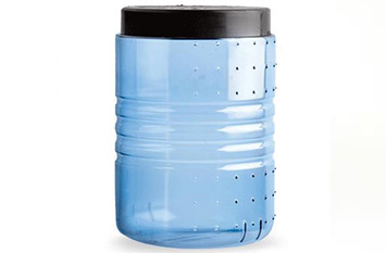
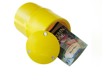
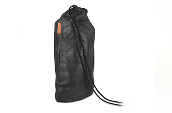
To reduce your campsite’s attractiveness to bears, all food, garbage, toiletries and cooking equipment must be stored in a bear-resistant container. Use only containers approved by the Interagency Grizzly Bear Committee. See list of examples below.
Hanging food from trees is not acceptable in most areas, since there are often no suitable trees to hang food from.
- The Bare Boxer
Contender Model 101, Champ Model 202
www.bareboxer.com - Craftsman Tech Composites
- Counter Assault
The Bear Keg
www.counterassault.com - Lighter1 Bear Bins – Backpacker Cache
Big Daddy Model (1.03 kg)
Lil’ Sami Model (610 g)
www.lighter1.com - BearVault
www.bearvault.com - Garcia Machine Backpackers’ Cache
Model 812
www.backpackerscache.com - UDAP Industries Inc.
“No Fed Bear” Canister
www.pepperpower.com - Ursack
Food Storage Container
www.ursack.com

Human waste
Select a spot away from trails and campsites and at least 70 m from water sources. Dig a hole 12 to 16 cm into the dark-coloured, biologically active soil layer. Loosely fill the hole with soil and or rocks afterward. Burn your toilet paper.
Water
Giardia lamblia is a parasite carried by humans and some domestic and wild animals. These parasites can occur in any surface water in the park and may contaminate the water supply. Boil your drinking water or purify it with a water filter or iodine tablets.
Washing
Keep yourself and your campsite odour-free. Keep sleeping bags, tents, and sleeping clothes free of food, food odours or beverages. Wash and store all dishes and food utensils immediately after use. To wash yourself or your dishes, carry water 70 m away from streams or lakes and use small amounts of biodegradable soap. Strain food particles from dishwater and store with garbage. Disperse strained water on land at least 50 metres downwind from your sleeping area.
Campfires
Campfires are NOT allowed in random camping areas. Cooking stoves only; no exceptions.
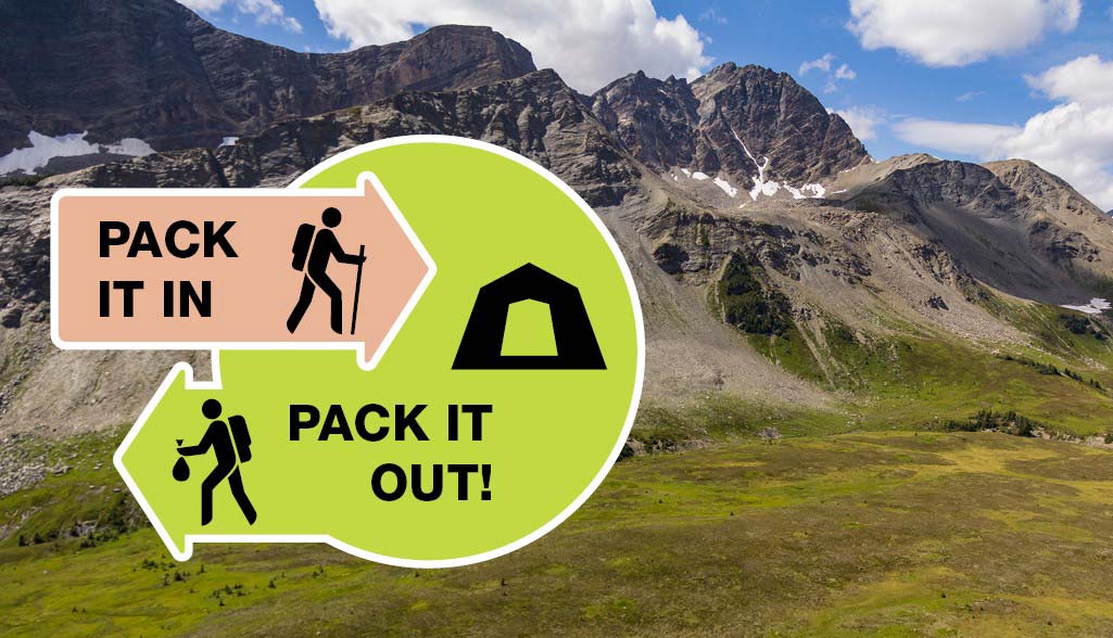
Garbage
Pack it in and pack it out! You are responsible for everything you take into the backcountry and this includes garbage. Take special care to remove all micro-trash – small pieces of plastic, foil, etc.
Trails
If there is a trail, stay on it. Shortcutting between trail switchbacks damages both the soil and plant life. This not only ruins the look of an area, but makes it susceptible to further damage by erosion. In alpine areas without trails, spread out, to avoid creating a new trail.
Safety
You are responsible for your own safety.
Be prepared for extreme weather and mountainous terrain. Cell phone coverage is unavailable in most areas.
Visitor safety
Information on mountaineering, ice climbing, visitor safety.
parks.canada.ca/mountainsafety
Weather forecasts
Avalanche information
1-800-667-1105 | parks.canada.ca/avalanche
Emergency
Call 780-852-3100 or 877-852-3100.
Maps
| Gem Trek | National Geographic |
|---|---|
| Jasper and Maligne Lake Columbia Icefields |
Jasper North Jasper South |
For more information on low impact travel in the backcountry contact: leavenotrace.ca 1-877-238-9343
Related links
- Athabasca Island
- Athabasca Pass
- The Brazeau Loop
- Celestine Lake to Rock Lake Trail
- Fiddle River Trail
- Fryatt Trail
- Saturday Night Lake Loop
- Jacques Lake
- Maligne Lake
- Skyline
- Tonquin Valley Trail
- Little Heaven – Upper Blue Creek
- Maligne Pass
- The North Boundary Trail
- Jonas Pass-Poboktan Creek
- South Boundary trail
- Bivouacking guidelines
- Horse use in Jasper National Park
- Date modified :