
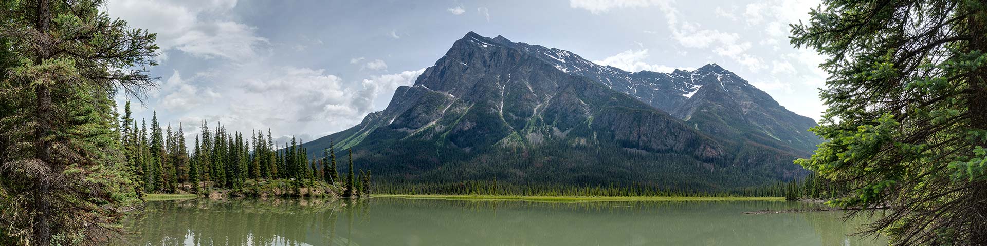
Large gravel flats and glaciers dominate the scenery toward Athabasca Pass National Historic Site
Athabasca Pass
Jasper National Park
 Athabasca Pass Backcountry Guide (PDF, 924.26 KB)
This remote, historic trail follows the Whirlpool River Valley, the traditional route of early fur traders crossing the Rocky Mountains. The trail starts on an old fire road that passes by Whirlpool Campground. This campground overlooks the river and is a great option for families or beginner backpackers. Beyond Whirlpool, the trail becomes more rugged as it stretches to the remote reaches of the west park boundary. Some rivers and creeks are not bridged. Fords can be dangerous. Rivers can be impassable during times of high water.
Planning considerations
- Maintained trail: Medium priority to Whirlpool; low priority Whirlpool to Athabasca Pass
- 48.5 km one-way
- Trail #115: 4 - 5 days
- Bikes permitted to Simon Creek
- Dogs permitted
- Horses permitted
The details
The Athabasca Pass is a historical hike with impressive scenery. Much of the trail has not changed since the days of the fur trade. The trail travels along an old fire road for the first 9 km. After 6 km, you arrive at Whirlpool Camp. This scenic camping area sits above a side channel of the Whirlpool River and is great for beginner backpackers.
Trees from Tie Camp were used to cut railway ties in the early 20th century. They were floated down river to Jasper for the railroad construction.
Tie Camp is the next campground with the ruins of the Otto brothers’ camp a few kilometres beyond. The trail is mainly forested to Middle Forks campground, a beautiful site alongside the river. Beyond Middle Forks, the valley opens up to the beauty of this wilderness trail. Four kilometres after Middle Forks is Scott gravel flats—an expanse of old river bed with stunning views. Scott Camp is one of the nicest camping areas on the trail. In low water you can ford the Whirlpool River here and explore a large tarn immediately below Scott Glacier.
From here, the trail alternates between forest and gravel flats until you arrive at the remains of a bridge over a canyon. A reroute trail brings you to just below Kane Meadows Camp; another one of the more beautiful sites along the trail. From here you are eight kilometres away from the National Historic Site of Athabasca Pass and the Committee’s Punchbowl. Fur traders traditionally stopped here and toasted the officers of the Hudson’s Bay Company. The last park hiker campground is 1 km below the pass.
- Beyond Whirlpool Campground, the trail is remote and rarely maintained. The trail may be overgrown in places; expect route finding.
- Most creeks and rivers are not bridged. Fords can be dangerous (especially Simon Creek and the Whirlpool River near Kane Meadows). Rivers can be impassable during times of high water.
- Biking is permitted to Simon Creek.

Campground information
| Campground | Elevation | Description | # of sites | Toilet type | Food storage | UTM |
|---|---|---|---|---|---|---|
| Whirlpool #55 |
1241 m | A scenic campground above the river, great for families. | 4 | Privy | Lockers | 11U 432762 5831268 |
| Tie Camp #56 |
1245 m | A camp on the edge of the forest, 2 km from the ruins of the Otto Brothers’ Camp. | 2 | Bar | Pole | 11U 429859 5828494 |
| Middle Forks #58 |
1362 m | A nice site on a clearing with a spring water creek. | 2 | Bar | Pole | 11U 427613 5822011 |
| Scott Camp #59 |
1405 m | A spectacular campground on the Whirlpool River with great views of Scott Glacier. | 4 | Bar | Pole | 11U 424019 5814972 |
| Kane Meadows #60 |
1602 m | Next to Kane Creek with open views. | 4 | Bar | Pole | 11U 418614 5809695 |
| Athabasca Pass #61 |
1764 m | A small site on the edge of the pass. | 4 | Bar | Pole | 11U 419003 5804471 |
How to get there

Located 35 km south of Jasper off Wabasso Road (Highway 93A).
From Jasper
- Take the Icefields Parkway towards Banff and turn right after the park gate onto Wabasso Road.
- Continue along Wabasso Road for 15 km and turn right onto the unpaved Moab Lake Road.
- The trailhead is at the end of the 6.8-km road.
From Banff and Lake Louise
- Follow the Icefields Parkway north towards Jasper.
- Turn left at the junction to Wabasso Road and Athabasca Falls, 200 km north of Lake Louise.
- Continue for 9 km and turn left onto unpaved Moab Lake Road.
- The trailhead is at the end of the 6.8-km road.
Are you prepared?

Safety is your responsibility
Refer to the Jasper National Park Backcountry Planning Guide:
- descriptions of trail types and campground facilities;
- equipment checklists;
- responsible camping practices;
- safety information.
Before heading out, check trail, weather and road conditions at: parks.canada.ca/jaspertrails.
Maps
| National Geographic | Gem Trek |
|---|---|
| Jasper South | Jasper and Maligne Lake |
Permits
A backcountry camping permit is mandatory for all overnight trips and can be obtained online at reservation.pc.gc.ca or by calling 1-877-737-3783.
- Date modified :