
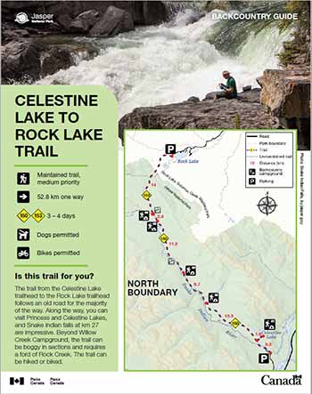
Celestine Lake to Rock Lake Trail
Jasper National Park
 Celestine Lake to Rock Lake Backcountry Guide (PDF, 689 KB)
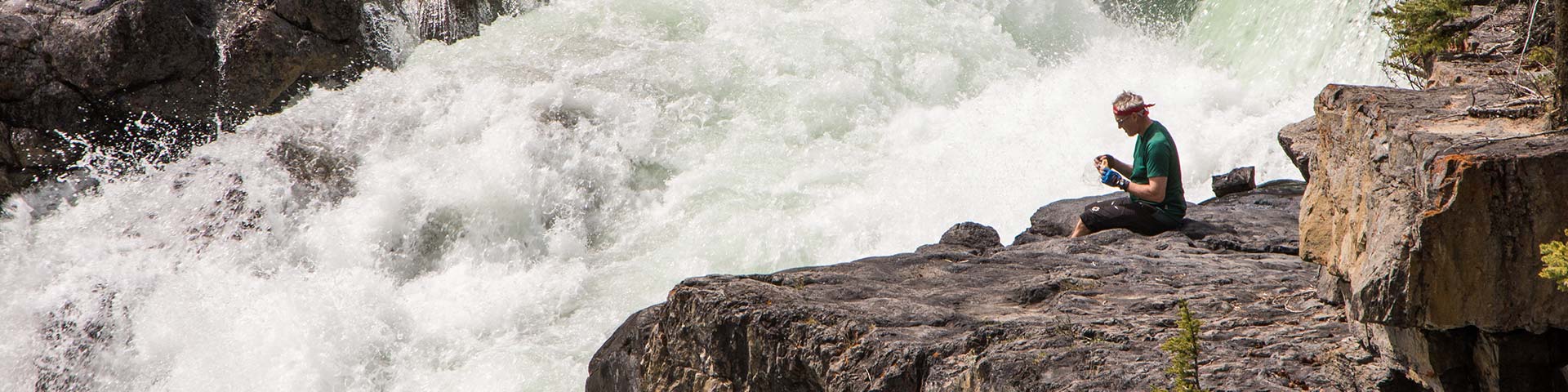
The trail from the Celestine Lake trailhead to the Rock Lake trailhead follows an old road for the majority of the way. Along the way, you can visit Princess and Celestine Lakes, and Snake Indian falls at km 27 are impressive. Beyond Willow Creek Campground, the trail can be boggy in sections and requires a ford of Rock Creek. The trail can be hiked or biked.
Planning considerations
- Maintained trail: medium priority
- 52.8 km one way
- Trail #150 and #153: 3 - 4 days
- Dogs permitted
- Bikes permitted
The details
The trail starts with the crossing of a footbridge over the Snake Indian River and canyon. After the bridge, the old fire road climbs steadily to a bench above the river. At km 5, you reach an old parking lot. To the right is the trail to Princess Lake, Celestine Lake Campground (#41) and Devona lookout. The tranquil, forest-fringed Celestine Lake is 2 km up the trail and is a great destination for an overnight stay. The trail to the old Devona fire lookout climbs steadily from a junction just before the campground for 2.6 km to an open ridge above the Athabasca River.
The trail continues along an old, dirt roadway to Shalebanks Campground (#62) and then Seldom Inn Campground (#63). Here, the trail changes to single track. At km 26.5, the 200 m side trail to Snake Indian Falls is well worth the trip. After Horseshoe Campground (#65), the trail opens up into some broad meadows on its way to Willow Creek Campground (#66). There can be boggy sections between here and Rock Creek. While often fairly low, the ford at Rock Creek can be challenging during high water. From here, it is a 6.5 km straightforward hike to the Rock Lake Trailhead.
- Celestine Lake Campground has a water pump. Boil or treat all drinking water.
- Fires are permitted in designated fire pits only. Check the trail report for fire bans.

Campground information
| Campground | Elevation (m) | Description | # of sites | Toilet type | Food storage | UTM |
|---|---|---|---|---|---|---|
| Celestine #41 |
1273 m | A beautiful campsite next to a forest-fringed lake. | 6 | Throne | Cable | 11U 429335 5893692 |
| Shalebanks #62 |
1258 m | A simple camping area in the forest. | 4 | Bar | Pole | 11U 420005 5899584 |
| Seldom Inn – Hiker #63 |
1294 m | A simple camping area in the forest beside the trail just south of Snake Indian Falls. | 4 | Bar | Pole | 11U 416098 5904980 |
| Horseshoe #65 |
1367 m | A beautiful little camping area along the shore of the Snake Indian River. | 4 | Bar | Pole | 11U 420005 5899584 |
| Willow Creek – Hiker #66 |
1360 m | A simple camping area near Willow Creek, across the creek from Willow Creek Horse Camp. | 4 | Throne | Cable | 11U 410612 5914645 |
How to get there
Celestine Lake trailhead
- The trailhead is 44 km from Jasper.
- Drive east on Highway 16, turn off on the Snaring Road and continue past Snaring Campground.
- After the Snaring River bridge, the road will turn to gravel.
- A one-way timed road begins at 13.7 km. From here it is 14 km of rough gravel road to the trailhead.
Note:
- The road is not recommended for low clearance vehicles and it may be impassable during high water or heavy rain events.
- No trailers or RVs.
- Parks Canada or utility service vehicles may use the one-way, timed road at any time.
- Celestine Road is open to motorists from mid-May to mid-October.
Hours of travel are:
In:
- 8 am to 9 am
- 11 am to 12 pm
- 2 pm to 3 pm
- 5 pm to 6 pm
Out:
- 9:30 am to 10:30 am
- 12:30 pm to 1:30 pm
- 3:30 pm to 4:30 pm
- 6:30 pm to 7:30 pm
Rock Lake trailhead
This trailhead is located in the Willmore Wilderness outside of Jasper National Park.
- Travel Highway 16 east, about 70 km, toward Hinton
- Turn north on Hwy 40 and travel about 40 km
- Turn west at the Rock Lake turnoff and travel 32 km on a gravel road to Rock Lake.
- Look for the signs directing you to Willmore Wilderness Park and the trailhead parking lot. You do not want to park at the Rock Lake Campground.
Are you prepared?
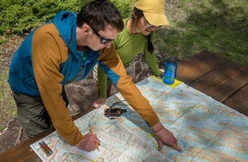
Safety is your responsibility
Refer to the Jasper National Park Backcountry Planning Guide:
- descriptions of trail types and campground facilities;
- equipment checklists;
- responsible camping practices;
- safety information.
Before heading out, check trail, weather and road conditions at: parks.canada.ca/jaspertrails.
Maps
| NTS | National Geographic |
|---|---|
| Snaring 83E/1 | Jasper North |
Permits
A backcountry camping permit is mandatory for all overnight trips and can be obtained online at reservation.pc.gc.ca or by calling 1-877-737-3783.
- Date modified :