
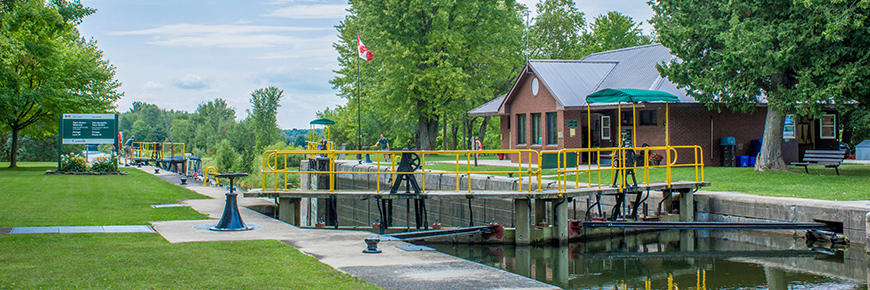
Lock 39 - Portage
Trent-Severn Waterway National Historic Site
Lock 39, isolated from road traffic, is a very popular spot with well-maintained grounds and a reasonably large boater camping area. It is an easy walk down a gravel road or a short bike ride to the Talbot Dam, a popular tourist spot for the two-week pickerel run in mid-April and whitefish run in the fall.
Getting here
- Address: 33245 Region Road #50, Beaverton, Ontario
- Nautical chart: #2025 (more on Nautical charts)
- Kilometer marker: 289.1km (mile 179.6)
- GPS: 44°29'56.4"N 79°07'57.2"W
Hours of Operation
Contact:
- Phone number: (705) 426 – 7911
- Email address: trentsevern@pc.gc.ca
Navigational data
- Lock length: 36.6 m (120 ft)
- Lock width: 9.7 m (32 ft)
- Average lift: 4.0 m (13 ft)
- Max. mooring period: 2 nights
Facilities and services
- Overnight mooring
- Camping
- Washrooms
- Potable water
- Picnic area
- Visitor information
History
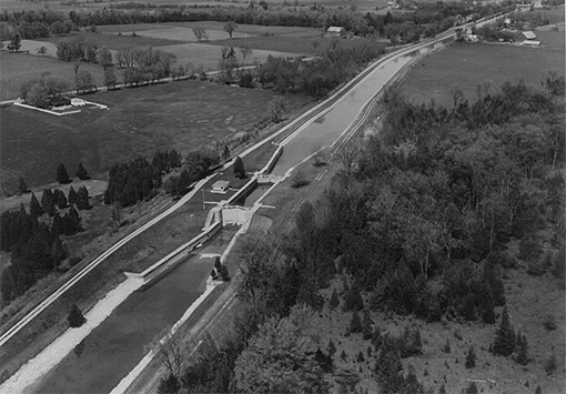
Constructed: 1900-1907
The area’s landscape and infrastructure are a view into the decisions of the past. Just upstream, the Talbot Dam creates a small bay where the Talbot River diverges from the canal - two routes of navigation that took decades to determine. For an iconic view, look west from atop the lock gates at Lock 39, and see the entire canal from Locks 39 - 41, and right to Lake Simcoe.
Tourism information
- Beaverton District Chamber of Commerce
Phone number: (705) 426-2051
- Durham Tourism
Phone number: (905) 723-0023 or 1-800-413-0017
Related links
- Lock 1 - Trenton
- Lock 2 - Sydney
- Lock 3 - Glen Miller
- Lock 4 - Batawa
- Lock 5 - Trent
- Lock 6 - Frankford
- Lock 7 - Glen Ross
- Lock 8 - Percy Reach
- Lock 9 - Meyers
- Lock 10 - Hagues Reach
- Lock 11-12 - Ranney Falls
- Lock 13 - Campbellford
- Lock 14 - Crowe Bay
- Lock 15 - Healey Falls
- Lock 16 / 17 - Healey Falls Flight Lock
- Lock 18 - Hastings
- Lock 19 - Scotts Mills
- Lock 20 - Ashburnham
- Lock 21 - Peterborough Lift Lock
- Lock 22 - Nassau Mills
- Lock 23 - Otonabee
- Lock 24 - Douro
- Lock 25 - Sawer Creek
- Lock 26 - Lakefield
- Lock 27 - Young's Point
- Lock 28 - Burleigh Falls
- Lock 30 - Lovesick
- Lock 31 - Buckhorn
- Lock 32 - Bobcaygeon
- Lock 33 - Lindsay
- Lock 34 - Fenelon Falls
- Lock 35 - Rosedale
- Lock 36 - Kirkfield
- Lock 37 - Bolsover
- Lock 38 - Talbot
- Lock 40 - Thorah
- Lock 41 - Gamebridge
- Lock 42 - Couchiching
- Lock 43 - Swift Rapids
- Lock 44 - Big Chute Marine Railway
- Lock 45 - Port Severn
- Date modified :