
Lake Superior National Marine Conservation Area. Photo: Dale Wilson
National Marine Conservation Areas System Plan
Canada is truly a maritime nation with a rich marine heritage. We have the longest coastline in the world—over 243,000 km along three oceans, plus another 9,500 km along the Great Lakes. With our partners, we also share responsibility for over 5 million km2 of marine waters—the equivalent of about 60% of the country's land mass!
The vast marine ecosystems off these coasts, varied and productive, have played a major role in shaping Canada's history and economy. So it is no wonder that the national marine conservation areas representing this powerful force are an important component of Parks Canada's networks of nationally significant places.
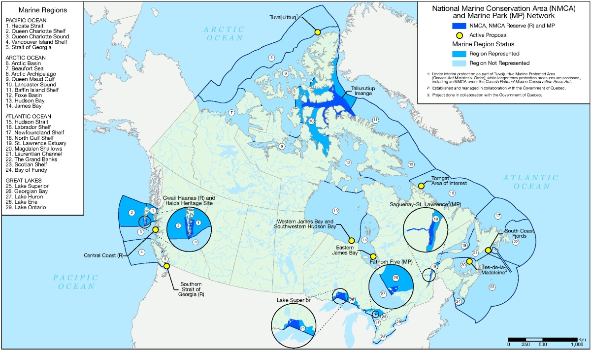
The National Marine Conservation Areas System Plan divides the oceans and Great Lakes in Canada into 29 marine regions, each one a distinct combination of natural and cultural characteristics and encompassing a combination of submerged and coastal lands and the water, ice, and species found there.
Parks Canada is working towards the long-term goal of establishing at least one NMCA in each of the 29 marine regions. Within each region, Parks Canada works to support Indigenous leadership in conservation through the selection of NMCA locations of mutual interest. Proposals for NMCA establishment can be advanced by Indigenous peoples, provincial and territorial governments, stakeholders, and the public.
Understanding and appreciating
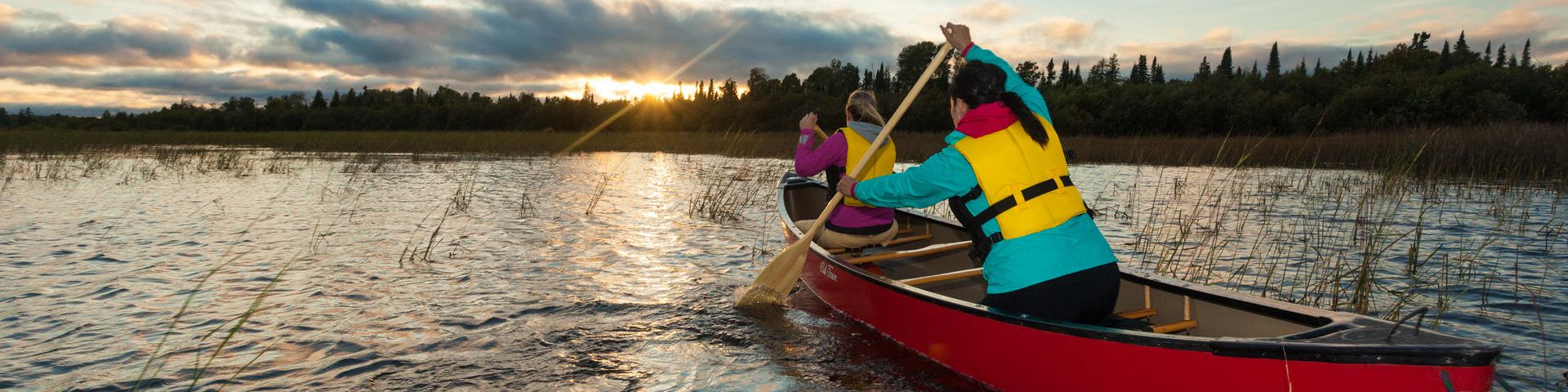
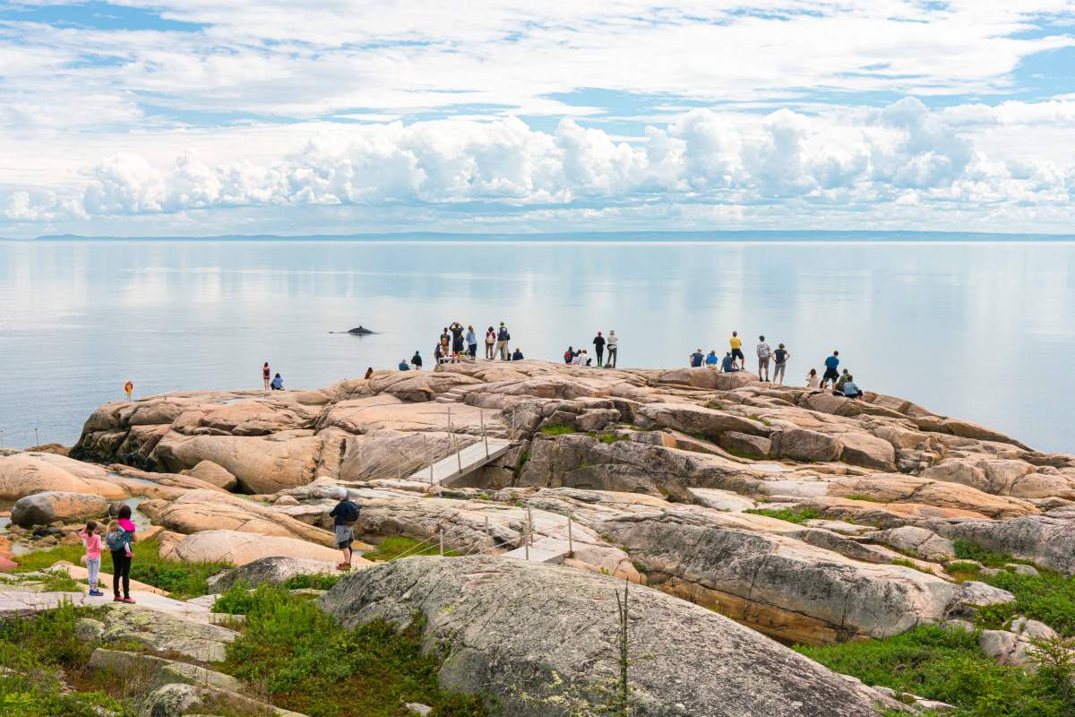
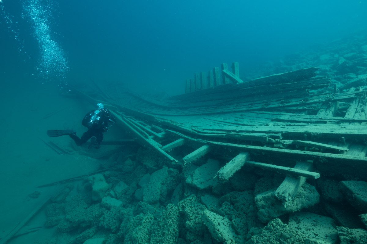
National marine conservation areas are gateways to nature, adventure, learning, and exploration, offering visitors the opportunity to connect with fascinating marine environments both above and below the surface, both onshore and offshore.
NMCAs showcase the important relationships that Indigenous peoples and coastal communities have with marine environments and recognize the historical and contemporary contributions these groups make toward stewarding these special places.
There is always something to learn—and a hidden gem to discover—when you visit an NMCA, including:
- marine and coastal habitats
- rich aquatic biodiversity
- archaeological and cultural features
- Indigenous and coastal community values and perspectives
- engaging citizen science opportunities
- captivating research
- interactive presentations and activities
- limitless opportunities for self-guided exploration, both on-site and virtually
Hike or paddle along coastlines shaped over millennia. Expand your understanding of the rich relationships connecting Indigenous peoples with the land and water. Watch sea birds soar, dive through water teeming with unique marine life, and explore intriguing underwater archaeological sites.
NMCAs offer a variety of opportunities for visitors to take part in tours and programs, appreciate iconic coastal and cultural landscapes, and develop a deeper appreciation of these unique marine environments.
Protecting and conserving
Marine and coastal ecosystems have always been important places of human use and activity. From fishing to shipping, people rely on these places for their livelihoods and well-being. Oral histories reflect relationships that have existed and continue to exist between Indigenous peoples and the land and water over millennia. Ongoing traditional use of marine areas that fall within NMCA boundaries can support the continuity of Indigenous knowledges, cultural identities, and well-being.
Certain human activities can have damaging effects on the marine environment, such as pollution and overexploitation of resources. To harmonize conservation practices with human activities, national marine conservation areas are established in order to protect the marine environment for the benefit, education, and enjoyment of all people. They are managed in ways that meet the needs of present and future generations without compromising ecosystem health.
National Marine Conservation Areas System Plan
National marine conservation areas are established in a manner set out in the National Marine Conservation Areas Policy and guided by the national system plan, Sea to Sea to Sea.
Read more about creating new national marine conservation areas.
Map of national marine conservation areas, national marine conservation area reserves and national marine parks in Canada
The map below identifies the marine regions of Canada. It also notes whether these regions are represented by a national marine conservation area, national marine conservation area reserve, or national marine park, or are underrepresented.
-
Text version
This is a map of the country of Canada, divided into provinces, territories, and marine regions. The general purpose of this map is to identify the 29 marine regions of Canada and whether or not they are presently represented by a national marine conservation area, national marine conservation area reserve, or marine park.
The map contains a legend in the top left corner, another legend in the top right corner, and a 0 to 1,000 km scale in the bottom right. The year 2022 is indicated outside the bottom right corner and the Parks Canada logo with the Canada flag is positioned in the bottom left.
Land regions of Canada are represented in light green, and water is represented in shades of blue. A multitude of blue lines surround the different Canadian waters, indicating the country’s established marine boundaries. These lines also separate Canadian waters from neighbouring countries, the United States and Greenland, and separate Canadian waters from other international waters. International waters situated in western Canada encompass the Pacific marine regions to the north, west and south. International waters situated in northern Canada encompass the Arctic marine regions to the west, north and east. International waters situated in eastern Canada encompass the Atlantic marine regions to the north-east, east, south, and south-west. International waters situated in the Great Lakes encompass the Great Lakes marine regions to the south-east, south, and south-west. These same blue lines are used to divide Canadian waters into 29 distinct marine regions. These marine regions range in scale and composition; some include waters adjacent to and/or within one or more provinces and territories. Within each of these 29 regions is a number from 1 to 29. In the legend in the top left corner, these numbers denote the unique name for each marine region.
Each of the 29 marine regions appears in either blue or light blue. The legend in the top right corner of the map indicates the corresponding level of representation of each marine region within the NMCA System Plan. Light blue indicates that the region is not represented within the NMCA System Plan, and blue indicates that the region is represented in the NMCA System Plan. Dark blue on the map and in the legend indicates where there are existing NMCAs, NMCA reserves, or marine parks. The legend also notes that small yellow circles appearing on the map identify locations where there are active proposals for a new NMCA, NMCA reserve, or marine park.
The legend at the top right also includes the numbers 1 through 3 that provide additional information. 1 is associated with Tuvaijuittuq Marine Protected Area and is found beside the site’s name on the map. It states that this active national marine conservation area proposal is under interim protection as part of Tuvaijuittuq Marine Protected Area (Oceans Act Ministerial Order), while longer term protection measures are assessed, including an NMCA under the Canada National Marine Conservation Areas Act.
2 is associated with Saguenay-St. Lawrence Marine Park, is found beside the site’s name on the map, and states that the site is established and managed in collaboration with the Government of Quebec.
3 is associated with the Magdalen Islands and states that this active marine protected area proposal project is being done in collaboration with the Government of Quebec.
The following is a description of each of Canada’s 29 marine regions including: each region’s boundaries; the region’s corresponding number in the top left legend; the region’s level of representation in the System Plan as colour coded according to the legend in the top right; and the details of any indicated NMCA, NMCA reserve, marine park, or active proposal in each region.
Canada's 29 marine regions are divided into four regional groups on this map. The first group is the Pacific Ocean, found along the west coast of British Columbia.
-
1. Hecate Strait, region 1 – indicated as represented in the NMCA Systems Plan. Region 1 includes a large portion of Gwaii Haanas National Marine Conservation Area Reserve and Haida Heritage Site, situated in the immediate surrounding waters of the Haida Gwaii archipelago.
Region 1’s northern boundary line begins in the Dixon Entrance situated just north of Haida Gwaii archipelago. The boundary line then extends south-east through the Dixon Entrance following along the B.C.-U.S. border towards the Portland Inlet. Region 1’s eastern boundary line runs south along northern British Columbia's coastline, passing through Chatham Sound, continuing towards Caamaño Sound. Region 1’s southern boundary line, shared with Region 3, begins in the Caamaño Sound and extends south-west through the Hecate Strait towards the southern portion of Gwaii Haanas National Marine Conservation Area Reserve and Haida Heritage Site. Region 1’s western boundary line is shared with Region 2 at two locations: in the southern portion of Gwaii Haanas National Marine Conservation Area Reserve and Haida Heritage Site situated along the southern coast of Haida Gwaii archipelago, as well as along the northern coast of Haida Gwaii archipelago towards the Dixon Entrance. Region 1’s western boundary line begins in the southern portion of Gwaii Haanas National Marine Conservation Area Reserve and Haida Heritage Site, extending north along the Haida Gwaii archipelago’s eastern coast through the Hecate Strait. Region 1’s western boundary line then arches north-west near Rose Point, passing through the McIntyre Bay along the northern coast of the Haida Gwaii archipelago. Region 1’s western boundary line then curves north just past Langara Island and continues through the Dixon Entrance towards the B.C.-U.S. border.
-
2. Queen Charlotte Shelf, region 2 – indicated as represented. Region 2 includes a large portion of Gwaii Haanas National Marine Conservation Area Reserve and Haida Heritage Site, situated in the immediate surrounding waters of the Haida Gwaii archipelago.
Region 2’s eastern boundary line, shared in part with Region 1, begins at the B.C.-Alaska border just north of the Haida Gwaii archipelago, extending south through the Dixon Entrance, continuing along the western coast of the archipelago and extending through a portion of Gwaii Haanas National Marine Conservation Area Reserve and Haida Heritage Site. Region 2’s southern boundary line, shared with Region 3, begins near Cape St. James, extending west towards the border dividing Canadian and international waters in the Pacific Ocean. Region 2’s western boundary line follows the Canadian-international waters border north towards the B.C.-Alaska border. Region 2’s northern boundary line begins at the Canadian-international waters border in the Pacific Ocean, extending east along the B.C.-Alaska border towards the Dixon Entrance, just north of the Haida Gwaii archipelago.
-
3. Queen Charlotte Sound, region 3 – indicated as not represented. Region 3 includes the active proposal for Central Coast National Marine Conservation Area Reserve, situated in the immediate surrounding waters of the central British Columbia coast; as well as a small portion of Gwaii Haanas National Marine Conservation Area Reserve and Haida Heritage Site, situated in the immediate surrounding waters of the Haida Gwaii archipelago.
Region 3’s blue boundary lines are shared with four different Regions; two Regions along its northern boundary line, and two Regions along its southern boundary line. Region 3’s northern boundary line is shared with Region 1 in the Queen Charlotte Sound, as well as Region 2 in the Pacific Ocean. Region 3’s southern boundary line is shared with Region 4 in the Pacific Ocean, as well as Region 5 in the northern Strait of Georgia. Region 3’s northern boundary begins at the border separating Canadian and international waters in the Pacific Ocean, extending east passing through a small portion of Gwaii Haanas National Marine Conservation Area Reserve and Haida Heritage Site, towards the Caamaño Sound along B.C.’s northern coast. Region 3’s eastern boundary line begins in the Caamaño Sound, extending south along the central coastline through the Laredo Sound, then the Central Coast National Marine Conservation Area Reserve active proposal location and continuing south through the Queen Charlotte Strait towards the northern portion of the Strait of Georgia. Beginning in the northern portion of the Strait of Georgia, Region 3’s southern boundary line extends north-west through the Discovery Passage along the north-eastern coast of Victoria Island, through the Queen Charlotte Strait, and along the northern coast of Victoria Island. Continuing west, Region 3’s southern boundary line passes through the Scott Channel towards the border dividing Canadian and international waters in the Pacific Ocean. Region 3’s western boundary line extends north along the Canadian-international waters border until reaching its northern boundary line.
-
4. Vancouver Island Shelf, region 4 – indicated as not represented. Situated in the surrounding waters of Vancouver Island's western coast, Region 4 does not include any national marine conservation areas.
Region 4’s eastern boundary line begins in the Queen Charlotte Sound on the northern coast of Victoria Island, extending south along Victoria Island's western coast, passing through Brooks Bay, Barkley Sound and continuing south-east through the Juan de Fuca Strait towards Victoria. Region 4’s southern boundary line begins in the Juan de Fuca Strait near Victoria, along the B.C.-U.S. border, extending west towards the Canadian-international waters border in the Pacific Ocean. Region 4’s western boundary line begins at the B.C.-U.S. border in the Pacific Ocean, extending north along the Canadian-international waters border towards Region 3’s southern boundary line. Region 4’s northern boundary line begins at the Canadian-international waters border in the Pacific Ocean, extending east towards the northern coast of Victoria Island.
-
5. Strait of Georgia, region 5 – indicated as not represented. Region 5 includes the active proposal for the Southern Strait of Georgia National Marine Conservation Area Reserve, situated in the southern portion of the Georgia Strait in the surrounding waters just west of Vancouver.
Region 5’s northern blue boundary line begins in the northern portion of the Georgia Strait on the coastline of Vancouver Island, extending east just south of Quadra Island, through the Desolation Sound towards Lund. Region 5’s eastern boundary line begins near the Desolation Sound, extending south-east along the B.C. coastline continuing past Vancouver, towards the B.C.-U.S. border. Region 5’s southern boundary line begins near Tsawwassen at the B.C.-U.S. border in the southern portion of the Georgia Strait, following the border west past the Southern Strait of Georgia National Marine Conservation Area Reserve proposal location, continuing through the Strait of Juan de Fuca. Region 5’s western boundary line, shared in part with Region 4, begins in the Strait of Juan de Fuca along the southern coast of Victoria Island, extending east along the coast, past Victoria, through the Georgia Strait. Continuing north along the eastern coast of Victoria Island, Region 5’s western boundary line extends past Nanaimo, towards Quadra Island in the northern portion of the Georgia Strait.
-
6. Arctic Basin, region 6 – indicated as not represented. Region 6 includes the active proposal for Tuvaijuittuq Marine Protected Area, situated in the Arctic Ocean along the north-western coast of Ellesmere Island in northern Nunavut.
Region 6 shares its southern boundary in part with Region 7 in the Beaufort Sea, as well as Region 8 in the Arctic Ocean. Region 6’s southern boundary line begins in the Beaufort Sea at the Yukon-Alaska border, curving north-east over the Yukon-Northwest Territories border, through the Beaufort Sea, into the Arctic Ocean, and over the Northwest Territories-Nunavut border. Region 6’s southern boundary line continues north passing through a portion of the Tuvaijuittuq Marine Protected Area active proposal location, and continues north-east towards the Lincoln Sea just north of Alert. Region 6’s eastern boundary line begins in the Lincoln Sea extending north-west along the Nunavut-Greenland border towards the Canadian-international waters border in the Arctic Ocean. Region 6’s northern boundary line begins at the Nunavut-Greenland border in the Lincoln Sea, extending south-west along the Canadian-international waters border in the Arctic Ocean, towards the Canada-Alaska border. Region 6’s western boundary line begins at the Canadian-international waters border in the Arctic Ocean, extending south-west along the Canada-Alaska border through the Beaufort Sea.
-
7. Beaufort Sea, region 7 – indicated as not represented. Situated in the Amundsen Gulf, Region 7 does not include any national marine conservation areas.
Region 7’s north blue boundary line, shared with Region 6, begins at the Yukon-Alaska border in the Beaufort Sea, and arches north-east continuing just past Banks Island. Extending towards Banks Island, Region 7’s eastern boundary line, shared in part with Region 8, continues along the southern coastline of Banks Island, through the Amundsen Gulf curving north through Prince of Wales Strait, towards McClure Strait. Following Victoria Island’s western coastline, Region 7’s eastern boundary line extends south through the Minto Inlet, then Prince Albert Sound. Crossing the Northwest Territories-Nunavut border, Region 7’s eastern boundary line extends south-east through the Dolphin and Union Strait towards the Coronation Gulf. Region 7 shares part of its eastern boundary line with Region 9. Beginning near the Coronation Gulf, Region 7’s southern boundary line extends west through the Dolphin and Union Strait, and over the Nunavut-Northwest Territories border. Continuing west, through Darnley Bay, Franklin Bay, then Liverpool Bay, the boundary line extends over the Northwest Territories-Yukon border through the Mackenzie Bay, towards the U.S. border.
-
8. Arctic Archipelago, region 8 – indicated as not represented. Region 8 includes the active proposal for Tuvaijuittuq Marine Protected Area, situated in the Arctic Ocean along the north-western coast of Ellesmere Island in northern Nunavut.
Region 8 shares its blue boundary lines with four different regions; Region 6 along the northern boundary line, Region 7 along the western boundary line, Region 9 along the southern boundary line, and Region 10 along the eastern boundary line. Region 8’s northern boundary begins at the Nunavut-Greenland border, just north of Alert which is situated at the tip of Ellesmere Island. Extending south-west in the surrounding waters of Ellesmere Island, passing through Tuvaijuittuq Marine Protected Area proposal location, Region 8’s northern boundary line crosses over the Nunavut-Northwest Territories border, continuing south-west towards the surrounding waters north of Banks Island. Region 8’s western boundary line begins near the north coast of Banks Island, extending east to the McClure Strait, along the northern coast of Victoria Island, through the Viscount Melville Sound, crossing over the Northwest Territories-Nunavut border, then extending west through Hadley Bay. Region 8’s western boundary line then curves south through the Goldsmith Channel just south of Stefansson Island, continuing south-east through the McClintock Channel, towards the Victoria Strait. Region 8’s southern boundary line begins on the south-eastern coast of Victoria Island, crossing east through the Larsen Sound, passing along the northern shore of King William Island, continuing through the James Ross Strait, then towards the Boothia Peninsula. Region 8’s eastern boundary line begins in the James Ross Strait extending north along the Boothia Peninsula coastline through the Larson Sound and Franklin Strait, and continuing, continuing north towards the south-western corner of Somerset Island. Region 8’s eastern boundary line then extends west towards Prince of Wales Island, passing through Willis Bay, following the island shoreline. Region 8’s eastern boundary line arches south-west through the Franklin Strait, then north-west through the McClintock Channel, continuing north along Prince of Wales island's western shoreline through Ommanney Bay, towards Russell Island. As of Russell Island, Region 8’s eastern boundary line crosses through the Barrow Strait, reaching Bathurst Island, then continues north through Graham Moore Bay, then Austin Channel, along Bathurst Island’s western coast. Once reaching the north-eastern shoreline of Bathurst Island, Region 8’s eastern boundary line extends east along the north-western coast of Devon Island, curving north-east through the Norwegian Bay, towards the Ellesmere Island’s western coast. Extending north along the Island coast, Region 8’s eastern boundary line passes through Baumann Fiord, the Eureka Sound, then Nansen Sound, curving north-east along Ellesmere Island’s coastline to Alert. Once having reached Alert, the eastern boundary line curves south through the Kennedy Channel, continuing along Ellesmere Island’s coast south, just past Scoresby Bay. The boundary line then arches north-east in Kane Basin, continuing north along the Nunavut-Greenland border through the Kennedy Channel, extending north just past Alert.
-
9. Queen Maud Gulf, region 9 – indicated as not represented. Situated south of Victoria Island, along the north-western Nunavut mainland coastline, Region 9 does not include any national marine conservation areas.
Region 9’s northern blue boundary line, shared with Region 7, begins near the Dolphin and Union Strait, in the Coronation Gulf along Victoria Island’s southern coastline. Region 9’s northern boundary line passes through the Dense Strait, then Victoria Strait, extending east just north of King William’s Island. Region 9’s northern boundary line is shared with Region 8, near King William’s Island. Region 9’s eastern boundary line begins in the James Ross Strait, following eastern Nunavut’s mainland coastline south-east, through Rae Strait, then Rasmussen Basin, continuing along Chantrey Inlet’s shoreline. Region 9’s southern boundary line begins in the Chantrey Inlet, extending north-west through Simpson Strait, and passing through Queen Maud Gulf. Extending south along northern Nunvut’s mainland coast, Region 9’s southern boundary line passes through McLoughlin Bay, continuing north-west through the Dense Strait, then Bathurst Inlet, continuing through the Coronation Gulf, towards the Dolphin and Union Strait.
-
10. Lancaster Sound, region 10 – indicated as represented. Situated in the Lancaster Sound along Baffin Island’s north-western coastline, Region 10 includes the Tallurutiup Imanga National Marine Conservation Area.
Region 10’s western boundary line begins on the south coast of Bathurst Island, extending south through the Barrow Strait, towards Prince of Wales Island and continues along the island's eastern coast through the Peel Sound, towards the Franklin Strait. Region 10’s southern boundary line begins on the south-eastern coast of Prince of Wales Island, then crosses the Peel Sound, reaching Somerset Island, to then extend north along the island coast through the Peel Sound, towards the Barrow Strait. Region 10’s southern boundary line then passes through a portion of the Tallurutiup Imanga National Marine Conservation Area along the northern coast of Somerset Island, curving south through the Gulf of Boothia, then through Committee Bay. Curving north in Committee Bay, Region 10’s southern boundary line, passes the Fury and Hecla Strait, where it shares its boundary in part with Region 12. The southern boundary line continues north along Baffin Island’s western coast passing through the Prince Regent Inlet, then curves east through the Tallurutiup Imanga National Marine Conservation Area, along the north-western coast of Baffin Island in Lancaster Sound. Region 10’s southern boundary line continues east along the island coast, just past Bylot Island, then proceeds to extend north-east through Baffin Bay, reaching the Nunavut-Greenland border. Region 10 shares part of its southern boundary line with Region 11 in Baffin Bay. Region 10’s eastern boundary line begins in Baffin Bay, curving north-west along the Nunavut-Greenland border, towards the Kane Basin. Region 10’s northern boundary line, shared in part with Region 8, begins at the Nunavut-Greenland border in the Kane Basin, extending west towards the central east coast of Ellesmere Island. Region 10’s northern boundary line extends south, curving west just past Smith Bay, and passing through a portion of Tallurutiup Imanga National Marine Conservation Area. Extending west through the Jones Sound, Region 10’s northern boundary arches back east in the Norwegian Bay, passing through the Jones Sound. Region 10’s northern boundary line follows Devon Island’s southern coast west, passing through the Tallurutiup Imanga National Marine Conservation Area, then through the Wellington Strait, towards Bathurst Island.
-
11. Baffin Island Shelf, region 11 – indicated as not represented. Situated in the Lancaster Sound along Baffin Island’s north-western coastline, Region 11 includes a small portion of the Tallurutiup Imanga National Marine Conservation Area.
Region 11’s western blue boundary line, shared with Region 10, begins in Tallurutiup Imanga National Marine Conservation Area, along the north-eastern coast of Baffin Island near Cape MacCulloch, then extends north-east through Baffin Bay, reaching the Nunavut-Greenland border. Region 11’s northern boundary line extends south-east along the Nunavut-Greenland border passing through the Baffin Bay and continuing through the northern portion of the David Strait. Sharing its boundary line with Region 15, Region 11’s eastern boundary line begins in the David Strait, at the Nunavut-Greenland border, and extends south-west towards Cape Dyer, situated on the south-eastern coast of Baffin Island. Region 11’s southern boundary line follows Baffin Island’s north-eastern coast, extending north-west passing through Home Bay, continuing through a portion of Tallurutiup Imanga National Marine Conservation Area, towards Cape MacCulloch.
-
12. Foxe Basin, region 12 – indicated as not represented. Situated in the Foxe Basin, as well as the northern portion of the Hudson Bay, Region 12 does not include any national marine conservation areas.
Beginning in the Fury and Hecla Strait, Region 12’s northern blue boundary line extends east along the southern coastline of Baffin Island, continuing through Steensby Inlet, arching south-east along the shoreline in Foxe Basin. Passing through the Foxe Channel towards the Nunavut-Quebec border, Region 12 shares part of its northern boundary line with Region 15. Region 12’s southern boundary line extends south-west along the Nunavut-Quebec border, near the Hudson Strait, passing along north-western Quebec’s coastline, through the northern portion of the Hudson Bay. Extending west, Region 12’s southern boundary line passes just south of Mansel Island and Coats Island, continuing north-west through Fisher Strait extending west, south of Southampton Island. Region 12’s southern boundary line is shared with Region 13’s northern boundary line. Region 12’s western boundary line begins near Southampton Island in the Roes Welcome Sound, extending north through Wager Bay, then Repulse Bay. Continuing north along eastern Nunavut’s coastline, Region 12’s western boundary line passes through Lyon Inlet, along the Foxe Basin western shoreline, then through Fury and Hecla Strait, towards the Boothia Gulf. Region 12’s western boundary line is shared in part with Region 10’s boundary line in the Fury and Hecla Strait.
-
13. Hudson Bay, region 13 – indicated as not represented. Region 13 includes an active proposal for the Western James Bay and Southwestern Hudson Bay National Marine Conservation Area, situated in the south-eastern portion of the Hudson Bay, along part of northern Ontario’s coastline.
Region 13’s western blue boundary line begins in the north-western corner of the Hudson Bay, along the Nunavut coastline near Southampton Island. Extending south through Daly Bay, Rankin Inlet, then Chesterfield Inlet, Region 13’s western boundary line crosses the Nunavut-Manitoba border, continuing south along the border towards Button Bay, near Churchill. Region 13’s southern boundary line begins in the Button Bay near Churchill, extending south-east along the southern shoreline of the Hudson Bay. Continuing east through Port Nelson, Region 13’s southern boundary line crosses the Manitoba-Ontario border, continuing past the Western James Bay and Southwestern Hudson Bay National Marine Conservation Area proposal location. Extending north-east over the Ontario-Nunavut border situated near James Bay, Region 13’s eastern boundary line crosses through the Hudson Bay past Belcher Islands, and over the Nunavut-Quebec border near Cape Dufferin. Continuing north, Region 13’s eastern boundary line passes through Povungnituk Bay, then Mosquito Bay, continuing towards Kovic Bay. Region 13’s eastern boundary line is shared with Region 14. Beginning in Kovic Bay, Region 13’s northern boundary line, shared with Region 12, extends west over the Quebec-Nunavut border, to the south of Mansel Island, followed by Coats Island. The boundary continues through the Fisher Straight, passes through Bay of Gods Mercy, located south of Southampton Island, and then reaches to Roes of Welcome Sound, near the northern portion of the Hudson Bay.
-
14. James Bay, region 14 – indicated as not represented. Region 14 includes an active proposal for Eastern James Bay National Marine Conservation Area, situated in the south-eastern portion of James Bay.
Region 14’s eastern blue boundary line begins in the Hudson Bay along the Nunavut-Quebec border, near Inukjuak. Extending south along the Nunavut-Quebec border, Region 14’s eastern boundary line curves south-east, just past Long Island, into the James Bay. Region 14’s southern boundary line begins on the north-eastern coast of the James Bay, following the Quebec coast south past the Eastern James Bay National Marine Conservation Area active proposal location, crossing over the Nunavut-Quebec border into Rupert Bay. Extending west over the Quebec-Ontario border into Hannah Bay, Region 14’s southern boundary line then arches north-west over the Ontario-Nunavut border, continuing north through the Akimiski Strait, towards the Hudson Bay. Region 14 shares its western boundary line with Region 13. Beginning along the Ontario-Nunavut border, just north of James Bay in the Hudson Bay, Region 14’s western boundary line crosses over the Ontario-Nunavut border, extending north-east through the Hudson Bay, towards Inukjuak.
-
15. Hudson Strait, region 15 – indicated as not represented. Situated in the waters along the south-eastern portion of Baffin Island, Region 15 does not include any national marine conservation areas.
Region 15’s northern blue boundary line begins along the southern coastline of Baffin Island, in the Hudson Strait near the Foxe Channel. Extending east through the Hudson Strait, Region 15’s northern boundary line arches north-west near Resolution Island, passing through Gabriel Strait, continuing along the eastern coastline of Baffin Island. The boundary continues north through Frobisher Bay and then Cumberland Sound. Region 15’s northern boundary line extends north-east towards the Nunavut-Greenland border, just past Exeter Sound. Region 15’s northern boundary line is in part shared with Region 11. Region 15’s eastern boundary line extends south-east through the David Strait along the Nunavut-Greenland border. Region 15’s southern boundary line, shared in part with Region 16 and 12, begins in the David Strait at the Nunavut-Greenland border, extending south-west towards the north-western corner of Newfoundland and Labrador. Continuing west just north of Killliniq Island, Region 15’s southern boundary line arches south along the shorelines of Ungava Bay, through the Hudson Strait and along northern Quebec. Beginning near Charles Island, Region 15’s western boundary line, shared with Region 12, extends north-west through the Hudson Strait, towards the Foxe Channel near Kinngait which is situated on the southern coast of Baffin Island.
-
16. Labrador Shelf, region 16 – indicated as not represented. Region 16 includes an active proposal for the Torngat Area of Interest Inuit (Indigenous) protected area, situated in the Labrador Sea, along the northern coastline of Labrador’s mainland.
Region 16’s western boundary line, shared with Region 15, begins just north of Killliniq Island in the Hudson Strait, extending north-east through the David Strait, towards the Nunavut-Greenland border. Region 16’s northern boundary line begins in the David Strait, extending east along the Nunavut-Greenland border, then the Canadian-international waters border in the Labrador Sea, continuing towards the Newfoundland Sea. Region 16’s shared eastern boundary line with Region 17’s western boundary line begins at the Canadian-international waters border in the Labrador Sea, extending south-west towards the Strait of Belle Isle. Region 17’s southern boundary line, partially shared with Region 18, extends north-west from the Strait of Belle Isle, along the Newfoundland and Labrador mainland coast, passing through Groswater Bay and the Torngat Area of Interest Inuit (Indigenous) protected area active proposal location. Region 16’s southern boundary line continues north-west over the Newfoundland and Labrador-Nunavut border, through the Gray Strait, extending just past Killliniq Island.
-
17. Newfoundland Shelf, region 17 – indicated as not represented. Region 17 is situated in the Newfoundland Sea, along the Newfoundland and Labrador north-eastern Island coast, and does not include any national marine conservation areas.
Region 17 has three different shared boundary lines; its western boundary being shared with Region 16, its southern boundary being shared with Region 18, and its eastern boundary being shared with Region 22. Region 17’s southern boundary line begins in the Strait of Belle Isle, extending east along Newfoundland and Labrador’s northern coast, passing through Pistolet Bay, Notre Dame Bay, Bonavista Bay, then Trinity Bay. Region 17’s eastern boundary line begins near Baccalieu Island along the Newfoundland and Labrador northern coastline, curving north-east through the Newfoundland Sea towards the border dividing Canadian and international waters in the North Atlantic Ocean. Region 17’s northern boundary line extends west along the Canadian-international waters border through the Newfoundland Sea, until reaching its western boundary line. Region 17’s western boundary line begins in the Newfoundland Sea at the Canadian-international waters border, extending south-west towards the Strait of Belle Isle.
-
18. North Gulf Shelf, region 18 – indicated as not represented. Region 18 is situated in the Strait of Belle Isle and in the north-western portion of the Gulf of St. Lawrence, along the eastern Quebec coastline and does not include any national marine conservation areas.
Region 18’s northern blue boundary line begins near Sept-Iles in the Gulf of St. Lawrence in eastern Quebec. Extending north along the Quebec coastline, Region 18’s northern boundary line crosses over the Quebec-Newfoundland and Labrador border, through the Strait of Belle Isle towards Belle Isle. Region 18 shares its eastern boundary line with Region 16 and 17 near Belle Isle. Region 18’s eastern boundary line begins in the Strait of Belle Isle, just south of Belle Isle, along the Newfoundland and Labrador coastline and through Saint John Bay. Beginning just north of Ingornachoix Bay, Region 18’s southern boundary line, shared with Region 21, extends south-west through the St Lawrence Gulf, continuing along the northern coast of Anticosti Island through the Jacques Cartier Passage and continuing west towards Sept-Isle.
-
19. St. Lawrence Estuary, region 19 – indicated as represented. Situated in the Saguenay River and the St. Lawrence River along the south-eastern Quebec coastline, Region 19 includes Saguenay-St. Lawrence Marine Park.
Region 19’s eastern blue boundary line begins in the St. Lawrence River, near Quebec City, extending north-east just east of the Ile d’Orlean along the river shoreline, past Rimouski, towards Chap-Chat. Region 19’s northern boundary line, shared with Region 21, extends west across the St. Lawrence River beginning near Chap-Chat and continuing towards Pointe-des-Monts. Beginning near Pointe-des-Monts, Region 19’s western boundary line extends south through Outardes Bay, then through Saguenay-St. Lawrence Marine Park, continuing south passing the Ile d’Orlean along the river’s western shoreline, towards Quebec City.
-
20. Magdalen Shallows, region 20 – indicated as not represented. Situated in the St. Lawrence Gulf just north-east of Prince-Edward Island, Region 20 includes an active proposal for a marine protected area in the Magdalen Islands.
Region 20’s northern blue boundary line, shared with Region 21, begins near Gaspé Bay and extends east through the St. Lawrence Gulf towards, passing just north above the Magdalen Islands, towards Cape Breton Island, near the Cabot Strait. Beginning at the north-western coast of Nova Scotia, Region 20’s eastern boundary line extends south along the Cape Breton coastline through St. George’s Bay. Beginning in St. George’s Bay, Region 20’s southern boundary line extends west through Amet Sound, then the Northumberland Strait, crossing the Nova Scotia-New Brunswick border in Verte Bay. Region 20’s southern boundary line continues north-west along the New Brunswick coastline through Miramichi Bay. Beginning in Miramichi Bay, Region 20’s western boundary line continues north-west crossing the New Brunswick-Quebec border in Chaleur Bay, extending along Quebec’s coastline towards Gaspé Bay.
-
21. Laurentian Channel, region 21 – indicated as not represented. Situated in the Gulf of St. Lawrence along the north-east coast of Quebec and the south-western coastline of Newfoundland and Labrador island, Region 21 includes an active proposal for a national marine conservation area in the South Coast Fjords area on the southwest coast of the island of Newfoundland.
Region 21’s northern blue boundary line, shared with Region 18, begins near Sept Iles, extending north-east along the southern coast of Anticosti Island, continuing towards Isle of Belle Strait. Region 21’s eastern boundary line begins in Ingornachoix Bay along the western coast of Newfoundland and Labrador’s island, extending south-east through Bay of Islands, Port au Port Bay, then through St. George’s Bay. Continuing south, Region 21’s eastern boundary line curves north-east through the Cabot Strait, extending along the coastline through Fortune Bay, towards St Pierre and Miquelon. Region 21’s southern boundary line—shared with Regions 22, 23 and 20—begins near Point May, extending south-west following the Newfoundland and Labrador-St Pierre and Miquelon border, continuing through the Cabot Strait towards the north-western coast of Cape Breton Island. Continuing west, Region 21’s southern boundary line curves north-west past the marine protected area in the Magdalen Islands proposal location, following Region 20’s northern boundary line through the Gulf of St. Lawrence towards Gaspé. Passing through the Honguedo Strait, Region 21’s southern boundary line continues towards the St. Lawrence River, reaching Region 19’s northern boundary line. Beginning near Cap-Chat, Region 21’s western boundary line crosses through the St. Lawrence River, along Region 19’s boundary line, reaching Pointe-des-Monts. Region 21’s western boundary line then follows the Quebec shoreline towards Sept-Iles.
-
22. The Grand Banks, region 22 – indicated as not represented. Situated in the North Atlantic Ocean along the eastern shores of the Newfoundland and Labrador coast, Region 22 does not include any national marine conservation areas.
Region 22 shares its boundaries with three different regions; Region 21 along its western boundary, Region 23 along its southern boundary, and Region 17 along its northern boundary. Region 22’s western boundary begins at the Newfoundland and Labrador-St Pierre de Miquelon border near Fortune Bay, extending north along the Newfoundland and Labrador eastern coast, passing through Placentia Bay, St Mary’s Bay, and Conception Bay, continuing towards Baccalieu Island. Region 22’s northern boundary line begins at Baccalieu Island, curving north-east through the Newfoundland Sea towards the Canadian-international waters border in the North Atlantic Ocean. Region 22’s eastern boundary line begins in the Newfoundland Sea, curving south-west along the Canadian-international waters border in the North Atlantic Ocean, continuing towards the Gulf of St. Lawrence. Region 22’s southern boundary line begins at the Canadian-international waters border in the North Atlantic Ocean, extending west towards the Newfoundland and Labrador-St Pierre de Miquelon border. Following the border north-east through the Gulf of St. Lawrence, Region 22’s southern boundary line continues towards Fortune Bay.
-
23. Scotian Shelf, region 23 – indicated as not represented. Situated in the North Atlantic Ocean along the eastern waters of Nova Scotia, Region 23 does not include any national marine conservation areas.
Region 23 shares its boundaries with three different regions; its western boundary with Region 24 and its northern boundary with Regions 21 and 22. Region 23’s western boundary line begins in the Cabot Strait, extending south-east along Nova Scotia’s northern coast, passing through St. Anns Bay towards Scatrie Island. Region 23’s western boundary line extends south along Nova Scotia’s eastern coastline, passing through the Chedabucto Bay, then Mahone Bay, continuing south towards Chebogue Harbour. Region 23’s eastern boundary line then curves south-east towards the Nova Scotia-U.S. border in the Gulf of Maine. Region 23’s southern boundary line begins in the Gulf of Maine at the Nova Scotia-U.S. border, extending east along the border towards the Canadian-international waters border in the North Atlantic Ocean. Region 23’s eastern boundary begins at the Nova Scotia-U.S. border, curving north along the Canadian-international waters border in the North Atlantic Ocean, continuing towards the Gulf of St. Lawrence. Beginning at the Canadian-international waters border in the North Atlantic Ocean, Region 23’s northern boundary line extends west along part of the Canada-St Pierre de Miquelon border, continuing west through the Cabot Strait towards Cape Breton Island’s north-western coast.
-
24. Bay of Fundy, region 24 – indicated as not represented. Situated in Fundy Bay along the south-western coastline of Nova Scotia and south-eastern New-Brunswick, Region 24 does not include any national marine conservation areas.
Region 24’s northern blue boundary line begins at the New Brunswick-Nova Scotia border, extending south-east along the south-western coast of Nova Scotia in the Chignecto Bay, then continues north along the coast passing through the Minas Bay. Region 24’s eastern boundary line begins in the Minas Bay, extending south along the coast through the Fundy Bay and St. Mary’s Bay, then arching south-west near Chebogue Harbour, continuing towards the Nova Scotia-U.S. border. Region 24 shares part of its eastern boundary line with Region 23. Following the Nova Scotia-U.S. border, Region 24’s western boundary line extends north-west through the Grand Manan Channel, continuing north along the New Brunswick coast through Fundy Bay, towards the New Brunswick-Nova Scotia border in Chignecto Bay.
-
25. Lake Superior, region 25 – indicated as represented. Situated in western Lake Superior, near Thunder Bay, Region 25 includes Lake Superior National Marine Conservation Area.
Region 25’s north blue boundary line begins in the south-western portion of Lake Superior, in Pigeon Bay at the Ontario-U.S. border. Following the shoreline, Region 25’s northern boundary line extends east, through Thunder Bay, passing along a portion of Lake Superior National Marine Conservation Area, through Black Bay, then Nipigon Bay. The northern boundary line continues east through Whitefish Bay, towards Sault Ste. Marie. Region 25’s southern boundary line begins in Whitefish Bay near Sault Ste. Marie, extending north-west through Lake Superior along the Ontario-U.S. border, passing along a portion of Lake Superior National Marine Conservation Area, continuing towards Pigeon River.
-
26. Georgian Bay, region 26 – indicated as represented. Situated in the Georgian Bay, near Tobermory, Region 26 includes Fathom Five National Marine Park.
Region 26’s northern blue boundary line begins in the north-western portion of the North Channel, at the Ontario-U.S. border, near St Mary’s River. Extending east along the North Channel shoreline, Region 26’s boundary line continues through the Georgian Bay, past Parry Sound, arching south along Nottawasaga Bay’s coastline. Region 26’s southern boundary line begins in the Nottawasaga Bay near Collingwood, extending north-west along the shoreline through Owen Sound, then through a portion of Fathom Five National Marine Park, near Tobermory. Region 26 shares a portion of its southern boundary line with Region 27’s northern boundary line. Region 26’s southern boundary line continues north-west along the northern shoreline of Manitoulin Island, towards the Ontario-U.S. border. The southern boundary line then continues north-west along the Ontario-U.S. border, extending west just south of St. Joseph Island, towards St. Mary’s River.
-
27. Lake Huron, region 27 – indicated as not represented. Situated in Lake Huron, along the southern Ontario coast, Region 27 does not include any national marine conservation areas.
Region 27’s northern blue boundary line begins at the Ontario-U.S. border near Cockburn Island. Extending south-east along the southern coast of Manitoulin Island, Region 27’s boundary line, shared with Region 26, continues through Lake Huron, past Grand Bend, towards the St. Clair River. Region 27’s western boundary line begins near the St. Clair River, extending north-west along the Ontario-U.S. border towards Cockburn Island.
-
28. Lake Erie, region 28 – indicated as not represented. Situated in Lake Erie, along the southern Ontario coastline, Region 28 does not include any national marine conservation areas.
Beginning near the Detroit River, at the Ontario-U.S. border, Region 28’s southern blue boundary line extends north-east along the border towards the Niagara River. Following Lake Erie’s coastline, Region 28’s northern boundary line extends south-west towards the Detroit River near the Ontario-U.S. border.
-
29. Lake Ontario, region 29 – indicated as not represented. Situated in Lake Ontario, along the southern Ontario coastline, Region 29 does not include any national marine conservation areas.
Region 29’s southern blue boundary line begins in southern Ontario at the Ontario-U.S. border near the Niagara River, extending west along Lake Ontario’s shoreline towards Hamilton. Arching north-east along Lake Ontario’s shoreline, Region 29’s northern boundary line continues past Toronto, then Prince Edward, continuing towards Kingston. Region 29’s eastern boundary line extends south-west along the Ontario-U.S. border, continuing towards Niagara-on-the-Lake.
In the Pacific Ocean, the marine regions are:
In the Arctic Ocean, there are:
In the Atlantic Ocean, there are:
In the Great Lakes, there are:
-
Download ready-to-print format of national marine conservation area, national marine conservation area reserve, or marine park in Canada map (PDF, 4.9 MB)
- Date modified :